
Technical data
- Difficulty
- Difficile
- Status
- aperta
- Distance
- 18 km
- Total duration
- 7 h
- Approach
- 4 h 30 min
- Ferrata time
- 45 min
- Elevation gain
- 200 m
- Max altitude
- 2584 m
Route planning
How to plan Ferrata del Ghiacciaio Antelao
Ferrata del Ghiacciaio Antelao is in Antelao, Belluno, Italy and is rated Molto Difficile. Available route data lists about 7 h total time, 18 km of distance, 200 m of elevation gain.
For day planning, consider an approach of about 270 min, about 45 min on the cable, a maximum altitude near 2584 m. Reported route features include: Ghiacciaio, Alta montagna, Itinerario lungo, Itinerario Alpinistico.
The page includes a parking or driving-directions reference. A GPX track is not available yet, so bring an alternative map source.
As with every via ferrata, evaluate season, lingering snow, storms, crowds and equipment condition. Page last updated on 7/4/2026.
Features
Description
Overview
Technical description of the Antelao Ice Via Ferrata. This highly scenic route culminates at the Forcella del Ghiacciaio, a glacial pass separating the Lower Glacier from the Upper Glacier of the Antelao massif. Its classification as a medium-difficulty via ferrata refers exclusively to the equipped section; the entire route unfolds in a severe, high-altitude environment, demanding physical fitness, proper gear, and basic mountaineering skills.
Approach
The excursion involves logistical complexity due to the long return loop to the starting point, regardless of which variant you choose. This description follows the option starting from the Capanna degli Alpini in Val d'Oten, generally considered the most direct approach. Access is from Calalzo di Cadore, following signs for Val d'Oten. The final stretch of road is unpaved and very rough, safely passable only by off-road vehicles; alternatively, you can park at Praciadelan and use the shuttle service, for which it's advisable to check availability by contacting the rifugio in advance.
From the Capanna degli Alpini (1395 m), take trail 255 toward Rifugio Galassi. The route, well-defined but continuously ascending, initially winds through dense forest before climbing, with numerous switchbacks, up the steep scree slopes flanking the Torrente Oten, ending with a final steep pull just before the rifugio. The walk takes about 1 hour and 45 minutes. The environment evolves from wooded to glacial, and from Rifugio Galassi, an imposing view of the south face of Antelao and the basin of the Lower Glacier unfolds.
From the rifugio, leave the normal route (trail 227) to follow signpost 250 toward the Upper Glacier and the start of the ferrata. The trail climbs the valley, staying at the base of the imposing left-hand (orographic) walls, over terrain that transitions from grassy and rocky to progressively more compact and rocky. You cross debris-filled basins and slabs of rock polished by ancient glacial action, with the bulk of the Lower Glacier constantly dominating the scene. The markers lead to a diagonal traverse that cuts across the entire valley, bringing you to the opposite side at the foot of a long, sloping slab: here the via ferrata begins. This approach section takes about 1 hour and 30 minutes from the rifugio, for a total of 3 hours and 15 minutes from the Capanna degli Alpini.
Via Ferrata
The ferrata presents itself as a linear and seemingly undemanding climb up a slab inclined at about 200 meters, with an average gradient of 45 degrees. The route begins with a fairly comfortable diagonal traverse, followed by a short horizontal section that leads to the southwestern spurs of Cima Cadin. The path then turns decisively right to tackle the actual ascent of the slab.
The climbing alternates sections of compact, smooth rock with short steps and grassy gullies. One of these gullies is particularly pronounced and may require a straddling position, but difficulties remain manageable thanks to the moderate slope, the presence of numerous natural holds, and integration with some metal pegs. The upper part of the slab becomes steeper but introduces no significant technical passages, allowing for fluid progression. You finally emerge at the Forcella del Ghiacciaio at 2584 meters. The time for the equipped section is about 45 minutes, for a total of 2 hours and 15 minutes from Rifugio Galassi and 3 hours and 45 minutes from the Capanna degli Alpini.
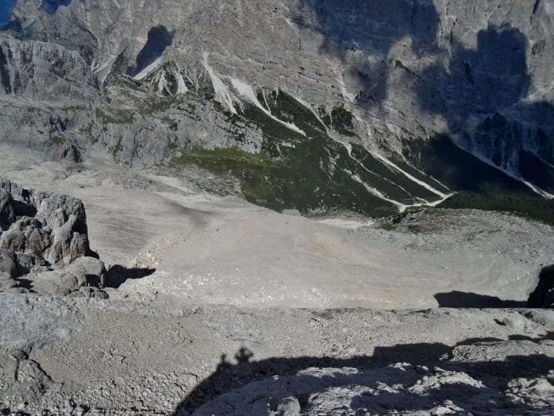
The view from the pass is magnificent: it opens onto the upper glacial basin and the proglacial meltwater lakes, while below, at the bottom of the valley, you can glimpse Rifugio Galassi, tiny in this majestic setting.
Descent
From the pass, follow a short ridge section, exposed but not equipped, then begin the descent on the opposite side (Val Antelao). Descend the steep valley keeping the Upper Glacier to your right, with its crevasses clearly visible. The obvious trail descends along the moraine debris, staying on the left-hand (orographic) side of the valley, at the foot of the slopes of Cima Cadin.
The descent features some critical points on polished and unstable rock, requiring attention and a sure foot. After the first few meters without protection, you encounter a short equipped section with a metal cable serving as a handrail on the left. Note that, starting from 2021, this passage has been improved with additional anchors, reducing the technical commitment but still requiring you to wear and be clipped into your via ferrata gear. Once past this section, the main technical difficulties are over.
Continue with the long descent down the wide scree slope until you reach the pastures of Alpe Antelao. During the descent, you might notice a track branching off to the left: this is a shortcut that includes an exposed and awkward passage, generally not recommended. Instead, continuing on the main trail 250, you encounter the turnoff for Cason Antelao and Pradacielan along CAI trail 258. Taking this left fork, you descend into the valley without further obstacles to the village. The complete descent from Forcella del Ghiacciaio takes about 3 hours, for a total excursion time of about 7 hours from the Capanna degli Alpini.
Useful Notes
Antelao, nicknamed the King of the Dolomites, is a technically demanding mountain that requires solid hiking experience and familiarity with the alpine environment. Do not underestimate the context, fooled by the moderate difficulties of the equipped section alone: the environment is remote, and the descent on the opposite side, despite recent improvements, retains challenging passages on variable terrain. This ascent offers the unique experience of moving through the heart of one of the most imposing and spectacular massifs in the Dolomites. For cartography, the use of Tabacco map no. 016 (Dolomiti di Auronzo e Cadore) is recommended.
Track and weather
Plan the route
Preview the GPX track from the backend, download it for your GPS device, open parking directions, and check a short forecast before leaving.
GPX track unavailable
This route does not include a downloadable track yet.
Images
FAQ
What level of commitment does this via ferrata require?
ferrata.faqAnswers.commitment
How much elevation gain should I plan for?
The listed ferrata elevation gain is 200 m. Also consider approach, return and maximum altitude, because they can matter more than the equipped section alone.
Where is the route located?
Ferrata del Ghiacciaio Antelao is located in Antelao, Belluno, Italy. Before leaving, check parking, access and current local conditions.
When is the best time to climb it?
The best season depends on altitude, aspect and lingering snow. Avoid storms, wet rock and uncertain conditions; start early and keep a margin for the return.
Gear and safety planning
Use the technical data on this page to plan equipment, timing and offline navigation. For a general checklist, read the equipment guide before opening the route in the app.
Video
Watch the route
Useful YouTube videos for getting a real feel for the route before you go.
Logbook
Route condition reports
Recent community notes about closures, snow, equipment damage, trail issues and current conditions.
Community
Reviews, check-ins and photos
-
0 reviews
1
1 climbers
0
Shared by the community
Community photos
Recent images uploaded by Sferrati members.
No community photos yet
Open this route in the app to add the first photo.
Reviews
Recent impressions from climbers who know the route.
No reviews yet
Be the first to review this via ferrata from the app.
Continue in the app
Track the climb, save maps offline, and sync this route to your personal profile.
Use the app to climb
Offline maps, tracking, saves, and profile sync.
Scan the code before leaving, install the app, and keep your route data ready when reception fades.
