
Technical data
- Difficulty
- Medio
- Status
- aperta
- Distance
- 11 km
- Total duration
- 7 h 45 min
- Approach
- 1 h 30 min
- Ferrata time
- 4 h
- Elevation gain
- 539 m
- Max altitude
- 2639 m
Route planning
How to plan Ferrata Gadotti al Sass Aut
Ferrata Gadotti al Sass Aut is in Sass Aut, Trento, Italy and is rated Medio. Available route data lists about 7 h 45 min total time, 11 km of distance, 539 m of elevation gain.
For day planning, consider an approach of about 90 min, about 240 min on the cable, a maximum altitude near 2639 m. Reported route features include: Itinerario lungo.
The page includes a parking or driving-directions reference. A GPX track is available to review and download.
As with every via ferrata, evaluate season, lingering snow, storms, crowds and equipment condition. Page last updated on 7/4/2026.
Features
Description
Overview
The Ferrata Gadotti traces a long alpine route along the ridge that separates Sass delle Dodici from Punta Vallaccia, in the wildest sector of Val San Nicolò, a tributary of the Val di Fassa. The technical difficulty is generally considered moderate, but the route's demanding character is defined by its considerable length and high total elevation gain. The terrain crossed is severe and isolated alpine in nature, far from the more frequented travel corridors: this is therefore an ascent reserved for experienced hikers in excellent physical condition, to be planned exclusively when stable and favorable weather conditions are in place.
Approach
The route begins at the Pensione Soldanella in Val San Nicolò, accessible from Pozza di Fassa. From the pension, cross the road and, just before the bridge, take a wide trail that climbs the right orographic side of the valley. Follow the trail 635, which with sustained steepness enters the forest and then opens into the broad basin of the Vallaccia, a natural amphitheater dominated by the imposing profile of Punta Vallaccia. From this point the via ferrata ideally begins, although the official start marker is located further ahead. The estimated time for this approach section is about 1 hour and 30 minutes.
The initial environment is typically Dolomitic, with a trail that develops on a wooded and scree-covered slope, gradually preparing you for the more open and rocky terrain of the basin.
Via Ferrata
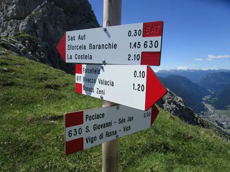
The equipped route begins with a first section that uses metal rungs and a diagonal ramp of modest difficulty, but potentially treacherous if the rock is wet. After overcoming a rocky spur, you reach the Bivacco Zeni at 2100 meters (about 15 minutes from the start; total 1h45'). At the bivouac there is a fork: take the right to enter the true Ferrata Gadotti, where shortly after you encounter the commemorative plaque dedicated to Franco Gadotti.
The pace now becomes more continuous and alpine. The route proceeds along an inclined ledge, with the cable fixed to the left, offering moderate exposure but no significant technical passages, heading toward Sass delle Dodici. The path alternates between walking sections on ledges and short rocky steps to be climbed or descended, as well as simple traverses. Later, the route turns to climb mid-slope toward Cima Dodici; at the beginning of the season you may encounter a residual snowfield, which should be approached with caution.
You thus reach a saddle at 2390 meters (1h30' from the start; total 3h). From this pass, a short detour to the right (10 minutes) leads to Cima Dodici (2443 m), a summit that offers an exceptional panorama of the Val di Fassa and the chains of Catinaccio, Sassolungo, and Sassopiatto.
From the saddle, the route turns south toward Sas Aut. Ignoring the detour for trail CAI 630, you ascend a well-equipped rocky gully with metal rungs, which leads to the broad summit meadows of Sas Aut (2551 m) (45 minutes from the saddle; total 3h45').
The character of the via ferrata changes again. From the meadows you descend south to a scree-filled gully that, despite the presence of protections, requires attention and a very sure foot due to the unstable ground. Keeping to the left side, you arrive at the most distinctive passage of the entire route: the Bus del Diaol, a narrow fissure in the rock equipped with rungs, to be descended in a slight overhang.
After exiting this key passage, you continue south with constant ups and downs on scree terrain to Forcella di Baranchie (2550 m), then turn left (east) and conquer the summit of Punta Vallaccia (2637 m), the terminal point of the Ferrata Gadotti (1h30' from Sas Aut; 4h from the start; total 5h15').
The experience is highly panoramic and physically demanding, with a discontinuous rhythm dictated by the alternation of equipped sections on solid rock, walking on scree, and ridge passages.
Descent
From the summit of Punta Vallaccia, descend east to a junction. Here you can opt for a short detour to the right to visit the characteristic Rifugio Vallaccia (2275 m), before reaching Forcella Vallaccia. From this pass, take trail CAI 615 descending, which leads back to Bivacco Zeni and, from there, along the ascent route, to the starting point. The descent time from Punta Vallaccia is about 2 hours and 30 minutes, for a total of approximately 7 hours and 45 minutes from the start of the approach.
Useful Notes
The Ferrata Gadotti is formally classified as easy, but it presents some points of localized difficulty that demand particular concentration: the initial section after Bivacco Zeni, the unstable gully below Sas Aut, and, most prominently, the Bus del Diaol. The hike is very long and, despite the geographical proximity to tourist areas, is little-traveled and has a wild atmosphere. Navigation in the sector between the Bivouac and Forcella Vallaccia can become problematic in bad weather, making it absolutely essential to tackle the route only with stable weather and excellent visibility.
Track and weather
Plan the route
Preview the GPX track from the backend, download it for your GPS device, open parking directions, and check a short forecast before leaving.
Images
FAQ
What level of commitment does this via ferrata require?
ferrata.faqAnswers.commitment
How much elevation gain should I plan for?
The listed ferrata elevation gain is 539 m. Also consider approach, return and maximum altitude, because they can matter more than the equipped section alone.
Where is the route located?
Ferrata Gadotti al Sass Aut is located in Sass Aut, Trento, Italy. Before leaving, check parking, access and current local conditions.
When is the best time to climb it?
The best season depends on altitude, aspect and lingering snow. Avoid storms, wet rock and uncertain conditions; start early and keep a margin for the return.
Gear and safety planning
Use the technical data on this page to plan equipment, timing and offline navigation. For a general checklist, read the equipment guide before opening the route in the app.
Video
Watch the route
Useful YouTube videos for getting a real feel for the route before you go.
Logbook
Route condition reports
Recent community notes about closures, snow, equipment damage, trail issues and current conditions.
Community
Reviews, check-ins and photos
-
0 reviews
1
1 climbers
0
Shared by the community
Community photos
Recent images uploaded by Sferrati members.
No community photos yet
Open this route in the app to add the first photo.
Reviews
Recent impressions from climbers who know the route.
No reviews yet
Be the first to review this via ferrata from the app.
Continue in the app
Track the climb, save maps offline, and sync this route to your personal profile.
Use the app to climb
Offline maps, tracking, saves, and profile sync.
Scan the code before leaving, install the app, and keep your route data ready when reception fades.
