
Lorenzo Lussana
May 20, 2026
Ottimo per le prime esperienze...
Ottimo per le prime esperienze
FacileAvvicinamentoAttrezzaturaParcheggio

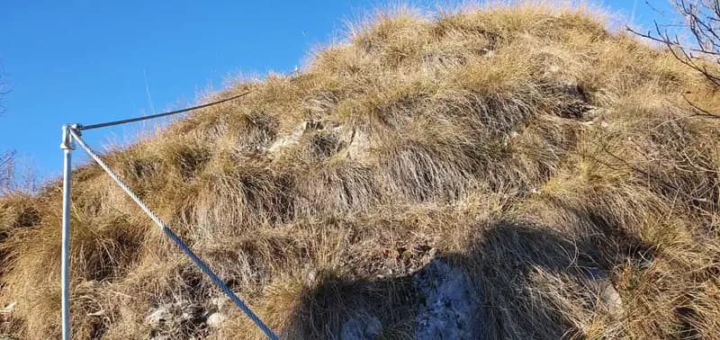
Corna Maria · Bergamo · Italy
Route planning
Ferrata il nido dei Santa Croce is in Corna Maria, Bergamo, Italy and is rated Moderatamente Difficile. Available route data lists about 2 h 15 min total time, 3,5 km of distance, 150 m of elevation gain.
For day planning, consider an approach of about 30 min, about 40 min on the cable, a maximum altitude near 1057 m. Reported route features include: Avvicinamento corto, Ponti sospesi, Scale.
The page includes a parking or driving-directions reference. A GPX track is available to review and download.
As with every via ferrata, evaluate season, lingering snow, storms, crowds and equipment condition. Page last updated on 7/4/2026.
The Ferrata del Nido dei Santa Croce is a recently equipped route that climbs the face of Corna Maria in the Bergamo Prealps, above San Pellegrino Terme in Val Brembana. Overall, the itinerary is rated easy, with a single key section of vertical wall that can be classified as moderately difficult. The route is climbable in almost any season, offers fun sequences, and culminates in crossing a distinctive suspension bridge. Its modest elevation and relative brevity make it an excellent choice for a short outing of just a few hours.
The setting is classic pre-Alpine terrain, with jagged limestone rock forming slabs and vertical steps. The route unfolds across a compact face, alternating short vertical sections with ledges and small terraces, ensuring a varied and never monotonous rhythm. The character is predominantly scenic and playful, with technical demands concentrated in a few specific spots-ideal for a progressive introduction to the sport.
The starting point is the hamlet of Santa Croce, in the municipality of San Pellegrino Terme. Reach San Pellegrino Terme by traveling through Val Brembana, then turn off following signs for Dossena/Antea and then for Santa Croce. In the village, parking is easy, for example in the large open area near the church.
From here, the two target peaks of the hike-Corna Maria on the left and Corna Pedezzina on the right-are already clearly visible. Take the CAI trail 561, which is intuitive and well-marked, heading decisively toward Corna Maria. At the junction that forms the hiking loop, continue straight toward Monte Rabbioso. Along the ascending trail, you'll encounter some specific signposts for the via ferrata. This leads to a saddle with a green hunting hut, where you turn left: just beyond, on the right, appears the sign marking the start of the equipped route. Following the tracks, you reach the start of the via ferrata in about 30 minutes from the parking area.
The approach follows a forest path with a compact, even surface, with a steady but never excessive gradient. The environment is classic Valdimagnina-side scenery, with sparse larches and beeches gradually giving way to the rocky outcrops of the face. The start is easily identifiable, located at the base of a first rocky step that immediately introduces the route's morphology.
The first few meters consist of a short section of equipped trail with a rocky step, followed by a walkable connecting section. You then tackle the most demanding part of the route: a beautiful vertical limestone wall, well-fractured and equipped with numerous stirrups and handholds, requiring moderately difficult effort. You climb for about thirty meters, gradually veering right, until reaching a small earthy terrace that offers a fine view over Val Brembana.
This first wall represents the technical heart of the itinerary. The rock, compact and rich in natural holds, allows for very intuitive climbing despite the exposure. The passage is continuous and well-protected, with a constant angle that demands moderate physical effort. The subsequent terrace provides a first pause with a spectacular panoramic effect, opening the view over the middle valley.
Moving a few meters to the left, you ascend a well-stepped ridge and then make an easy horizontal traverse to the right. This leads to a metal ladder that you descend. Below, you can already see the suspension bridge, reachable after about fifteen meters of descent aided by many stirrups. Be careful at a couple of passages where you need to lean out slightly to find footholds. A short traverse to the left finally brings you to the suspension bridge, 17 meters long with a wooden plank walkway.
The rhythm changes decisively: after the initial verticality, the route becomes more horizontal and articulated across ledges. The equipped descent toward the bridge is a key passage, requiring control and a good reading of the stirrup sequence, often positioned to encourage fluid movement but in a couple of spots demanding a shift in balance. The suspension bridge, firmly anchored to the rock, is the most spectacular and photogenic moment, though technically very simple.
After crossing the bridge, climb to the right, tackling a series of modest difficulty passages that lead to another terrace. The final rocky steps, beautiful and climbable, lead to the end of the vertical sections, where the cables now serve only as handrails (about 30 minutes from the start). Following the trail, you finally reach the summit of Corna Maria (1057 m) in about 40 minutes from the start of the ferrata, for a total of about 1 hour and 15 minutes from the Santa Croce parking area.
The final part unfolds across slabs and chimneys of solid rock, with very enjoyable and low-exposure climbing passages. The itinerary gradually loses difficulty, transforming into an equipped trail before emerging on the panoramic summit. The overall experience is well-balanced, with an initial technical climax, a central attraction (the bridge), and a progressively calmer, more contemplative conclusion.
From the summit of Corna Maria, follow the metal cable that descends eastward, skirting the peak toward Pizzo Rabioso. Continue on a well-marked trail along the ridge for about 70 meters, then turn right downhill until you intercept CAI trail 561. Keeping right, you return to Santa Croce (about 2 hours total for the entire loop). If you want to extend the hike, turning left allows you to complete the loop circuit. During the descent, following the appropriate signage, you can also take on the nearby Ferrata alla Corna Pedezzina.
The descent initially runs along a grassy and rocky ridge, with open views of the valley, before quickly plunging into the forest. The path is clear and the gradient moderate, allowing for a comfortable and fast return. The option to connect with the ferrata on Corna Pedezzina, located on the opposite side of the saddle, offers the possibility of creating a challenging two-ferrata circuit for experienced hikers.
This via ferrata is part of a larger project that also includes the adjacent route on Corna Pedezzina, completed in 2023. Being a recent installation, the equipment is abundant and in excellent condition. The low elevation makes it climbable almost all year round, with the possible exception of the hottest hours during the summer months. Caution is recommended on the terrain, which may present debris or instability typical of a recently built route. The itinerary is suitable for beginners with a minimum of experience, who should pay particular attention on the first wall and the descent section before the suspension bridge. The via ferrata was opened to the public in early 2022.
The rock, though generally compact, may in some sections have residual construction debris or small loose stones, common in recent installations. The protection is very dense, minimizing the gaps between anchors and increasing the sense of security. Sun exposure is significant for much of the route, making it advisable to avoid scorching summer days. The overall character is that of an educational and scenic itinerary, perfect for honing safe progression technique in a spectacular but not extreme environment.
Track and weather
Preview the GPX track from the backend, download it for your GPS device, open parking directions, and check a short forecast before leaving.
ferrata.faqAnswers.commitment
The listed ferrata elevation gain is 150 m. Also consider approach, return and maximum altitude, because they can matter more than the equipped section alone.
Ferrata il nido dei Santa Croce is located in Corna Maria, Bergamo, Italy. Before leaving, check parking, access and current local conditions.
The best season depends on altitude, aspect and lingering snow. Avoid storms, wet rock and uncertain conditions; start early and keep a margin for the return.
Use the technical data on this page to plan equipment, timing and offline navigation. For a general checklist, read the equipment guide before opening the route in the app.
Video
Useful YouTube videos for getting a real feel for the route before you go.
Logbook
Recent community notes about closures, snow, equipment damage, trail issues and current conditions.
Community
5.0
1 reviews
0
0 climbers
3
Shared by the community
Recent images uploaded by Sferrati members.
Recent impressions from climbers who know the route.
May 20, 2026
Ottimo per le prime esperienze
Track the climb, save maps offline, and sync this route to your personal profile.
Use the app to climb
Scan the code before leaving, install the app, and keep your route data ready when reception fades.
