
Technical data
- Difficulty
- Difficile
- Status
- aperta
- Distance
- 1,5 km
- Total duration
- 1 h 30 min
- Approach
- 15 min
- Ferrata time
- 30 min
- Elevation gain
- 150 m
- Max altitude
- 250 m
Route planning
How to plan Ferrata Parete dei Falchi
Ferrata Parete dei Falchi is in Prealpi Bellunesi, Belluno, Italy and is rated Difficile. Available route data lists about 1 h 30 min total time, 1,5 km of distance, 150 m of elevation gain.
For day planning, consider an approach of about 15 min, about 30 min on the cable, a maximum altitude near 250 m. Reported route features include: Avvicinamento corto.
The page includes a parking or driving-directions reference. A GPX track is not available yet, so bring an alternative map source.
As with every via ferrata, evaluate season, lingering snow, storms, crowds and equipment condition. Page last updated on 7/4/2026.
Features
Description
Overview
The Via Ferrata at Parete dei Falchi, located near Soverzene in the province of Belluno, is a short but extremely intense route that demands excellent athletic conditioning and considerable arm strength. The itinerary is concentrated and varied, culminating in a descent that features exposed sections on unstable terrain, requiring maximum attention.
Several critical issues should be noted as of Autumn 2020. The traditional access from the parking area near the power plant is no longer viable due to a landslide on the bike path. The alternative is to park near the church in the hamlet of Soccher, reachable from Cadola. From there, head north along the paved road, ignoring the signs for Castello di San Giorgio, cross a canal, and follow the bike path for about a kilometer, looking for the rocky rib that hosts the via ferrata. The start is not immediately visible from the road but lies higher up, so careful searching is required. Additionally, the condition of the hardware is suboptimal: maintenance appears to have been neglected for some time, with frayed cable in places and loose clamps.
Approach
The original starting point for the route is the area around the power plant between Soverzene and Pian di Vedoia. From Pian di Vedoia, cross the bridge over the Piave River and look for parking near the facility. However, as noted, this access is currently compromised.
After crossing the bridge, the road curves left. Near this curve, you can continue straight and immediately take a dirt road with a no-entry sign that branches off to the right toward the river. Follow this track south, skirting the climbing walls and the bank of the Piave, until you reach a metal footbridge. Beyond it, you'll spot the distinct rocky rib where, a few meters off the ground, the metal fixtures of the via ferrata begin. This section takes about 15 minutes from the traditional parking area. Note that a landslide in 2017 made the approach more problematic, though it is still passable.
Via Ferrata
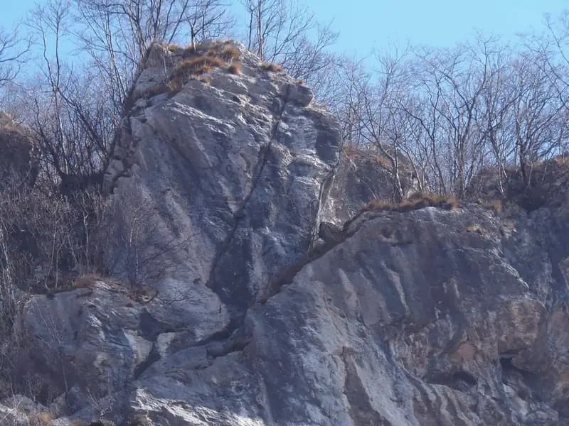
The Via Ferrata at Parete dei Falchi immediately presents itself as an athletic and difficult challenge. The start is the first test: the cable begins about four meters off the ground, forcing you to climb a free section of grade III before you can clip in. Once you reach the cable, you ascend vertically up a wall about twenty meters high, characterized by pronounced overhangs that, despite their shape, do little to ease the sustained steepness of the route. The itinerary unfolds almost entirely on a compact limestone wall that rises steep and vertical, offering a concentrated and physically demanding experience.
After the overhangs, the climb continues vertically and airily on compact rock with few holds, made even more treacherous by the presence of vegetation that compromises grip. After rounding an arête, you tackle a short section on slippery grass, aided by the cable. You then climb toward a rocky roof, overcome without protection but without particular difficulty, which is bypassed with a diagonal traverse to the left. You then angle right over a series of mixed steps of grass and rock, up to a small ledge useful for a rest. The pace is sustained and continuous, with no true resting spots, and constant exposure heightens the sense of commitment.
From here begins the likely most demanding passage of the route. You ascend a rocky spur with an ascending traverse to the right, overhanging in places, requiring strength, agility, and the use of a few metal pegs to find holds on an otherwise very smooth wall. The final section, on a slab, is decidedly athletic and demands a good dose of strength to overcome. Once this challenging sector of about fifteen meters is finished, the via ferrata concludes. The climbing time is about 30 minutes from the start, for a total of 45 minutes from the parking area. The character of the route is predominantly vertical and technical, with passages that test raw strength more than climbing technique.
Descent
The descent follows the recent orange trail markers that drop steeply toward the power plant. The path is very steep and, due to leaf litter, slippery in several sections. In the final part, you must traverse an exposed, narrow ledge with friable terrain, followed by a sloping, slippery rock. This passage is equipped with a cord, but its condition is not optimal. Before this point, it is possible and advisable to follow an arrow on the left that allows you to bypass the most exposed section. Once you reach the approach trail, you return to the parking area. The descent takes about 30 minutes from the top, for a total of 1 hour and 15 minutes for the entire outing. The return on a steep, unstable trail requires concentration, completing an experience that combines a technical ascent with a challenging descent on alpine terrain.
Useful Notes
The general condition of the equipment affects the safety of the route. In some places, the distance between the pegs is considerable, which, in the event of a fall, could generate a significant fall factor with potentially serious consequences. It is therefore essential to proceed with the utmost caution.
Despite its brevity, the via ferrata is intense and athletic, requiring in many sections a predominant use of arm strength. For this reason, it can be considered excellent specific training for tackling longer and more demanding via ferratas. Its location and relative speed of execution also make it a great option to combine with other routes in the area, such as the Via Ferrata at Palestra della Val Gallina, the Via Ferrata della Memoria at Vajont, or the Via Ferrata at Sora el Sass, heading up toward Cadore. The route is essentially scenic, offering views of the Piave River, but its technical and physical nature makes it primarily an athletic test piece.
Track and weather
Plan the route
Preview the GPX track from the backend, download it for your GPS device, open parking directions, and check a short forecast before leaving.
GPX track unavailable
This route does not include a downloadable track yet.
Images
FAQ
What level of commitment does this via ferrata require?
ferrata.faqAnswers.commitment
How much elevation gain should I plan for?
The listed ferrata elevation gain is 150 m. Also consider approach, return and maximum altitude, because they can matter more than the equipped section alone.
Where is the route located?
Ferrata Parete dei Falchi is located in Prealpi Bellunesi, Belluno, Italy. Before leaving, check parking, access and current local conditions.
When is the best time to climb it?
The best season depends on altitude, aspect and lingering snow. Avoid storms, wet rock and uncertain conditions; start early and keep a margin for the return.
Gear and safety planning
Use the technical data on this page to plan equipment, timing and offline navigation. For a general checklist, read the equipment guide before opening the route in the app.
Video
Watch the route
Useful YouTube videos for getting a real feel for the route before you go.
Logbook
Route condition reports
Recent community notes about closures, snow, equipment damage, trail issues and current conditions.
Community
Reviews, check-ins and photos
-
0 reviews
0
0 climbers
0
Shared by the community
Community photos
Recent images uploaded by Sferrati members.
No community photos yet
Open this route in the app to add the first photo.
Reviews
Recent impressions from climbers who know the route.
No reviews yet
Be the first to review this via ferrata from the app.
Continue in the app
Track the climb, save maps offline, and sync this route to your personal profile.
Use the app to climb
Offline maps, tracking, saves, and profile sync.
Scan the code before leaving, install the app, and keep your route data ready when reception fades.
