Overview
The Ferrata Rino Pisetta, which ascends the imposing southern face of Cima Garzolet above Sarche, is a highly demanding route defined by marked technicality, continuous exposure, and sustained length. This is a sport-oriented via ferrata that demands peak physical fitness and solid experience on similar routes. The progression alternates between vertical slabs, airy traverses, and chimneys on compact limestone offering sparse natural holds. The south-facing exposure makes an early morning start advisable during summer to avoid direct solar radiation.
Approach
The access point is the town of Sarche in Trentino. Coming from the center toward Madonna di Campiglio, after a roundabout you'll spot a gas station on the left; immediately after, a small secondary road on the right climbs up to the dedicated parking area. Park near the elementary school and the bowling green. Skirting the bowling green, you reach its rear where a white signpost marks the start of the trail. The path enters the woods and, after an initial fork keeping right, continues left on a steep and physically demanding climb, following the white-red trail markers. The start of the route, marked by a metal plaque, is reached in about 45 minutes of walking from the parking lot. The setting is typical of the middle Valle del Sarca, with a steep wooded slope that foreshadows the severity of the wall.
Via Ferrata
The route opens immediately with a vertical wall about twenty meters high, one of the key passages of the entire ascent, requiring careful searching for holds and, often, active progression on the cable. After overcoming this obstacle, the cable bends left into an exposed, slightly descending traverse, then climbs vertically toward a chimney. Beyond this, a ledge on the left offers a first rest stop and, on the right, provides a potential escape route.
The climb resumes with another vertical wall, more articulated and jagged, followed by a traverse to the left and several rocky steps. You then encounter a distinctive crack in the rock, usable for hand and foot placements, which introduces a long, strenuous, and intensely exposed traverse to the left. In this section, some passages demand total adhesion and considerable arm effort. After rounding an edge and climbing diagonally, you arrive at a small rocky balcony.
Here begins the most athletic section of the climb: you continue in an ascending traverse, aided by some artificial holds, then tackle a new steep vertical slab. Again, a crack runs parallel to the cable, but the scarcity of natural holds makes it necessary to pull frequently on the cable to advance. A rocky ledge finally offers a well-deserved rest.
The cable resumes vertically up a second wall, equally exposed and airy, where a crack gradually evolves into a shallow chimney. Exiting the chimney, a traverse to the left leads to the last great vertical wall, a particularly challenging passage due to the polished rock and near-total absence of holds, forcing essentially physical progression on the cable.
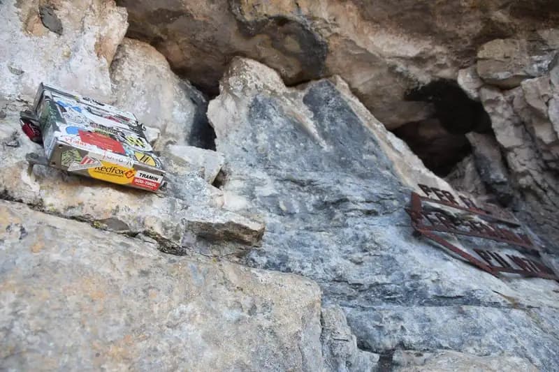
Once this obstacle is overcome, the main difficulties are over. The final section, which still requires 30-45 minutes, unfolds through gullies, short walls, and steps of moderate difficulty, where it becomes easier to climb directly on the rock. You thus conquer the final spur, with the summit register, and tackle the summit ridge. This last stretch is equipped with a metal cable that primarily serves as a handrail; it is exposed and tiring but not technically difficult, and finally leads to a wooden bench at the summit. The climbing time for the via ferrata is about 2 hours and 15 minutes from the start, for a total of 3 hours from the parking lot. The route develops mainly over vertical slabs and ledges, with a tight rhythm and few rest points, offering a continuous and physically totalizing experience.
Descent
From Cima Garzolet (961 m), descend westward along a trail toward Ranzo. After reaching a picnic area and a mule track, continue descending to a fork in sight of the town. Here you have two options: The first, shorter option (about 1 hour and 30 minutes from the summit), keeps left following the CAI trail markers downhill. After a small religious building, a sign indicates "Sarche." The trail continues with a tiring up-and-down and some equipped sections on exposed but not difficult ledges, then descends via steep switchbacks through the woods until rejoining the approach trail and returning to the parking lot (total hike duration: 4 hours and 30 minutes). The second option (about 2 hours from the summit) descends right toward Val Dossel on the CAI 613 trail, then takes the CAI 01 ST trail to Castel Toblino. This route includes passing along the exposed equipped ledge of the Costa di Monte Oliveto before leading, via the approach trail, back to the parking lot (total hike duration: 4 hours and 45 minutes). Both descents are of a hiking nature, with exposed but non-technical sections, allowing you to admire the landscape of the Valle dei Laghi.
Useful Notes
The equipment of the Ferrata Rino Pisetta is in excellent condition, with the metal cable well-tensioned, a crucial aspect for a route of this commitment. To safely tackle the smooth rock sections, climbing shoes are strongly recommended to ensure maximum adhesion, along with a pair of via ferrata gloves to protect your hands during progression and the frequent pulls on the cable. Given the sustained difficulty and the lack of equipped rest points, it is useful to master techniques for creating a safety belay along the route. For navigation, the use of detailed maps of the area is recommended, such as those of the Gruppo di Brenta or the Valle dei Laghi e Alto Sarca.