
Ferrata Roda di Vael
Roda di Vael · Bolzano · Italy
Technical data
- Difficulty
- Moderatamente Difficile
- Status
- aperta
- Distance
- 13,1 km
- Total duration
- 4 h 15 min
- Approach
- 1 h
- Ferrata time
- 1 h
- Elevation gain
- 246 m
- Max altitude
- 2806 m
Route planning
How to plan Ferrata Roda di Vael
Ferrata Roda di Vael is in Roda di Vael, Bolzano, Italy and is rated Moderatamente Difficile. Available route data lists about 4 h 15 min total time, 13,1 km of distance, 246 m of elevation gain.
For day planning, consider an approach of about 60 min, about 60 min on the cable, a maximum altitude near 2806 m. Reported route features include: Scale, Funivia all'andata, Funivia al ritorno.
The page includes a parking or driving-directions reference. A GPX track is available to review and download.
As with every via ferrata, evaluate season, lingering snow, storms, crowds and equipment condition. Page last updated on 7/4/2026.
Features
Description
Overview
The Ferrata Roda di Vael is a moderately difficult route to the summit of the same name, one of the most imposing peaks in the Rosengarten Group. The route features a relatively gentle ascent from Passo del Vajolon, while the descent toward Torre Finestra includes more challenging sections. This itinerary pairs effectively with the nearby Ferrata Masarè, forming a complete and rewarding loop in the heart of one of the most celebrated Dolomite massifs.
Approach
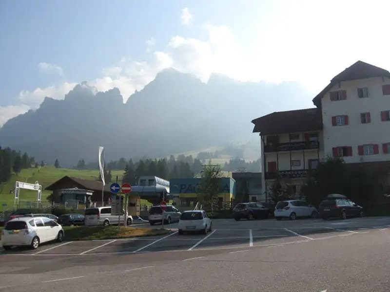
The recommended starting point is Rifugio Paolina (2125 m), accessible from Carezza (Passo di Costalunga, Bolzano) via the Paolina cable car. A large parking area is available near the lifts at Carezza. From the hut, take trail CAI 552 heading north, which climbs at a moderate grade to the base of the imposing western wall of the Roda di Vael. Continue following signs for CAI 549 and Passo del Vajolon, tackling a short equipped section with a fixed rope and ladder, where caution is advised for possible lingering snow even late in the season. This brings you to Passo del Vajolon (2565 m) in about an hour from the hut. An alternative approach starts from the Val di Fassa, from Vigo, taking the cable car to Rifugio Ciampedie and then following trails CAI 541 and 551, for an approach of roughly two hours to Passo Vajolon.
Via Ferrata
From the pass, the ferrata unfolds with a linear and logical progression along the crest of the mountain ridge. The route alternates between equipped sections of moderate-easy difficulty and short unprotected stretches on rock, with no significant technical obstacles. The terrain is classic Dolomite, with solid rock that allows for continuous, pleasant climbing along ledges and slabs. During the ascent, a beautiful panorama opens over the debris basin behind the Rosengarten. Continue along an equipped ridge trail, overcoming a few final rocky steps before reaching the summit of the Roda di Vael (2806 m), crowned by a distinctive metal cross. The climbing time from the notch is about 45 minutes, for a total of 1 hour and 45 minutes from the start. From the summit, the descent follows a broad trail on the opposite side, protected on the steeper sections. Cross a few rocky steps and a ladder heading toward Forcella della Roda. At this point, ignore the steep gully with ropes and continue at the same elevation. Reaching the notch, you face the key passage of the entire route: climbing a vertical and highly exposed wall with scarce natural holds, traversing diagonally to the left. The exposure is significant, but the environmental difficulty is mitigated by numerous stirrups that ease the progression, leading to the exit at Pian del Diaol (2625 m). This section takes about 1 hour and 15 minutes from the start, for a total of 2 hours and 15 minutes. Continue beneath the distinctive Torre Finestra, recognizable by its cleft with a cross, until reaching a junction after an easy trail section. To the right, the Ferrata Masarè continues upward (about 2 hours), while to the left, the descent path concludes the ferrata. This last option involves a narrow section with a ladder descending into a rocky cleft, followed by a couple of other short equipped stretches. The Ferrata Roda di Vael thus ends at Rifugio Roda da Vael (2283 m), reachable in about 45 minutes from the junction, for a total of 3 hours and 15 minutes.
Descent
From Rifugio Roda da Vael, the return to Rifugio Paolina follows a comfortable mid-slope trail, taking CAI 549 and then CAI 539. The route passes the Monument to Christomannos and leads to the top station of the cable car in about an hour. The total time for the excursion, excluding the Ferrata Masarè, is therefore about 4 hours and 15 minutes. If you include the Ferrata Masarè, the full loop takes about 6 hours and 15 minutes.
Useful Notes
The point of greatest difficulty is the exposed diagonal wall climbing to Pian del Diaol, which may cause some hesitation among less experienced hikers, though the excellent equipment reduces its technical demands. Watch out for loose debris that can be dislodged on the descent section. For maps, dedicated maps of the Val di Fassa or the Sciliar, Rosengarten, and Latemar are recommended. This route can be combined with other via ferratas in the Rosengarten Group, such as the Ferrata Santner, the Bepo de Medil, the Sentiero Attrezzato delle Scalette, the Ferrata al Catinaccio d'Antermoia, the Ferrata Laurenzi, or the more exposed Ferrata Maximilian.
Track and weather
Plan the route
Preview the GPX track from the backend, download it for your GPS device, open parking directions, and check a short forecast before leaving.
Images
FAQ
What level of commitment does this via ferrata require?
ferrata.faqAnswers.commitment
How much elevation gain should I plan for?
The listed ferrata elevation gain is 246 m. Also consider approach, return and maximum altitude, because they can matter more than the equipped section alone.
Where is the route located?
Ferrata Roda di Vael is located in Roda di Vael, Bolzano, Italy. Before leaving, check parking, access and current local conditions.
When is the best time to climb it?
The best season depends on altitude, aspect and lingering snow. Avoid storms, wet rock and uncertain conditions; start early and keep a margin for the return.
Gear and safety planning
Use the technical data on this page to plan equipment, timing and offline navigation. For a general checklist, read the equipment guide before opening the route in the app.
Video
Watch the route
Useful YouTube videos for getting a real feel for the route before you go.
Logbook
Route condition reports
Recent community notes about closures, snow, equipment damage, trail issues and current conditions.
Community
Reviews, check-ins and photos
-
0 reviews
3
3 climbers
0
Shared by the community
Community photos
Recent images uploaded by Sferrati members.
No community photos yet
Open this route in the app to add the first photo.
Reviews
Recent impressions from climbers who know the route.
No reviews yet
Be the first to review this via ferrata from the app.
Continue in the app
Track the climb, save maps offline, and sync this route to your personal profile.
Use the app to climb
Offline maps, tracking, saves, and profile sync.
Scan the code before leaving, install the app, and keep your route data ready when reception fades.
