Overview
The Ferrata Renato Salvatori is a classic easy-grade route, ideal as a first experience on fixed cables. It runs along the sharp crest that rises from the Foce di Petrosciana to the summit of Monte Forato (also known as Pania Forata), offering a distinctly panoramic and airy character while keeping technical demands modest. Its relatively low elevation allows for use over a broad stretch of the season, providing an introduction to the world of via ferratas in a highly evocative alpine setting typical of the Apuan Alps.
Approach
The most common starting point is the Albergo Alto Mattana, in Garfagnana. From Lucca, take the SS 12 toward Garfagnana, turning off for Diecimo and then Pescaglia, continuing past the village of Pascoso; from here, specific signage indicates the narrow paved road leading to the hotel, used as a topographic reference but no longer open for overnight stays. From the parking area in front, take the trail that climbs behind the building, quickly spotting the right-hand turn marked as Sentiero CAI 109. The route climbs decisively up the north side of Monte Nona, a wooded slope cut by gullies, first reaching the Foce delle Porchette. Continuing straight on trail 109, ignoring any other branches, you eventually arrive at the grassy saddle of the Foce di Petrosciana. The approach takes about 1 hour and 20 minutes of sustained hiking from the parking area.
Via Ferrata
At the Foce di Petrosciana, a marble plaque marks the start of the Ferrata Salvatori and the steep access, bypassing the trail that skirts the ridge lower down. You immediately tackle some easy rock steps before clipping into the first cable, which protects a short traverse toward a possible escape route. The route quickly becomes interesting with the encounter of a distinctive rock pinnacle, overcome via an exposed dihedral equipped with about 15 meters of cable, representing the first real vertical passage. At the top of the dihedral, a small ledge precedes the steepest and most technical wall of the route: this is a key section on compact limestone, with sparse holds, requiring careful progression. Once past this stretch, a 5-meter metal ladder marks the peak of the technical difficulties. From here onward, the via ferrata winds along the crest line, developing horizontally over a succession of rock spurs and ledges: it's an exhilarating, airy progression, exposed but never demanding, offering continuous views on both sides. After the cables end, a faint trail on free terrain leads to the summit cross of Monte Forato (Pania Forata), reached in about 50 minutes from the start (for a total of roughly 2 hours and 15 minutes from the parking area). The pace is pleasantly varied, with a concentrated, vertical first section that flows into a long, more relaxed and panoramic ridge traverse.
Descent
From the summit, descend briefly (about 40 meters) on the Garfagnana side until you intercept the well-marked Sentiero CAI 110. Follow this back in the direction of the via ferrata start, reachable in 20 minutes from the end of the cables. From that point, retrace the approach trail (CAI 109) back to the Albergo Alto Mattana. The total hike time, including the via ferrata, is around 3 hours and 45 minutes.
Useful Notes
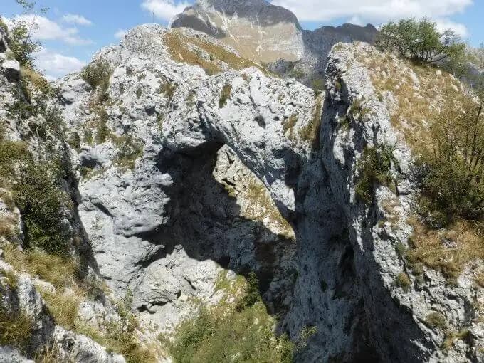
The Ferrata Salvatori is rated as easy, concentrating the most technical and vertical passages in its initial section. The destination, Monte Forato, is famous for its spectacular natural rock arch, a geological monument that alone justifies the outing. For more experienced hikers, it is possible to make a double-rope rappel right through this characteristic hole. The route can be combined with the nearby Ferrata del Procinto to create a more challenging loop. An alternative approach is also available starting from Fornovolasco (known for the Grotta del Vento), following trails CAI 6 and 12, which significantly lengthens the approach hike but passes through very pleasant wooded valleys. The via ferrata, dedicated to the memory of Renato Salvatori, was installed in 1977, inaugurated the following year, and underwent renovation work in 1998. For navigation, it is recommended to use a detailed map of the Apuan Alps.