
Ferrata Selvaggio Verde
Alpi Lepontine · Verbania · Italy
Technical data
- Difficulty
- Moderatamente Difficile
- Status
- aperta
- Distance
- 30 km
- Total duration
- 15 h 30 min
- Approach
- 3 h
- Ferrata time
- 8 h
- Elevation gain
- 450 m
- Max altitude
- 1842 m
Route planning
How to plan Ferrata Selvaggio Verde
Ferrata Selvaggio Verde is in Alpi Lepontine, Verbania, Italy and is rated Moderatamente Difficile. Available route data lists about 15 h 30 min total time, 30 km of distance, 450 m of elevation gain.
For day planning, consider an approach of about 180 min, about 480 min on the cable, a maximum altitude near 1842 m. Reported route features include: Itinerario lungo, Ponti sospesi, Itinerario Alpinistico.
The page includes a parking or driving-directions reference. A GPX track is not available yet, so bring an alternative map source.
As with every via ferrata, evaluate season, lingering snow, storms, crowds and equipment condition. Page last updated on 7/4/2026.
Features
Description
Overview
Opened in 2022, the Selvaggio Verde Ferrata is an innovative route that winds through the narrow, intricate gorge of the Rio Val Grande, within the Val Grande National Park. More than a traditional via ferrata, it is a technical trekking itinerary composed of numerous equipped sections that connect the localities of "In La Piana" and "Ponte Velina." The difficulty of individual cable sections is generally moderate, but the length, isolation, and rugged profile of the route make it a very demanding undertaking, suitable only for fit and well-prepared hikers. The recommended option is to split it over two days, using the bivouacs available along the way.
Approach
A convenient starting point is the village of Cicogna. Near the local cemetery, take a dirt road that, after a quarter-hour of gentle terrain among huts and pastures, turns into a trail, marking the entrance into the wild territory of the park. The path proceeds with repeated ups and downs among ruins and ancient alpine pastures, featuring short sections protected by chains to overcome some more exposed passages. After crossing the Torrente Velina and passing the alpine pasture of the same name, you reach Ponte Velina (478 m). The approach from Cicogna takes about 3 hours.
Via Ferrata
The core of the Selvaggio Verde stretches between Ponte Velina and Alpe In La Piana (895 m), following the winding course of the Rio Val Grande for about 11 km. The total elevation gain is roughly 450 meters, but the constant alternation of ascents and descents within the gorge multiplies the physical effort. The route, marked as P50, mixes exposed equipped trails with cables and chains, along with unprotected but still technical sections, often on water-polished rock or grassy ledges. You'll encounter two suspension bridges, several wooden walkways (some worn, to be crossed with caution), metal ladders, and stream crossings.
After about 2 hours and 30 minutes from Ponte Velina, you reach the stone bivouac of Orfalecchio (590 m). Shortly before the bivouac, a left deviation offers an escape route toward Ompio and Sciellina, leaving the gorge. Continuing, the environment becomes harsher and more majestic: progress is made among moss-covered walls, narrow airy catwalks, and waterfalls. It is essential to follow the red trail markers precisely, as the path sometimes gets lost in tall grass or among boulders. Concentration must remain high even on the unequipped sections, which are often exposed and slippery. Arrival at Alpe In La Piana occurs after about 7-8 hours from the start of the ferrata, for a total of about 10 hours from Cicogna. Here, it is possible to bivouac.
Descent
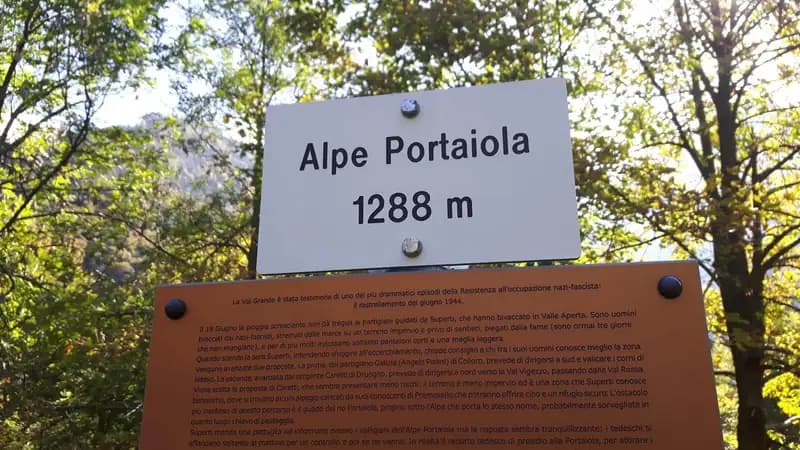
From the bivouac at Alpe In La Piana, the recommended return toward Valle Loana takes about 4 hours of walking. Follow trail P30 in the direction of Alpe Scaredi, then take the M14 route toward Fondo Li Gabbi. The first part is uphill, passing the ruins of Alpe Portaiola (1288 m), Alpe Scaredi (1842 m), and Alpe Cortenuovo (1793 m), the latter offering a wide panorama. From here begins the extensive final descent toward Valle Loana. The total time for the entire traverse, including approach, ferrata, and descent, is around 14-15 hours.
Useful Notes
The itinerary takes place in a remote context, devoid of support facilities. It is absolutely necessary to be completely self-sufficient: bring food, water, a sleeping bag, and all the gear needed for bivouacking. The huts offer only basic shelter. Phone coverage is absent for most of the route, making a detailed topographic map indispensable. The trail crosses protected areas, including the Integral Reserve of Monte Pedum and Natura 2000 network sites: it is essential to respect the environment and leave no trash behind.
The route can also be tackled in reverse or reached from other access points such as Bignugno, Ruspesso, or Sciellina, with possible alternative returns toward Premosello or Mottac. Within the Val Grande Park, there are no other classic via ferratas; for those seeking a more technical experience, in the province of Verbania you'll find the Ferrata di Montorfano, the Walserfall, the Ferrata al Pizzo d'Andolla, or those on Lake Maggiore like the Picasass and the Miccia.
Track and weather
Plan the route
Preview the GPX track from the backend, download it for your GPS device, open parking directions, and check a short forecast before leaving.
GPX track unavailable
This route does not include a downloadable track yet.
Images
FAQ
What level of commitment does this via ferrata require?
ferrata.faqAnswers.commitment
How much elevation gain should I plan for?
The listed ferrata elevation gain is 450 m. Also consider approach, return and maximum altitude, because they can matter more than the equipped section alone.
Where is the route located?
Ferrata Selvaggio Verde is located in Alpi Lepontine, Verbania, Italy. Before leaving, check parking, access and current local conditions.
When is the best time to climb it?
The best season depends on altitude, aspect and lingering snow. Avoid storms, wet rock and uncertain conditions; start early and keep a margin for the return.
Gear and safety planning
Use the technical data on this page to plan equipment, timing and offline navigation. For a general checklist, read the equipment guide before opening the route in the app.
Video
Watch the route
Useful YouTube videos for getting a real feel for the route before you go.
Logbook
Route condition reports
Recent community notes about closures, snow, equipment damage, trail issues and current conditions.
Community
Reviews, check-ins and photos
-
0 reviews
0
0 climbers
0
Shared by the community
Community photos
Recent images uploaded by Sferrati members.
No community photos yet
Open this route in the app to add the first photo.
Reviews
Recent impressions from climbers who know the route.
No reviews yet
Be the first to review this via ferrata from the app.
Continue in the app
Track the climb, save maps offline, and sync this route to your personal profile.
Use the app to climb
Offline maps, tracking, saves, and profile sync.
Scan the code before leaving, install the app, and keep your route data ready when reception fades.
