
Technical data
- Difficulty
- Difficile
- Status
- aperta
- Distance
- 3 km
- Total duration
- 3 h 15 min
- Approach
- 15 min
- Ferrata time
- 2 h 15 min
- Elevation gain
- 270 m
- Max altitude
- 1320 m
Route planning
How to plan Ferrata di Camoglieres
Ferrata di Camoglieres is in Alpi Marittime, Cuneo, Italy and is rated Difficile. Available route data lists about 3 h 15 min total time, 3 km of distance, 270 m of elevation gain.
For day planning, consider an approach of about 15 min, about 135 min on the cable, a maximum altitude near 1320 m. Reported route features include: Ponti sospesi, Avvicinamento corto.
The page includes a parking or driving-directions reference. A GPX track is available to review and download.
As with every via ferrata, evaluate season, lingering snow, storms, crowds and equipment condition. Page last updated on 7/4/2026.
Features
Description
Overview
The Camoglieres Via Ferrata, located in the namesake hamlet of Macra in the province of Cuneo, is a route demanding exceptional physical effort. Its course is defined by abundant metal equipment-ladders and rungs-that dictates an athletic progression over predominantly vertical and overhanging terrain, with constant and pronounced exposure. This is an ideal route for those seeking a test of endurance and sustained strength, where pure climbing technique takes a back seat to the ability to manage fatigue and prolonged exposure.
Approach
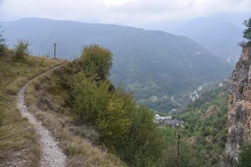
The starting point is the hamlet of Camoglieres, reachable via the SP 422 from Cuneo towards Caraglio and Dronero. After passing Lottullo, a marked junction on the right indicates the direction for Camoglieres and the via ferrata. From the parking area, with the characteristic limestone bastion already clearly visible, continue on foot along the paved lane to the last house in the settlement. Here, on the right, a well-marked trail begins, indicated by signs and yellow blazes, leading to the start of the ferrata in about 15 minutes from the car park. The quick and direct approach hints at the demanding nature of the route ahead.
Via Ferrata
The itinerary unfolds in successive sections, typical of the "French style" common in the Cuneo area, with a mandatory route punctuated by metal rungs. The first wall attacks immediately with a series of vertical rungs, initially following a dihedral line that also offers natural holds on the right, before a traverse to the left. The progression continues straight up, interrupted by a diagonal traverse equipped with rungs, to tackle strenuous and partially overhanging sections. The limestone rock, compact and polished, offers few natural rests, imposing a continuous rhythm. Reaching the top of this long section, you find yourself near a first escape route on the left.
A short trail connects to the second wall. This one also features challenging, overhanging passages, ascending diagonally until it overcomes an exposed arete. After a few final vertical meters, you skirt and climb a rocky gendarme with a short bulging section, then finish with one last slabby wall. The pace is always sustained, with the exposure increasing progressively as you move away from the base.
The trail resumes, descending slightly into a small wooded area, leading to the start of the third section. This begins with about twenty meters of vertical and overhanging wall, followed by an athletic and strenuous diagonal ascending traverse. You then climb vertical sections in strong exposure to the base of a rocky roof, which is bypassed along an exciting and exposed arete. A short traverse concludes this section, leading onto a trail from which the suspension bridge can be seen in the distance. The development along ledges and aretes characterizes this part, offering open views of the valley.
The fourth section is the least demanding. After a few equipped rocky steps, you tackle a high vertical wall, free of overhangs, for about twenty meters before turning right. You climb a gendarme, cross a pulpit-like ledge, and downclimb on the opposite side. Reaching an escape route, a short trail leads to the long, swaying Tibetan bridge, which marks the end of the fourth section. This section offers a momentary physical reprieve, while still maintaining a panoramic character.
Beyond the bridge, a trail leads to the final wall. On this connecting section, there are two escape routes: one for returning and one to reach the summit while avoiding the last, difficult stretch of ferrata. This finale is demanding and exposed. From a short ledge, you climb a vertical wall, attacking an arete, then turn slightly right into a difficult traverse. You re-engage vertically in strong exposure, overcoming the last strenuous meters before the difficulties cease. A final stretch of equipped trail, now free of technical obstacles, leads to the summit cross. The climbing time from the start is about 2 hours and 15 minutes (2 hours and 30 minutes from the car park), a time that confirms the athletic, non-stop nature of the entire route.
Descent
From the summit cross, a very well-marked trail with yellow blazes allows the return. It is important not to remove your harness, as the descent path includes a few short, still-equipped sections. In about 40 minutes you return to the car park, for a total hike time of about 3 hours and 15 minutes. The descent, though mostly on trail, retains a technical character and requires attention until the very end.
Useful Notes
The Camoglieres Via Ferrata is an athletic, tiring itinerary that should not be underestimated for its physical demands and continuous exposure. The climbing difficulties are mitigated by the abundant equipment of ladders and rungs, but the overall commitment remains high due to the length and continuity of the effort. Along the route, there are several escape routes for those who wish to interrupt the ascent. It is explicitly forbidden to descend the via ferrata, both for safety reasons and to avoid conflicts with climbers ascending.
Track and weather
Plan the route
Preview the GPX track from the backend, download it for your GPS device, open parking directions, and check a short forecast before leaving.
Images
FAQ
What level of commitment does this via ferrata require?
ferrata.faqAnswers.commitment
How much elevation gain should I plan for?
The listed ferrata elevation gain is 270 m. Also consider approach, return and maximum altitude, because they can matter more than the equipped section alone.
Where is the route located?
Ferrata di Camoglieres is located in Alpi Marittime, Cuneo, Italy. Before leaving, check parking, access and current local conditions.
When is the best time to climb it?
The best season depends on altitude, aspect and lingering snow. Avoid storms, wet rock and uncertain conditions; start early and keep a margin for the return.
Gear and safety planning
Use the technical data on this page to plan equipment, timing and offline navigation. For a general checklist, read the equipment guide before opening the route in the app.
Video
Watch the route
Useful YouTube videos for getting a real feel for the route before you go.
Logbook
Route condition reports
Recent community notes about closures, snow, equipment damage, trail issues and current conditions.
Community
Reviews, check-ins and photos
-
0 reviews
0
0 climbers
0
Shared by the community
Community photos
Recent images uploaded by Sferrati members.
No community photos yet
Open this route in the app to add the first photo.
Reviews
Recent impressions from climbers who know the route.
No reviews yet
Be the first to review this via ferrata from the app.
Continue in the app
Track the climb, save maps offline, and sync this route to your personal profile.
Use the app to climb
Offline maps, tracking, saves, and profile sync.
Scan the code before leaving, install the app, and keep your route data ready when reception fades.
