
Ferrata Tramuntin al Monte Rest
Monte Rest · Pordenone · Italy
Technical data
- Difficulty
- Moderatamente Difficile
- Status
- aperta
- Distance
- 8 km
- Total duration
- 6 h
- Approach
- 30 min
- Ferrata time
- 1 h
- Elevation gain
- 120 m
- Max altitude
- 1780 m
Route planning
How to plan Ferrata Tramuntin al Monte Rest
Ferrata Tramuntin al Monte Rest is in Monte Rest, Pordenone, Italy and is rated Moderatamente Difficile. Available route data lists about 6 h total time, 8 km of distance, 120 m of elevation gain.
For day planning, consider an approach of about 30 min, about 60 min on the cable, a maximum altitude near 1780 m. Reported route features include: Itinerario lungo.
The page includes a parking or driving-directions reference. A GPX track is available to review and download.
As with every via ferrata, evaluate season, lingering snow, storms, crowds and equipment condition. Page last updated on 7/4/2026.
Features
Description
Overview
The ascent of Monte Rest (1780 m) in the Carnic Prealps, on the Pordenone side, is accomplished via the Ferrata Tramuntin. This is a logical route with a very pronounced climbing feel, characterized by numerous enjoyable passages that often allow you to proceed without pulling on the cable. The route has a single, significantly challenging section that demands maximum attention: the second part of the ascent, only partially protected, offers exposed and far-from-simple free climbing moves.
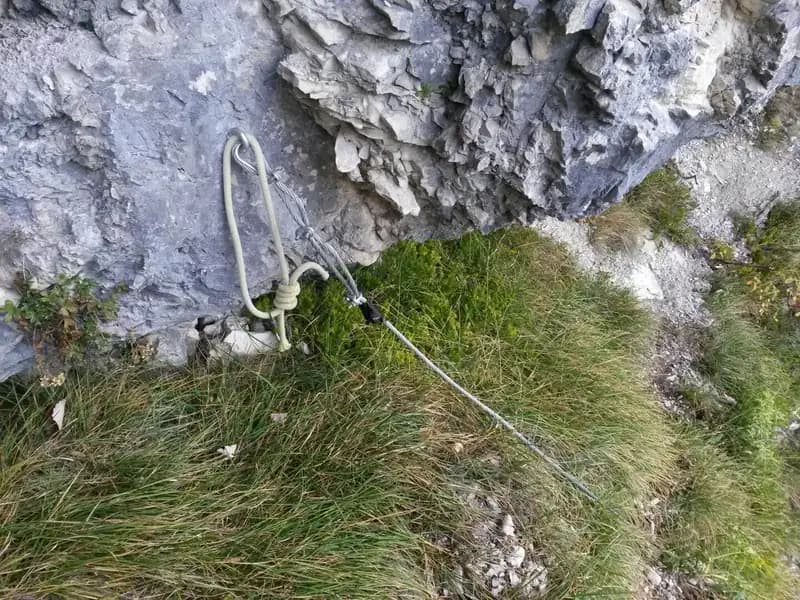
As of 2020, the ferrata is in fair condition. However, the trail leading from its end to Casera del Monte Rest is in poor shape, making it inadvisable to travel in bad weather, on wet ground, or for inexperienced hikers. It is strongly recommended to bring a rope and a belay device to be able to protect yourself at points where previous equipment, now deteriorated, could make the passage critical.
Approach
The starting point is along the road connecting Tramonti di Sopra (PN) to Ampezzo (UD). Coming from the south, at a very sharp left-hand switchback, you will notice a dark sign indicating the Palestra di Roccia and the Ferrata del Tramuntin. Park nearby.
From the sign, follow the trail through the woods, which makes a wide counterclockwise semicircle, leading to the ferrata's start in about 30 minutes. This is located just after a clear alpine climbing route (pitons and bolts) that ascends a gully, near a crag with numerous single-pitch and multi-pitch routes.
Via Ferrata
The Ferrata Tramuntin is a beautiful and wild route that exploits the natural discontinuities of the rock face. It has a modest length (about 100 meters) but offers considerable commitment. The start features well-angled rock rich in holds. After a few minutes, you encounter a first series of more difficult passages, followed by a traverse to the left that constitutes the single most challenging move of the entire route.
The route unfolds on a compact dolomite wall, alternating vertical sections with short ledges, at a sustained and continuous pace. The exposure is marked, especially on the key traverse, which requires fluid movement and careful footwork. Overall, the ferrata is extremely climbable, and the rock, though occasionally friable, offers many opportunities for purchase. You ascend a wide couloir until reaching the end of the metal fixtures in about 40 minutes from the start (about 1 hour and 15 minutes total from the car).
At this point, probably the most arduous part of the hike begins. The trail connecting the end of the via ferrata to Casera del Monte Rest is very steep, winding over rocky sections and potentially slippery grassy patches, demanding maximum caution. You climb, at times with some residual fixed ropes, following red marks until you emerge from the beech forest. Once you reach the casera, the final ascent to the summit of Monte Rest (1780 m) is highly recommended, for a total time of about 4 hours.
Descent
From the summit of Monte Rest, retrace your steps back to Casera Rest. From here, continue in a north-northwest direction, taking the trail that loses altitude until it meets the paved road. The return to the parking lot alternates between sections along the roadside and short trails that cut across the slope. The descent from Monte Rest takes about 2 hours, for a total of 6 hours for the excursion.
Useful Notes
This via ferrata remains virtually unknown due to a dispute between the CAI sections involved in its construction and management. For this reason, it is not marked on official hiking maps and is not considered officially open, despite the good state of maintenance of the equipped section.
It is essential to pay attention to the unprotected sections, both on rock and grass, during the ascent to the casera. These can become particularly dangerous and slippery after rain.
The excursion is enjoyable above all for the isolated and wild environment in which it takes place, despite the relatively modest altitude. The Ferrata del Tramuntin represents one of two equipped itineraries in the province of Pordenone.
Track and weather
Plan the route
Preview the GPX track from the backend, download it for your GPS device, open parking directions, and check a short forecast before leaving.
Images
FAQ
What level of commitment does this via ferrata require?
ferrata.faqAnswers.commitment
How much elevation gain should I plan for?
The listed ferrata elevation gain is 120 m. Also consider approach, return and maximum altitude, because they can matter more than the equipped section alone.
Where is the route located?
Ferrata Tramuntin al Monte Rest is located in Monte Rest, Pordenone, Italy. Before leaving, check parking, access and current local conditions.
When is the best time to climb it?
The best season depends on altitude, aspect and lingering snow. Avoid storms, wet rock and uncertain conditions; start early and keep a margin for the return.
Gear and safety planning
Use the technical data on this page to plan equipment, timing and offline navigation. For a general checklist, read the equipment guide before opening the route in the app.
Video
Watch the route
Useful YouTube videos for getting a real feel for the route before you go.
Logbook
Route condition reports
Recent community notes about closures, snow, equipment damage, trail issues and current conditions.
Community
Reviews, check-ins and photos
-
0 reviews
0
0 climbers
0
Shared by the community
Community photos
Recent images uploaded by Sferrati members.
No community photos yet
Open this route in the app to add the first photo.
Reviews
Recent impressions from climbers who know the route.
No reviews yet
Be the first to review this via ferrata from the app.
Continue in the app
Track the climb, save maps offline, and sync this route to your personal profile.
Use the app to climb
Offline maps, tracking, saves, and profile sync.
Scan the code before leaving, install the app, and keep your route data ready when reception fades.
