
Technical data
- Difficulty
- Facile
- Status
- aperta
- Distance
- 16 km
- Total duration
- 6 h
- Approach
- 1 h 30 min
- Ferrata time
- 1 h 45 min
- Elevation gain
- 250 m
- Max altitude
- 1479 m
Route planning
How to plan Sentiero Attrezzato GER
Sentiero Attrezzato GER is in Prealpi Bergamasche, Lecco, Italy and is rated Facile. Available route data lists about 6 h total time, 16 km of distance, 250 m of elevation gain.
For day planning, consider an approach of about 90 min, about 105 min on the cable, a maximum altitude near 1479 m. Reported route features include: Itinerario lungo.
Check the start point on an updated map before you go. A GPX track is not available yet, so bring an alternative map source.
As with every via ferrata, evaluate season, lingering snow, storms, crowds and equipment condition. Page last updated on 7/4/2026.
Features
Description
Overview
The Sentiero Attrezzato GER (Gruppo Escursionisti Rancesi) is a highly rewarding route that takes on the entire southern flank of Monte Coltiglione in the Lecco Prealps. While it doesn't present extreme alpine difficulties, it is an extremely demanding undertaking due to the total elevation gain and duration, featuring exposed sections and a few unroped passages. It requires excellent physical fitness and should be absolutely avoided in bad weather or when the rock is wet.
Approach
The starting point is the hamlet of Rancio Alto, above Lecco. From Lecco, follow the road toward Ballabio until you reach a pronounced double hairpin turn in a residential area. At the second hairpin, turn left onto Via Quarto and continue for about two hundred meters. On the right, you'll spot a narrow, steep asphalt lane marked by an open, rusty white barrier. Follow this lane, passing a left-hand hairpin; at the next fork, keep right and continue uphill to a parking area with a barrier.
There are several ways to reach the start of the Sentiero Attrezzato GER on Monte Coltiglione, listed here in order of increasing difficulty.
The technically easiest option follows the normal route to Monte San Martino. From the parking area, ascend the paved road to a hairpin, then continue straight along the mule track marked CAI 52 toward Rifugio Piazza, ignoring all deviations to the right for climbing routes or the Ferrata Corno del Medale. At a junction, you can either turn left for the Sentiero Attrezzato della Vergella or continue straight on the normal path; both converge at the Cappella della Madonna del Carmine (about 1 hour 15-30 minutes from the parking area). From here, you can take the steeper Sentiero Attrezzato Silvia (to the right of the chapel) or continue straight on the normal path. Either way, you'll reach a saddle below San Martino, where you follow signs northeast toward Coltiglione until the left-hand junction for the trail (total about 3 hours from the parking area).
A second option also starts from the parking area, ascending the paved road to the former Rifugio Medale, then following the Sentiero Attrezzato del Medale on the northeast face of Corno del Medale to a saddle below the summit. Here, keep right until you reach the right-hand junction for Coltiglione (about 1 hour 30 minutes from the parking area).
The most challenging but rewarding approach involves climbing the Ferrata del Gruppo Alpini on Corno del Medale. After reaching the summit of Corno, descend northwest, ignoring the first trail to the right, until the second junction where the Sentiero Attrezzato GER begins (total about 3 hours from the parking area).
Via Ferrata
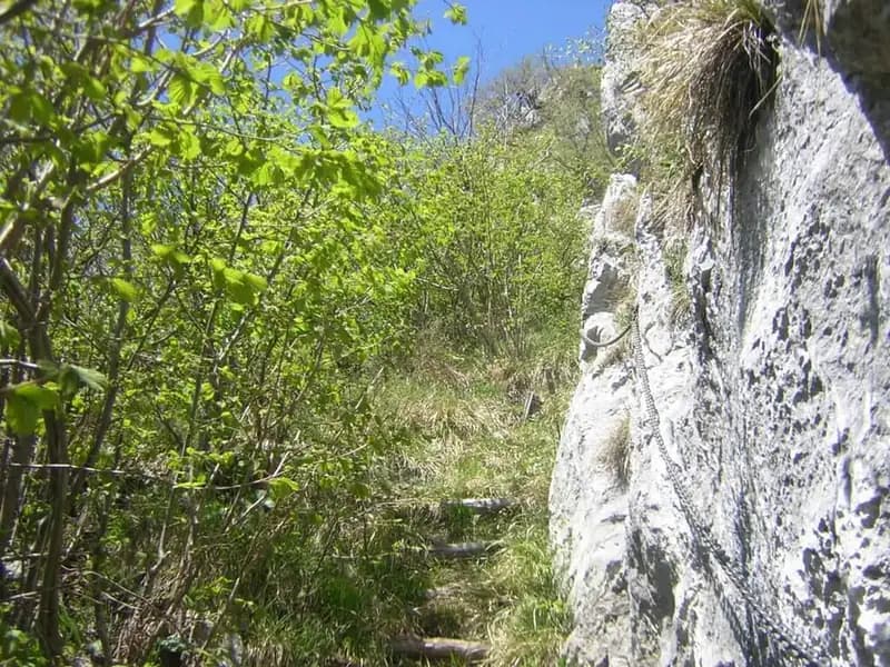
The route begins with an unremarkable rock step, overcome with a few free-climbing moves. The trail then drops slightly toward the Dente del Coltiglione, before continuing along a flat but highly exposed section protected by ropes and chains. This first sector, developed across ledges and limestone slabs, introduces the route's character: continuous progression, often traversing, across an open and airy face.
After these sections, the most distinctive part of the climb begins: ascending a long, steep gully. The terrain changes dramatically-you enter a debris-and-rock groove whose gradient steadily increases, making progress physically exhausting and the pace demanding.
Follow the red markers up the gully until you reach a cave clearly visible during the ascent. Here begins the technical heart of the route. Climb a wall diagonally from left to right, exiting from the cave's roof: this is the technically most challenging passage of the entire via ferrata, exposed and vertical. Continue along a ledge, then ascend a sloping ramp of mixed earth and rock, equipped with cables, before tackling a protected rocky gully that emerges onto the summit ridge. Follow this equipped ridge, at times narrow and panoramic, to its end, reaching the grassy, wooded summit of Monte Coltiglione (about 1 hour 45 minutes from the start of the via ferrata, for a total of about 3 hours 15 minutes from the parking area).
Descent
The simplest option from the summit of Coltiglione is to descend along the trail leading to the Piani dei Resinelli, reach Rifugio SEL, then follow the easy path of the Val Calolden, which returns toward the parking area (about 2 hours 30 minutes from the summit, for a total of about 6 hours).
A longer alternative follows signs for the Sentiero del Belvedere. At the junction for the Calolden summit, turn left toward Forcellino, then descend along the steep and not always well-marked trail of Val Verde (marked AA). At a junction, head toward Rifugio Piazza (2 hours from the summit). From the refuge, you have several options: return to the Madonnina del Carmine and from there to the parking area, or descend via the Sentiero Attrezzato dei Pizzetti or the Sentiero Attrezzato della Vergella. These variants take roughly 3 to 4 hours for the return.
Finally, there is the more challenging option of retracing the entire Sentiero Attrezzato GER in reverse, reaching the saddle below Medale and descending via the Sentiero Attrezzato del Medale.
Useful Notes
Although not technically difficult, the route is very long and physically draining. The itinerary unfolds in a rugged environment with a complete absence of water sources along the ascent: it is therefore essential to bring an abundant supply of water, commensurate with the significant elevation gain and duration. The choice of approach and descent should be carefully considered based on your fitness and available time, keeping in mind that the Sentiero Attrezzato GER is already a demanding route where the physical component clearly outweighs the technical one.
Track and weather
Plan the route
Preview the GPX track from the backend, download it for your GPS device, open parking directions, and check a short forecast before leaving.
GPX track unavailable
This route does not include a downloadable track yet.
Images
FAQ
What level of commitment does this via ferrata require?
ferrata.faqAnswers.commitment
How much elevation gain should I plan for?
The listed ferrata elevation gain is 250 m. Also consider approach, return and maximum altitude, because they can matter more than the equipped section alone.
Where is the route located?
Sentiero Attrezzato GER is located in Prealpi Bergamasche, Lecco, Italy. Before leaving, check parking, access and current local conditions.
When is the best time to climb it?
The best season depends on altitude, aspect and lingering snow. Avoid storms, wet rock and uncertain conditions; start early and keep a margin for the return.
Gear and safety planning
Use the technical data on this page to plan equipment, timing and offline navigation. For a general checklist, read the equipment guide before opening the route in the app.
Video
Watch the route
Useful YouTube videos for getting a real feel for the route before you go.
Logbook
Route condition reports
Recent community notes about closures, snow, equipment damage, trail issues and current conditions.
Community
Reviews, check-ins and photos
-
0 reviews
0
0 climbers
0
Shared by the community
Community photos
Recent images uploaded by Sferrati members.
No community photos yet
Open this route in the app to add the first photo.
Reviews
Recent impressions from climbers who know the route.
No reviews yet
Be the first to review this via ferrata from the app.
Continue in the app
Track the climb, save maps offline, and sync this route to your personal profile.
Use the app to climb
Offline maps, tracking, saves, and profile sync.
Scan the code before leaving, install the app, and keep your route data ready when reception fades.
