
Technical data
- Difficulty
- Facile
- Status
- aperta
- Distance
- 8,2 km
- Total duration
- 3 h 30 min
- Approach
- 1 h 15 min
- Ferrata time
- 45 min
- Elevation gain
- 300 m
- Max altitude
- 1042 m
Route planning
How to plan Sentiero Attrezzato Silvia
Sentiero Attrezzato Silvia is in Prealpi Bergamasche, Lecco, Italy and is rated Facile. Available route data lists about 3 h 30 min total time, 8,2 km of distance, 300 m of elevation gain.
For day planning, consider an approach of about 75 min, about 45 min on the cable, a maximum altitude near 1042 m.
The page includes a parking or driving-directions reference. A GPX track is not available yet, so bring an alternative map source.
As with every via ferrata, evaluate season, lingering snow, storms, crowds and equipment condition. Page last updated on 7/4/2026.
Description
Overview
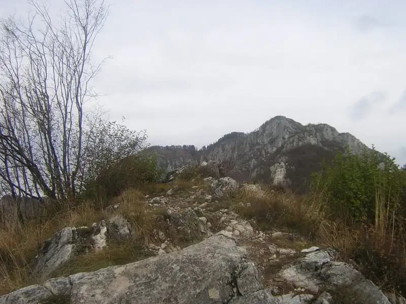
The Sentiero Attrezzato Silvia is the most direct route from the city of Lecco to the summit of Monte San Martino. The itinerary climbs decisively up the mountain's southwest flank, starting from the Cappella della Madonna del Carmine. Its central location makes it ideal for linking up with other equipped routes in the area, such as those on the Medale and Coltiglione, allowing you to build loops of varying difficulty and duration.
Approach
The route begins in the Rancio Alto district, above Lecco. From Lecco, follow the road toward Ballabio until you reach a prominent double hairpin turn within the urban area. At the second hairpin, continue straight, turning left onto via Quarto. After about two hundred meters, at a wide spot in the road, you'll see a narrow paved lane on the right, marked by a rusty white barrier that is usually open. Follow this lane, go around a left-hand hairpin, and at a fork, keep right and continue climbing. Shortly, you'll reach an area with a barrier suitable for parking.
From here, ascend the paved road to a hairpin turn, where you continue straight onto the mule track marked as CAI trail 52. The trail gains elevation, skirting the imposing limestone walls of the Medale and, later, Monte San Martino. Ignore all junctions leading to climbing routes and the via ferrata (CAI 58 to the right), continuing straight and climbing several switchbacks. About twenty minutes from the parking area, you reach a crucial fork. Both options lead to the Cappella della Madonna del Carmine: to the left, follow the Sentiero Attrezzato della Vergella, ascending a gully in about one hour (total 1h 30'); to the right, a steeper trail through the woods and over some rocky steps reaches the goal in about forty-five minutes (total 1h 15'). This latter, more direct variant has a more concentrated elevation gain and sections on bare rock, foreshadowing the character of the main route.
Via Ferrata
From the chapel, the route starts on the right side of the building, clearly marked with red paint marks. Immediately, a very steep trail leads quickly to the first two short sections equipped with cable. The first overcomes a series of easy rocky steps, while the second is a slabby section with ledges that you climb trending left. These early protections are most useful in wet conditions or when snow is present, but the moves are straightforward scrambling.
Just beyond, you encounter a fork: to the left, a trail branches off toward the Baita del Falco, but the main route continues right, climbing to a rock pinnacle that is the most characteristic and scenic passage. You can bypass it on the right via an exposed but not difficult trail, or tackle it directly by climbing an equipped chimney. In the latter case, ascend the inside of the chimney keeping the cable to your right; it's a vertical channel but well-protected, offering enjoyable climbing in a confined setting. Past this point, the cross on the summit of San Martino becomes visible in the distance. The trail continues steeply, alternating in a steady rhythm between sections on rock slabs, grassy trail passages, and more equipped steps, without ever presenting significant technical difficulty. The environment is typically pre-Alpine, with limestone often shaped into ledges and terraces, and the south-facing exposure guarantees constant views of the city and the lake. After the final, more vertical stretch, you finally emerge on the summit of Monte San Martino. The time from the chapel is about forty-five minutes, for a total of roughly two hours from the start.
Descent
Multiple return options exist. The simplest and quickest way is to head northeast, toward the Coltiglione. At a fork, take the left-hand trail that descends on the north side of Monte San Michele. Continue down, ignoring the turnoff for the Rifugio Piazza, until you reach the Baita del Falco and, from there, the Cappella della Madonna del Carmine. From here, retrace the approach trail back to the parking area, taking about an hour and thirty minutes from the summit.
For those wanting to link up other equipped itineraries, from the summit you can continue toward the Coltiglione, ignoring the main descent trail. You'll reach a fork where the Sentiero Attrezzato del GER for the Coltiglione branches off to the left, while a trail to the right leads to the Corno del Medale, from which you can descend via the Sentiero Attrezzato del Medale. Another alternative is to descend toward the Rifugio Piazza to take on the more challenging Sentiero Attrezzato dei Pizzetti on the way down. These options allow you to take advantage of the network of equipped routes in the area, turning the outing into a technical and scenic loop of considerable interest.
Useful Notes
The Sentiero Attrezzato Silvia is a steep and physically demanding route due to its concentrated elevation gain, but it presents no high technical difficulty (grade F). The key chimney passage is bypassable, and the cable sections can be free-climbed without necessarily pulling on the cables. It's important to be mindful of high summer temperatures, as the trail is exposed to the sun for most of its length, with few shady spots. The character of the route is primarily physical and scenic, rather than technical, with a sustained climbing pace. For more experienced hikers, this equipped trail can also serve as a valid and quick descent route, for example after climbing the more challenging Ferrata al Corno del Medale, taking advantage of its direct line and always manageable passages.
Track and weather
Plan the route
Preview the GPX track from the backend, download it for your GPS device, open parking directions, and check a short forecast before leaving.
GPX track unavailable
This route does not include a downloadable track yet.
Images
FAQ
What level of commitment does this via ferrata require?
ferrata.faqAnswers.commitment
How much elevation gain should I plan for?
The listed ferrata elevation gain is 300 m. Also consider approach, return and maximum altitude, because they can matter more than the equipped section alone.
Where is the route located?
Sentiero Attrezzato Silvia is located in Prealpi Bergamasche, Lecco, Italy. Before leaving, check parking, access and current local conditions.
When is the best time to climb it?
The best season depends on altitude, aspect and lingering snow. Avoid storms, wet rock and uncertain conditions; start early and keep a margin for the return.
Gear and safety planning
Use the technical data on this page to plan equipment, timing and offline navigation. For a general checklist, read the equipment guide before opening the route in the app.
Video
Watch the route
Useful YouTube videos for getting a real feel for the route before you go.
Logbook
Route condition reports
Recent community notes about closures, snow, equipment damage, trail issues and current conditions.
Community
Reviews, check-ins and photos
-
0 reviews
0
0 climbers
0
Shared by the community
Community photos
Recent images uploaded by Sferrati members.
No community photos yet
Open this route in the app to add the first photo.
Reviews
Recent impressions from climbers who know the route.
No reviews yet
Be the first to review this via ferrata from the app.
Continue in the app
Track the climb, save maps offline, and sync this route to your personal profile.
Use the app to climb
Offline maps, tracking, saves, and profile sync.
Scan the code before leaving, install the app, and keep your route data ready when reception fades.
