
Ferrata Batteria Bassa
Alpi Cozie · Torino · Italy
Technical data
- Difficulty
- Moderatamente Difficile
- Status
- aperta
- Distance
- 3,1 km
- Total duration
- 2 h 50 min
- Approach
- 10 min
- Ferrata time
- 1 h
- Elevation gain
- 120 m
- Max altitude
- 1880 m
Route planning
How to plan Ferrata Batteria Bassa
Ferrata Batteria Bassa is in Alpi Cozie, Torino, Italy and is rated Moderatamente Difficile. Available route data lists about 2 h 50 min total time, 3,1 km of distance, 120 m of elevation gain.
For day planning, consider an approach of about 10 min, about 60 min on the cable, a maximum altitude near 1880 m. Reported route features include: Avvicinamento corto, Interesse Storico, Galleria.
The page includes a parking or driving-directions reference. A GPX track is available to review and download.
As with every via ferrata, evaluate season, lingering snow, storms, crowds and equipment condition. Page last updated on 7/4/2026.
Features
Description
Overview
The Ferrata della Batteria Bassa is a compact, well-equipped route, perfect for a first taste of the via ferrata experience. The trail runs along the Italian-French border in the upper Susa Valley, winding through the ruins of historic military positions. Its moderate difficulty is paired with the thrill of exploration: some of the partially collapsed wartime structures can be inspected from the inside with a light source. This route forms the initial section of the more challenging itinerary known as the Ferrata dello Chaberton, offering an accessible preview.
Approach
The logical starting point is the ticket office for the Tibetan bridge in Claviere, in the province of Turin. For the full access route, from the nearby trail near the Chapel of San Gervasio, descend toward the Piccola Dora stream, following it on the left bank, ignoring the turnoff onto the bridge for the Ferrata di Rocca Clarì. The start of the via ferrata can be reached via this approach in about thirty minutes of walking. A shorter variant allows you to skip the first section: from the parking lot, walk two hundred meters along the main road toward the tunnel, then turn right onto the old Monginevro road. At a curve, on the left side, you'll spot the entrance to a pedestrian tunnel. Go through it (about thirty meters) and, with a short traverse to the right, rejoin the main route. This reduced access takes about fifteen minutes.
Via Ferrata
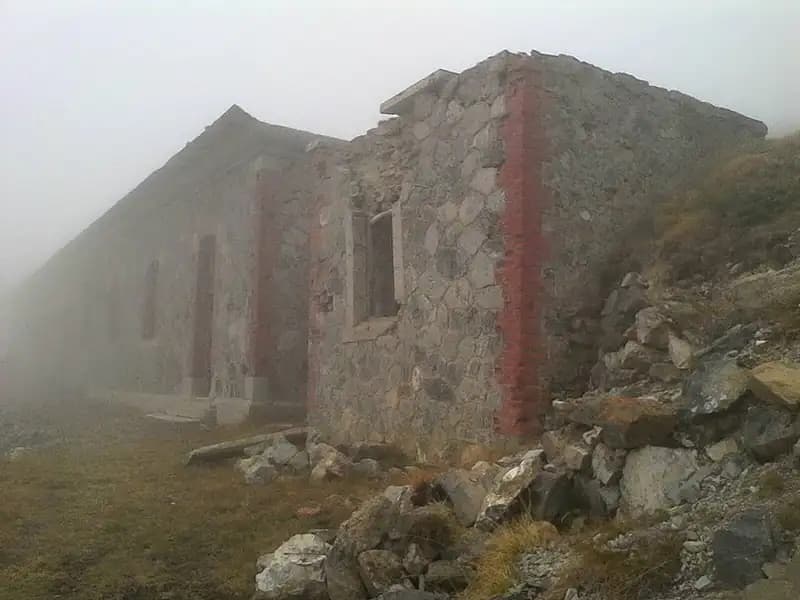
The equipped route begins with an ascent up a gully located beneath the viaduct of the old main road. The progression is pleasant, on solid, reliable rock, alternating between climbable slabs and sections of steep terrain; it's advisable to make use of the many natural holds for a smoother ascent. After joining the access variant, you gain elevation quickly, passing the viaduct and leaving the view of the starting roundabout behind. The route unfolds with a varied rhythm, fluidly alternating easy traverses, well-defined ledges, short vertical steps, and sections of equipped face, all on compact, high-quality rock. Two passages are particularly distinctive: a chimney that requires a stemming ascent and a passage under a fissure with a pronounced shape. After a final stretch on a trail, you arrive at the ruins of the military buildings of the Batteria Bassa, located at an elevation of 1910 m. The time for the via ferrata alone is about one hour and thirty minutes, for a total of two hours from the start of the hike.
Terrain reading and route rhythm The via ferrata develops mainly on a rocky slope shaped by glacial and fluvial erosion, presenting a complex morphology of ledges, gullies, and short walls. The rock, of a calcareous-marmoreal type, offers excellent grip and solidity. The rhythm of the route is discontinuous, played out in constant ups and downs, with exposed but not extreme passages alternating with restful sections on ledges or trail. The general character is that of a predominantly horizontal, traversing route, more technical than physically demanding, with a strong historical and scenic appeal that tempers the alpine commitment.
Descent
From the ruins of the battery, the return is made along a comfortable forest road, which leads back to the old Monginevro road and, consequently, to the initial parking lot near the ticket office for the Tibetan bridge in Claviere. This descent section takes about thirty minutes of walking.
Useful Notes
At the ticket office for the Tibetan bridge in Claviere, you can rent complete via ferrata equipment (harness, helmet, via ferrata set). The Ferrata della Batteria Bassa represents the first sector of the itinerary that, continuing on, leads to the summit of Monte Chaberton via the Via della Cresta Mario Perona, a long route with considerable elevation gain, completed in 2018. This via ferrata lends itself well to being combined with other equipped routes in the Claviere area, such as the more challenging Ferrata di Rocca Clarì or the Ferrata del Bunker. More broadly, the upper Susa Valley offers a wide selection of itineraries, including the ferratas of the Orrido di Foresto, the Orrido di Chianocco, the Ruceia, the Rouas, and, noted since 2024, the Ferrata delle Cascate di Novalesa.
Track and weather
Plan the route
Preview the GPX track from the backend, download it for your GPS device, open parking directions, and check a short forecast before leaving.
Images
FAQ
What level of commitment does this via ferrata require?
ferrata.faqAnswers.commitment
How much elevation gain should I plan for?
The listed ferrata elevation gain is 120 m. Also consider approach, return and maximum altitude, because they can matter more than the equipped section alone.
Where is the route located?
Ferrata Batteria Bassa is located in Alpi Cozie, Torino, Italy. Before leaving, check parking, access and current local conditions.
When is the best time to climb it?
The best season depends on altitude, aspect and lingering snow. Avoid storms, wet rock and uncertain conditions; start early and keep a margin for the return.
Gear and safety planning
Use the technical data on this page to plan equipment, timing and offline navigation. For a general checklist, read the equipment guide before opening the route in the app.
Video
Watch the route
Useful YouTube videos for getting a real feel for the route before you go.
Logbook
Route condition reports
Recent community notes about closures, snow, equipment damage, trail issues and current conditions.
Community
Reviews, check-ins and photos
-
0 reviews
0
0 climbers
0
Shared by the community
Community photos
Recent images uploaded by Sferrati members.
No community photos yet
Open this route in the app to add the first photo.
Reviews
Recent impressions from climbers who know the route.
No reviews yet
Be the first to review this via ferrata from the app.
Continue in the app
Track the climb, save maps offline, and sync this route to your personal profile.
Use the app to climb
Offline maps, tracking, saves, and profile sync.
Scan the code before leaving, install the app, and keep your route data ready when reception fades.
