
Technical data
- Difficulty
- Moderatamente Difficile
- Status
- aperta
- Distance
- 4,5 km
- Total duration
- 4 h
- Approach
- 1 h 15 min
- Ferrata time
- 2 h
- Elevation gain
- 300 m
- Max altitude
- 2335 m
Route planning
How to plan Ferrata del Limbo
Ferrata del Limbo is in Monte Mucrone, Biella, Italy and is rated Moderatamente Difficile. Available route data lists about 4 h total time, 4,5 km of distance, 300 m of elevation gain.
For day planning, consider an approach of about 75 min, about 120 min on the cable, a maximum altitude near 2335 m. Reported route features include: Ponti sospesi, Funivia all'andata, Funivia al ritorno.
The page includes a parking or driving-directions reference. A GPX track is available to review and download.
As with every via ferrata, evaluate season, lingering snow, storms, crowds and equipment condition. Page last updated on 7/4/2026.
Features
Description
Overview
The Ferrata del Limbo, the first via ferrata built in the Biella region and among the pioneers in Piedmont, unfolds along the compact eastern face of Monte Mucrone, towering above the famous Sanctuary of Oropa. Conceived by mountain guide Gianni Lanza and opened in 2001, it offers a route of considerable physical commitment in a rugged, secluded alpine setting. While the progression doesn't present extreme technical difficulties thanks to a dense succession of iron rungs, it is characterized by continuous exposure and a variety of obstacles, weaving through dihedrals, chimneys, vertical slabs, and a short Tibetan bridge. The excursion requires a rather long approach and return, with trails that are not always well-marked, but in favorable weather conditions, the effort is rewarded by an exceptional panoramic view stretching from Monte Rosa to the Matterhorn.
Approach
The route begins at the upper square of the Oropa cable car, accessible from Biella via the SP 144 road. From the top station, follow the signs for "Ferrata del Limbo (sentiero alto)" towards Lago del Mucrone. After skirting the lake on its left (hydrographic) side, a sign indicates the direction for Colle del Limbo and Monte Mucrone Parete E. The trail continues with a moderate slope along the mountainside, sometimes aided by fixed ropes during the summer season, guided by sparse cairns. The final section climbs a debris-filled gully, at the end of which, on the rocky wall to your right, the first metal rungs appear, marking the start of the via ferrata. The approach takes about 1 hour and 15 minutes from the top station (45 minutes from the lake).
Via Ferrata
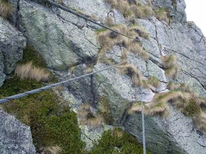
The equipped route begins with a sequence of rungs up an initial dihedral, tackled on its right side, with some slightly overhanging moves. After overcoming this first section, turn left to ascend a diagonal ledge, traverse left again, and climb vertically up the wall until emerging onto the broad and panoramic Colle del Limbo. This first 120-meter stretch is physically demanding and exposed, but excellently equipped.
Next comes a tall chimney, whose progression is eased by the abundant rungs that outline the path. At the top of the chimney, some boulders require a short climbing move to complete the second section. A short stretch of non-equipped trail leads to the start of the third part, marked by a white sign. Here you climb a beautiful vertical slab, slightly overhanging, before encountering a short three-rope Tibetan bridge. After crossing the bridge, ascend the final wall, traverse left, and reach the end of the equipped route. The Ferrata del Limbo takes about 2 hours from the start, for a total of 3 hours and 15 minutes from the top station.
Descent
From the end of the via ferrata, in a few minutes you reach a large cairn marking the false summit. Continuing over rocky terrain and a faint trail for another quarter of an hour, you arrive at the summit of Monte Mucrone (2335 m). The descent follows trail number 24 towards the Bocchetta del Lago, then turns right towards Lago del Mucrone and the cable car. This return section, where trail markers can be sparse or absent, takes about 1 hour and 30 minutes, bringing the total time for the excursion to about 3 hours and 45 minutes.
Useful Notes
The area is often covered in snow until the end of May, so in the early season it is essential to carefully assess conditions and take appropriate precautions. The sector, though very beautiful, is also frequently subject to cloud cover. Given the sometimes inadequate or outdated signage along the approach and descent trails, it is highly recommended to plan the route by consulting the maps and GPS tracks available for download on the Province of Biella website. For cartography, a reliable reference is the Valli del Monte Rosa map published by 4Land.
For fitter hikers with an early start, in good weather it is theoretically possible to combine the Ferrata Ciao Miki on the same day, also served by the Oropa cable car. Alternatively, descending into the valley, you can consider the Ferrata Nito Staich (short approach), the easier Ferrata della Balma, or the Sentiero Attrezzato dell'Infernone, reachable in about half an hour by car.
Track and weather
Plan the route
Preview the GPX track from the backend, download it for your GPS device, open parking directions, and check a short forecast before leaving.
Images
FAQ
What level of commitment does this via ferrata require?
ferrata.faqAnswers.commitment
How much elevation gain should I plan for?
The listed ferrata elevation gain is 300 m. Also consider approach, return and maximum altitude, because they can matter more than the equipped section alone.
Where is the route located?
Ferrata del Limbo is located in Monte Mucrone, Biella, Italy. Before leaving, check parking, access and current local conditions.
When is the best time to climb it?
The best season depends on altitude, aspect and lingering snow. Avoid storms, wet rock and uncertain conditions; start early and keep a margin for the return.
Gear and safety planning
Use the technical data on this page to plan equipment, timing and offline navigation. For a general checklist, read the equipment guide before opening the route in the app.
Video
Watch the route
Useful YouTube videos for getting a real feel for the route before you go.
Logbook
Route condition reports
Recent community notes about closures, snow, equipment damage, trail issues and current conditions.
Community
Reviews, check-ins and photos
-
0 reviews
2
2 climbers
0
Shared by the community
Community photos
Recent images uploaded by Sferrati members.
No community photos yet
Open this route in the app to add the first photo.
Reviews
Recent impressions from climbers who know the route.
No reviews yet
Be the first to review this via ferrata from the app.
Continue in the app
Track the climb, save maps offline, and sync this route to your personal profile.
Use the app to climb
Offline maps, tracking, saves, and profile sync.
Scan the code before leaving, install the app, and keep your route data ready when reception fades.
