Overview
The Via Ferrata alla Cascata di Stuller, inaugurated in 2019 near Moso in the Val Passiria, is a modern route that combines the grandeur of a waterfall with a varied, multi-branch layout. The structure offers a modular progression: a shared, challenging initial section then splits into a moderately difficult variant and an extremely difficult one, the latter dedicated to those seeking athletic, complex climbing passages. The route runs on solid, water-sculpted rock, alternating vertical sections on slabs and dihedrals with exposed traverses on ledges, delivering a spectacular and technically diverse experience.
Approach
The starting point is Moso (Moos), in the Val Passiria. From the south, exit the Brenner motorway at Vipiteno, take the state road heading south, and follow signs for the Val Passiria. After three closely spaced tunnels, turn left to enter Moso. For parking, the most convenient option is just after the turn: once past a church on the left side, immediately take a small downhill road; at the first fork, turning right reveals a few parking spots. Alternatively, you can leave the car in the village or near the church, adding a few minutes to the approach but shortening the return.
From the parking area, a trail gradually descends toward the stream, but without crossing it. Continue on the trail marked with number 11, cross the road by passing under it through a culvert, and keep climbing until you reach the start of the Ferrata di Stuller in about 30 minutes. The approach is pleasant and sets the scene, skirting the valley floor before entering the rocky slope.
Via Ferrata
The route is structured into three main variants, identified by the grades "Moderately difficult," "Very difficult," and "Extremely difficult." Right at the start, you face the first choice: the Very difficult variant begins by veering right on a slight descent.
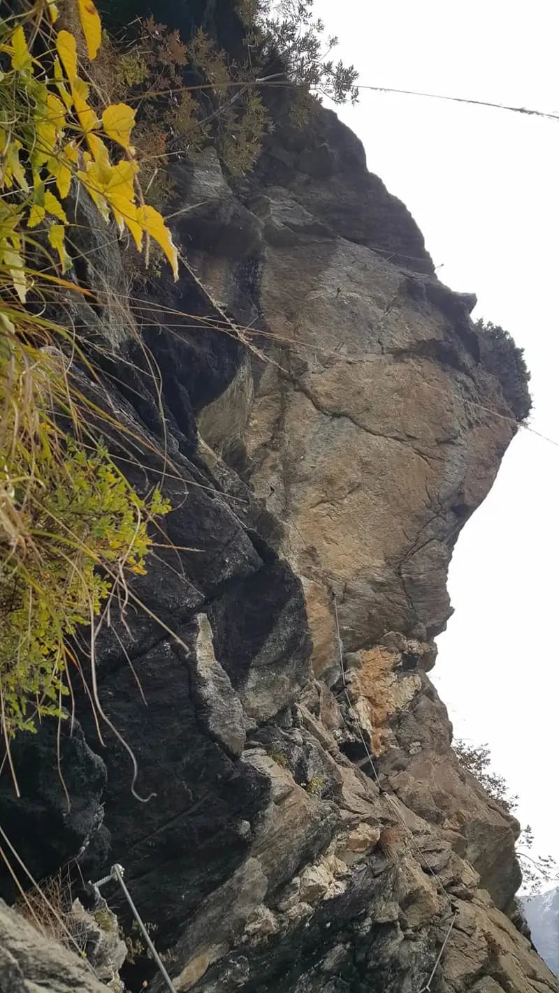
Moderately Difficult Variant (initial) Next to the starting plaque, you tackle a dihedral before entering a rocky cleft, where the cable runs between the wall and a rock blade. Watch your footing, as the ground can be slippery from moisture. Exiting, you reach a diagonal traverse to the left, at the end of which you overcome a first athletic but not difficult overhang. Continue with an exposed traverse to the right, walking on metal rungs to bypass a roof. This initial section alternates between smears on polished rock and short, steeper sections, offering a progressive introduction to exposure.
Very Difficult Variant (initial) The start of this variant is at a narrow chimney. Climb the fissure for about ten vertical meters; it's advisable to secure your backpack with a sling and retrieve it once you're out. Exiting the chimney, traverse right across a slightly overhanging section with smearing moves to a ledge. After the short ledge, tackle a decidedly overhanging wall with determination, climbing first vertically and then diagonally left. A subsequent horizontal traverse to the right, very strenuous, leads beneath another pronounced overhang. Once past it, the difficulty eases but doesn't end: climb a final vertical wall with small footholds but good handholds, until reaching a more sloping area where the two initial variants rejoin. This option requires sustained effort and good balance management on compact rock.
Common progression and second split From the junction ledge, the cable resumes vertically, then left, and again vertically. After gaining height and exposure, climb a beautiful equipped dihedral of about 15 meters that leads to a small earthy terrace. Here the equipment ends, and a connecting trail leads to the end of the first section. Along this trail, you encounter the second split: to the left, the Extremely difficult variant begins, while to the right, the Moderately difficult route continues. The pace briefly pauses, allowing a rest before tackling the next technical section.
Moderately Difficult Variant (second section) The route resumes on a small slab and then another dihedral. The rock is polished, but the rungs aid progression. You then arrive at an exposed, overhanging corner to the left, which you climb with an athletic burst, rounding a rocky spur. The passage is short but incisive, with a fine view over the valley.
Extremely Difficult Variant (second section) The two variants meet again after the spur. Round the spur, traverse left, and continue through a more climbable section. At the end of the traverse, climb an exposed step, emerging above a roof, where a marked junction again distinguishes the moderate variant from the extreme one. The character here becomes more vertical and athletic, with moves requiring precision and arm strength.
Moderately Difficult Variant (third section) This option includes passages never exceeding those already faced. It starts on a sloping slab to the left, climbs diagonally to a panoramic bench, then goes vertically, using the rungs to shift left and ascend a corner. After a move to the right, proceed diagonally on an easy section to the left until the equipment ends. A short trail section leads to the point where the extreme variant joins from the right. The route maintains a sustained but steady rhythm, with wide views of the waterfall.
Extremely Difficult Variant (third section) Follow a ledge to the right, then climb a first physical passage bypassing a small roof. The route continues in zig-zags on blackish rock until emerging, with an athletic move, onto a small terrace with a view of the valley. From here, the upper overhangs come into sight. Move left beneath a roof, which you bypass with a difficult, overhanging diagonal traverse to the left. The passage is very exposed and athletic; the rungs help, but it's crucial to manage your balance and keep your arms bent to avoid excessive fatigue. A chain allows you to extend the quickdraw with a sling if necessary. Then traverse right toward the corner, climb it, and continue on the demanding wall until the equipment ends. This section is the most technical and physically demanding of the entire route, characterized by continuous overhangs and climbing moves.
Conclusion of the ferrata After a few meters, you reach a trail (marked E5), where the easy variant joins from the left. From here, you could descend to Moso, but to complete the Ferrata di Stuller, continue uphill. After an easy stretch, the route still demands effort, following a well-equipped vertical line with rungs. You reach a sloping traverse to the right that leads to a narrow ledge, a prelude to the final traverses, with the Cascata di Stuller finally on your right. The climbing time for the ferrata is about 2 hours and 30 minutes, for a total of about 3 hours including the approach. The finale offers a close-up perspective of the waterfall, crowning the route with a powerful scenic impact.
Descent
From the end of the equipment, follow the trail to a paved road, which you take to the right, soon entering the village of Stuller. Continue on a small road initially uphill to the right, then downhill. At the junction with a larger road, keep left along a parking area and descend in the opposite direction from Moso. The road descends with two switchbacks (right, then left). At this point, a paved road with a sign and trail markers 10 E5 begins, soon becoming a trail. Then cut across the slope in a steep descent to the point where the two initial variants had joined. Continue on the trail that, passing alongside a tunnel, leads back to Moso. The descent takes about 1 hour and 30 minutes, for a total of about 4 hours and 30 minutes from the start of the hike. The return, though long, offers a different perspective on the slope just climbed.
Useful Notes
The Ferrata alla Cascata di Stuller is excellently equipped, with a well-tensioned cable that aids progression. The extreme variant is to be considered Extremely Difficult and requires good physical strength and excellent movement technique to handle the decidedly overhanging traverses. It can be useful to carry a sling to simulate a belay on the most demanding sections. The rest of the route presents no particular difficulties, although the rock is not always very climbable. The itinerary is notable for the scenery, which constantly accompanies the hiker with views of the valley and the waterfall, making the experience technically rich and visually spectacular.