Overview
The Sentiero Attrezzato de le Stel is a technical hiking route on the eastern side of the Val d'Adige, just south of Trento. This moderately demanding trail is an excellent choice for getting into the mountains during winter conditions or as a training ground at the start of the season. The itinerary blends traditional trail sections with equipped passages and short sequences of easy climbing, offering a complete experience that is neither overly physical nor exposed.
Approach
The starting point is Aldeno, in the Val d'Adige. Once you reach the La Busa area along the Via al Bondone, look for a steep track heading west. It's best to park nearby and take this track, which is initially paved. Follow the dirt road marked as CAI trail 631, sticking to the main direction and ignoring any secondary paths that branch off. After about a 40-minute walk, you'll arrive at a scenic spot equipped with benches. Continuing on, you'll cross a few short, low-difficulty equipped sections and, after a brief detour toward the waterfalls, rejoin trail 631. Leave this trail for good and take trail F01, clearly marked as the Sentiero Attrezzato de le Stel with the classic white-and-red CAI markers. The actual start of the equipped section sits at an elevation of about 620 meters, reachable in roughly one hour from the parking area. This approach, mostly along a dirt road, gradually eases you into the mountain environment.
Via Ferrata
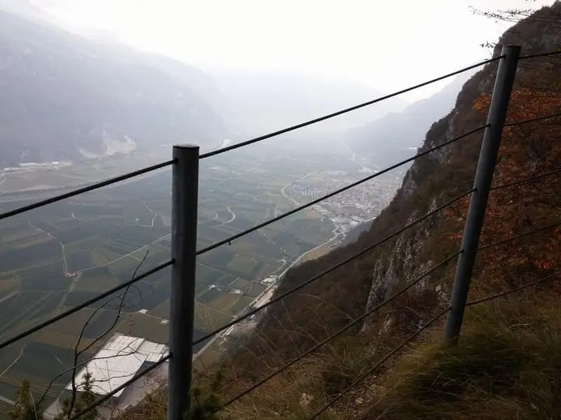
The route begins as a well-defined mid-slope path, skirting slopes covered with sparse vegetation. You'll soon encounter a few easy rock steps fitted with metal anchors that make them straightforward to negotiate. The trail alternates at a steady rhythm between simple hiking sections and short equipped sequences, always of low difficulty, until you reach the distinctive shrine of the Madonna, an excellent panoramic rest stop with a bench overlooking the Val d'Adige and its vineyards. The terrain gradually changes: as you continue, the path narrows and leads to a narrow, rather exposed rocky ledge, properly equipped with a steel cable. This airy section, on solid rock, offers a first taste of exposure. Once past it, the route begins to gain elevation more decisively through a series of small steps and equipped rock slabs. This is the most interesting and vertical part of the route, where you can climb easy passages, never exceeding second grade, using the fixed gear for self-belaying. The progression becomes more technical and continuous, over slabs and through gullies, in a steep but well-protected ascent. You continue this way until you reach a signpost and a marker indicating the end of the equipped route. The via ferrata itself takes about 1 hour and 30 minutes, for a total of 2 hours and 30 minutes from the start. The experience is characterized by a varied rhythm, with a crescendo of technical challenge toward the upper section, while still maintaining a predominantly hiking and scenic character.
Descent
From the final sign, climb briefly through the woods, then take the return route. The descent alternates between forest road sections and woodland paths, proceeding without technical difficulty at a higher elevation parallel to the via ferrata route, until it reconnects with CAI trail 631. From there, continue downhill back to the starting point. The estimated time for the return is about 2 hours from the end of the Sentiero Attrezzato de le Stel, bringing the total hike time to around 4 hours and 30 minutes. The descent is long but easy, over varied terrain.
Useful Notes
Despite the presence of a vertical section with easy climbable passages, the trail does not present high technical difficulty. The most challenging aspect may be navigation in the first half of the route, where the markings are not always perfect and you sometimes need to intuit the path through the vegetation. Pay attention to a point where an old trail, marked by a cord in less-than-optimal condition, climbs to the left; the new and old paths rejoin shortly after. For maps, the 4Land maps of the area are recommended. The Sentiero Attrezzato de le Stel lies in a zone rich in alpine offerings: to the south, near Mori, you'll find the exposed Ferrata Marangoni and the panoramic Ferrata del Somator, as well as the Ferrata Rio Secco near Cadino. Heading up the Val d'Adige toward Trento, you'll encounter the Sentiero Attrezzato Bertotti and the challenging Ferrata Segata on Monte Bondone.