
Sentiero Attrezzato della Scala Santa
Dolomiti di Brenta · Trento · Italy
Technical data
- Difficulty
- Facile
- Status
- aperta
- Distance
- 12 km
- Total duration
- 5 h
- Approach
- 1 h 30 min
- Ferrata time
- 1 h 30 min
- Elevation gain
- 200 m
- Max altitude
- 2489 m
Route planning
How to plan Sentiero Attrezzato della Scala Santa
Sentiero Attrezzato della Scala Santa is in Dolomiti di Brenta, Trento, Italy and is rated Facile. Available route data lists about 5 h total time, 12 km of distance, 200 m of elevation gain.
For day planning, consider an approach of about 90 min, about 90 min on the cable, a maximum altitude near 2489 m. Reported route features include: Scale, Funivia all'andata, Funivia al ritorno.
The page includes a parking or driving-directions reference. A GPX track is not available yet, so bring an alternative map source.
As with every via ferrata, evaluate season, lingering snow, storms, crowds and equipment condition. Page last updated on 7/4/2026.
Features
Description
Overview
The Sentiero Attrezzato della Scala Santa is the main access route to the Rifugio XII Apostoli, located in the southern sector of the Dolomiti di Brenta. Although it includes a protected section, the route is essentially a hiking trail and does not require any specific mountaineering skills. Its purpose is primarily logistical: it serves as the approach to a key mountain hut, which is the starting point for many more challenging itineraries within the Brenta Group.
Approach
The recommended starting point is the top station of the cable car that runs from Pinzolo up to Doss del Sabion. After reaching Pinzolo along the SS239, the lifts and a large parking area are clearly visible. Once you've parked, take the cable car, which operates in two stages: the first goes to Pra Rodont, and the second continues to Doss del Sabion at 2101 meters. An alternative without using the lifts is to hike up from Pinzolo along the Sentiero Tartarotti (trail marker CAI 307B), passing by the Rifugio Pra Rodont and the Baita dei Cacciatori.
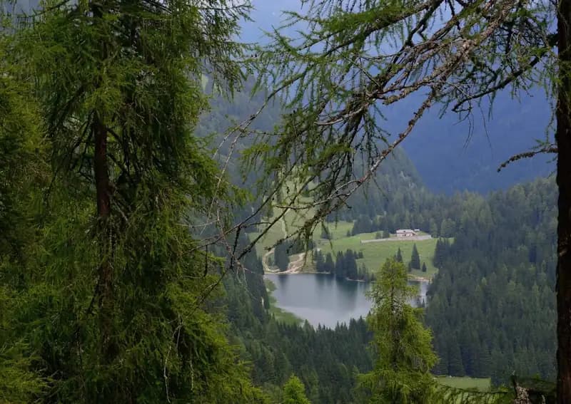
From the top station at Doss del Sabion, follow a trail that descends slightly eastward, quickly joining a contour path. Turning right (south), continue until you meet the CAI 307 trail coming up from the valley at the Baita dei Cacciatori (1836 m). From here, you enter the Val dei Nardi, heading east on a pleasant forest trail, with views of Lago d'Agola to your left. The landscape is classic Dolomites: wide scree slopes and conifer forests covering the valley floor. Staying on the right side of the valley, you reach the Lago Asciutto area, a broad, forested plateau where the hut's cableway begins. This initial section offers a steady, enjoyable pace. From here, the trail becomes noticeably steeper, marking the start of the most strenuous part of the approach (about 1 hour and 30 minutes from the cable car top station). The route climbs over grassy and rocky slopes, with well-defined switchbacks that demand increasing physical effort.
Via Ferrata
From the Lago Asciutto area, the ascent heads directly toward a prominent rocky notch, where the characteristic protected section known as the Scala Santa unfolds. The route enters a steep rocky gully, carved into the compact grey dolomite of the Southern Brenta. The climb is made easier by the presence of steel cables and fixed ladders, which make the passage technically straightforward once you've put on your safety gear. The surroundings become more enclosed and vertical, with walls hemming in the gully. After passing a distinctive shrine with a small Madonna statue, you continue on a steep trail with wooden steps and other short protected sections. Emerging from the gully, you find yourself in a wide, sunny moraine basin-a clear change in environment. The trail, always well-marked, continues with sustained steepness over unstable scree and boulders, demanding constant physical effort but no technical difficulty. It is essential to follow the red-and-white trail markers carefully to stay on the main route as it weaves between the blocks. The pace is that of a continuous alpine ascent, with only brief flat sections offering momentary relief. The final effort is rewarded by reaching a characteristic stone-paved staircase that leads onto the plateau where the Rifugio XII Apostoli stands, the destination of the hike (about 1 hour and 30 minutes from the Scala Santa, for a total of roughly 3 hours from the cable car top station). The last stretch is panoramic, with the view suddenly opening up onto the hut and the surrounding Dolomite towers.
Descent
For the return, retrace the ascent route back to the cable car station at Doss del Sabion. The descent requires extra caution on the scree sections and the wooden steps in the protected gully. The estimated time for the descent from the hut is about 2 hours, for a total hike duration of roughly 5 hours.
Useful Notes
The Scala Santa route has no significant technical difficulties and is the normal way to reach the Rifugio XII Apostoli, an important crossroads for hikes in the Brenta Group. The protected sections make it easier to overcome the steepest parts. Given the constant gradient and long stretches over uneven terrain, using telescopic trekking poles can be very helpful for reducing strain on your joints. For navigation, it is advisable to use a detailed map of the area, such as one dedicated to the Brenta Group.
From the hut, you can set out on other, more demanding protected routes, such as the Ferrata Castiglioni toward the Rifugio Agostini or the exposed Sentiero Attrezzato dell'Ideale, or you can join the system of high-level via ferratas in the Brenta, like the Ferrata Brentari toward the Rifugio Pedrotti, the gateway to the famous Bocchette Centrali and Alte. The character of this route is therefore that of a physically demanding but technically easy approach, offering a first taste of the more severe Dolomite environment.
Track and weather
Plan the route
Preview the GPX track from the backend, download it for your GPS device, open parking directions, and check a short forecast before leaving.
GPX track unavailable
This route does not include a downloadable track yet.
Images
FAQ
What level of commitment does this via ferrata require?
ferrata.faqAnswers.commitment
How much elevation gain should I plan for?
The listed ferrata elevation gain is 200 m. Also consider approach, return and maximum altitude, because they can matter more than the equipped section alone.
Where is the route located?
Sentiero Attrezzato della Scala Santa is located in Dolomiti di Brenta, Trento, Italy. Before leaving, check parking, access and current local conditions.
When is the best time to climb it?
The best season depends on altitude, aspect and lingering snow. Avoid storms, wet rock and uncertain conditions; start early and keep a margin for the return.
Gear and safety planning
Use the technical data on this page to plan equipment, timing and offline navigation. For a general checklist, read the equipment guide before opening the route in the app.
Video
Watch the route
Useful YouTube videos for getting a real feel for the route before you go.
Logbook
Route condition reports
Recent community notes about closures, snow, equipment damage, trail issues and current conditions.
Community
Reviews, check-ins and photos
-
0 reviews
0
0 climbers
0
Shared by the community
Community photos
Recent images uploaded by Sferrati members.
No community photos yet
Open this route in the app to add the first photo.
Reviews
Recent impressions from climbers who know the route.
No reviews yet
Be the first to review this via ferrata from the app.
Continue in the app
Track the climb, save maps offline, and sync this route to your personal profile.
Use the app to climb
Offline maps, tracking, saves, and profile sync.
Scan the code before leaving, install the app, and keep your route data ready when reception fades.
