
Technical data
- Difficulty
- Facile
- Status
- aperta
- Distance
- 11 km
- Total duration
- 5 h
- Approach
- 45 min
- Ferrata time
- 2 h
- Elevation gain
- 569 m
- Max altitude
- 2182 m
Route planning
How to plan Sentiero Attrezzato Violi
Sentiero Attrezzato Violi is in Dolomiti di Brenta, Trento, Italy and is rated Facile. Available route data lists about 5 h total time, 11 km of distance, 569 m of elevation gain.
For day planning, consider an approach of about 45 min, about 120 min on the cable, a maximum altitude near 2182 m.
The page includes a parking or driving-directions reference. A GPX track is not available yet, so bring an alternative map source.
As with every via ferrata, evaluate season, lingering snow, storms, crowds and equipment condition. Page last updated on 7/4/2026.
Description
Overview
The Sentiero Attrezzato Violi is a moderately difficult hiking connection, equipped with metal protections on the most exposed sections, linking Rifugio Casinei and Rifugio Brentei in the central sector of the Dolomiti di Brenta. This route offers a valid and generally less crowded alternative to the more direct Sentiero Bogani, set in a strikingly beautiful natural environment and providing privileged access to the massif's famous climbing routes. The trail unfolds across a varied slope, alternating wooded stretches with rocky passages along ledges and gullies, and is predominantly physical and panoramic in character.
Approach
The usual starting point is the parking area at Rifugio Vallesinella (1513 m), reachable by car from Madonna di Campiglio. A well-marked roundabout with brown signs for Vallesinella leads onto the roughly 4 km road that ends at the parking lot. From here, the CAI trail 317 climbs steeply but is well-defined, winding through dense forest with numerous switchbacks and no technical difficulties. In the final section, a junction appears: ignoring the left turn toward Rifugio Tucket, continue straight ahead to reach Rifugio Casinei (1850 m) in about 45 minutes, which marks the actual start of the via ferrata. This approach offers an initial immersion into the Dolomitic environment, with the forest gradually thinning out toward the rock walls.
Via Ferrata
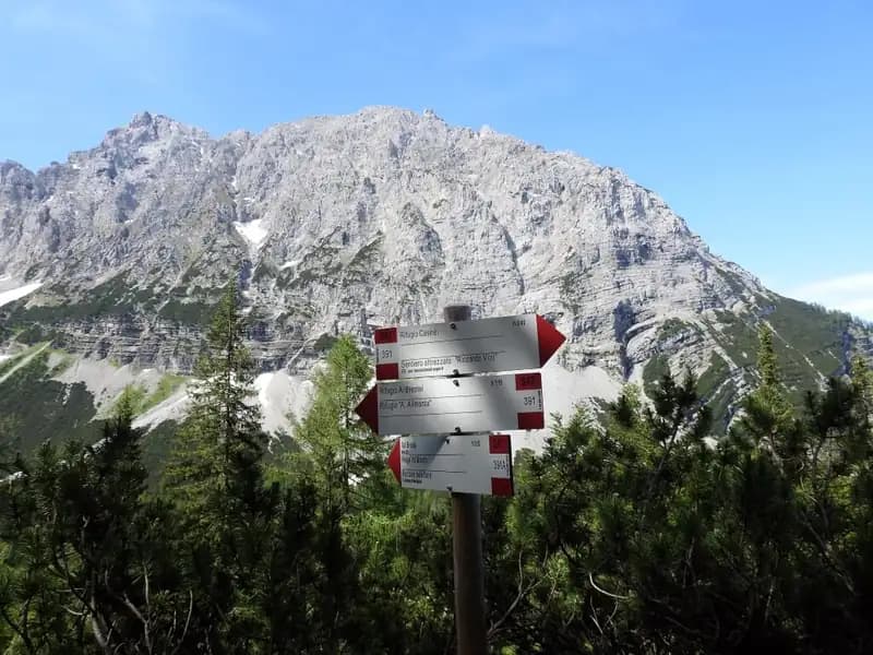
From Rifugio Casinei, the Sentiero Attrezzato Violi enters the forest with a moderate gradient, circling the slopes of Cima Fridolin from the west and staying at a lower elevation than the parallel Sentiero Bogani. The route proceeds over morphologically varied terrain, alternating sections of compact scree with short rocky steps. After the first stretch, you encounter a few short equipped passages with steel cables, followed by small slabs and rock ledges that, especially in damp conditions, can be slightly slippery, requiring caution. The progression is steady, without significant ups and downs, but the gradient gradually becomes steeper. After about 1 hour and 30 minutes from leaving Casinei, you reach the junction with the CAI trail 323. Past this point, you finally exit the treeline and tackle the final, steeper, and more demanding section: a debris-and-rock gully that, over roughly 200 meters of elevation gain, leads to the finish. The pace becomes slower and more physical, with exposure increasing progressively until the arrival. Rifugio Brentei (2182 m) is thus reached in 2 hours from Casinei, for a total ascent time of about 2 hours and 45 minutes from the Vallesinella parking lot.
Descent
From Rifugio Brentei, you have two main options for the return. The first is to return by the same route, descending the Sentiero Attrezzato Violi to Rifugio Casinei (about 1h 45') and then to the Vallesinella parking lot, for a total of about 5 hours round trip. The second, often preferred for a change of scenery, involves taking the Sentiero CAI 318 (Galleria Bogani). This route stays higher up, featuring some exposed but easy sections along ledges and steps, and also leads back to Rifugio Casinei. About halfway down this descent, a signpost indicates a right turn toward Rifugio Tucket, a potential variation for a longer loop. Ignoring this turn, you descend to Casinei and then to the parking lot in about 2 hours from Brentei, for a total of about 4 hours and 45 minutes for the entire loop. The descent via the Bogani is quicker and more airy, offering a different perspective on the group.
Useful Notes
The Sentiero Attrezzato Violi presents no significant technical difficulties, but its final, steeper, and continuous section makes it generally more strenuous on the ascent compared to the Sentiero Bogani, characterizing it as a route with a steady, physical pace. For this reason, it is often used for descent for a quicker return to the valley, especially after tackling other challenging hikes starting from Rifugio Brentei. Given its function as a connection between refuges, it is an ideal route for approaches or returns within longer itineraries in the Gruppo di Brenta, such as the famous Ferrate delle Bocchette Centrali or Alte, or the Sentiero Attrezzato Sosat. For those planning to combine it with other routes, consider an overnight stay at one of the high-altitude refuges to split the effort and avoid overly long and demanding approaches in a single day. For navigation, it is advisable to use a detailed map of the area.
Track and weather
Plan the route
Preview the GPX track from the backend, download it for your GPS device, open parking directions, and check a short forecast before leaving.
GPX track unavailable
This route does not include a downloadable track yet.
Images
FAQ
What level of commitment does this via ferrata require?
ferrata.faqAnswers.commitment
How much elevation gain should I plan for?
The listed ferrata elevation gain is 569 m. Also consider approach, return and maximum altitude, because they can matter more than the equipped section alone.
Where is the route located?
Sentiero Attrezzato Violi is located in Dolomiti di Brenta, Trento, Italy. Before leaving, check parking, access and current local conditions.
When is the best time to climb it?
The best season depends on altitude, aspect and lingering snow. Avoid storms, wet rock and uncertain conditions; start early and keep a margin for the return.
Gear and safety planning
Use the technical data on this page to plan equipment, timing and offline navigation. For a general checklist, read the equipment guide before opening the route in the app.
Video
Watch the route
Useful YouTube videos for getting a real feel for the route before you go.
Logbook
Route condition reports
Recent community notes about closures, snow, equipment damage, trail issues and current conditions.
Community
Reviews, check-ins and photos
-
0 reviews
0
0 climbers
0
Shared by the community
Community photos
Recent images uploaded by Sferrati members.
No community photos yet
Open this route in the app to add the first photo.
Reviews
Recent impressions from climbers who know the route.
No reviews yet
Be the first to review this via ferrata from the app.
Continue in the app
Track the climb, save maps offline, and sync this route to your personal profile.
Use the app to climb
Offline maps, tracking, saves, and profile sync.
Scan the code before leaving, install the app, and keep your route data ready when reception fades.
