
Alta via Bruno Federspiel
Monzoni · Trento · Italy
Technical data
- Difficulty
- Moderatamente Difficile
- Status
- aperta
- Distance
- 17 km
- Total duration
- 7 h 30 min
- Approach
- 2 h 30 min
- Ferrata time
- 3 h
- Elevation gain
- 150 m
Route planning
How to plan Alta via Bruno Federspiel
Alta via Bruno Federspiel is in Monzoni, Trento, Italy and is rated Moderatamente Difficile. Available route data lists about 7 h 30 min total time, 17 km of distance, 150 m of elevation gain.
For day planning, consider an approach of about 150 min, about 180 min on the cable. Reported route features include: Itinerario lungo, Interesse Storico, Itinerario Alpinistico.
The page includes a parking or driving-directions reference. A GPX track is available to review and download.
As with every via ferrata, evaluate season, lingering snow, storms, crowds and equipment condition. Page last updated on 6/4/2026.
Features
Description
Panoramica
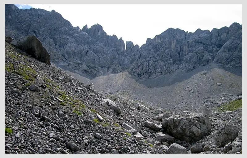
L’Alta Via Bruno Federspiel è un itinerario di cresta lungo ed esposto che attraversa il Gruppo del Monzoni, collegando Forcella de la Costela a Passo delle Selle, in provincia di Trento. Pur non presentando passaggi tecnici estremi, si sviluppa in un ambiente severo, con continui saliscendi e tratti aerei che richiedono passo sicuro e resistenza. Il percorso ha anche un marcato interesse storico, attraversando zone utilizzate come postazioni militari durante la Prima Guerra Mondiale.
Avvicinamento
Il punto di partenza è Malga Crocefisso, in Val San Nicolò, laterale della Val di Fassa nei pressi di Pozza di Fassa. Quando consentito, è possibile risalire la Val Monzoni in auto e parcheggiare poco oltre, altrimenti si lascia l’auto alla malga.
Dal parcheggio si segue la strada della Val Monzoni, coincidente con il CAI 603, raggiungendo la Baita Monzoni. Si prosegue in salita fino a un bivio dove si imbocca a destra il CAI 624 in direzione del Rifugio Valacia, che si raggiunge dopo circa 1h30’. Dal rifugio si continua lungo il sentiero ripido fino alla Forcella de la Costela, punto di inizio dell’Alta Via, in circa 2h30’ complessive.
Via Ferrata
Dalla Forcella de la Costela si apre davanti una lunga e articolata cresta. Il percorso inizia su sentiero abbastanza ampio, che gradualmente si restringe avvicinandosi al filo di cresta, aumentando l’esposizione. Si procede a mezzacosta con tratti che richiedono attenzione costante, fino a raggiungere lo Spiz del Malinvern, dove compaiono i primi passaggi attrezzati. Da qui è possibile un’uscita anticipata tramite un sentiero laterale.
Proseguendo sull’Alta Via, si scende lungo la cresta erbosa verso Forcella Ricoletta e si continua alternando discese e risalite. Sono presenti brevi tratti protetti, cenge esposte, passerelle in legno e semplici sezioni attrezzate che agevolano il superamento dei punti più delicati. Un breve diedro in discesa e un traverso protetto conducono a una zona ricca di resti bellici, visitabili tramite brevi deviazioni.
L’itinerario prosegue senza particolari difficoltà tecniche ma con impegno continuo fino a raggiungere il Passo delle Selle, termine dell’Alta Via, in circa 3 ore dall’attacco.
Discesa
Dal Passo delle Selle sono disponibili due possibilità di rientro verso Malga Crocefisso. La più semplice segue il CAI 604 in direzione nord, passando dal Rifugio Taramelli e ricollegandosi al percorso dell’andata, con un tempo di circa 1h45’. La seconda opzione, più impegnativa, utilizza il Sentiero Attrezzato Gino Badia, che presenta alcuni tratti protetti e una discesa su ghiaione ripido, prima di ricongiungersi al CAI 603. In questo caso i tempi si allungano fino a circa 2h30’ dal passo.
Note utili
L’Alta Via Bruno Federspiel è un itinerario fisicamente impegnativo, poiché il dislivello complessivo risulta amplificato dai numerosi saliscendi lungo la cresta. Rispetto ad altri percorsi vicini, è generalmente meno frequentata e più esposta, soprattutto nella prima parte. Per ridurre la fatica, può essere valutata la percorrenza in senso inverso, utilizzando gli impianti di risalita dal Passo di San Pellegrino per raggiungere il Passo delle Selle e affrontare la via in leggera discesa.
Track and weather
Plan the route
Preview the GPX track from the backend, download it for your GPS device, open parking directions, and check a short forecast before leaving.
Images
FAQ
What level of commitment does this via ferrata require?
ferrata.faqAnswers.commitment
How much elevation gain should I plan for?
The listed ferrata elevation gain is 150 m. Also consider approach, return and maximum altitude, because they can matter more than the equipped section alone.
Where is the route located?
Alta via Bruno Federspiel is located in Monzoni, Trento, Italy. Before leaving, check parking, access and current local conditions.
When is the best time to climb it?
The best season depends on altitude, aspect and lingering snow. Avoid storms, wet rock and uncertain conditions; start early and keep a margin for the return.
Gear and safety planning
Use the technical data on this page to plan equipment, timing and offline navigation. For a general checklist, read the equipment guide before opening the route in the app.
Video
Watch the route
Useful YouTube videos for getting a real feel for the route before you go.
Logbook
Route condition reports
Recent community notes about closures, snow, equipment damage, trail issues and current conditions.
Community
Reviews, check-ins and photos
-
0 reviews
0
0 climbers
0
Shared by the community
Community photos
Recent images uploaded by Sferrati members.
No community photos yet
Open this route in the app to add the first photo.
Reviews
Recent impressions from climbers who know the route.
No reviews yet
Be the first to review this via ferrata from the app.
Continue in the app
Track the climb, save maps offline, and sync this route to your personal profile.
Use the app to climb
Offline maps, tracking, saves, and profile sync.
Scan the code before leaving, install the app, and keep your route data ready when reception fades.
