
Ferrata degli Alleghesi al Civetta
Civetta · Belluno · Italy
Technical data
- Difficulty
- Moderatamente Difficile
- Status
- aperta
- Distance
- 18,5 km
- Total duration
- 10 h
- Approach
- 3 h
- Ferrata time
- 3 h 30 min
- Elevation gain
- 870 m
- Max altitude
- 3220 m
Route planning
How to plan Ferrata degli Alleghesi al Civetta
Ferrata degli Alleghesi al Civetta is in Civetta, Belluno, Italy and is rated Moderatamente Difficile. Available route data lists about 10 h total time, 18,5 km of distance, 870 m of elevation gain.
For day planning, consider an approach of about 180 min, about 210 min on the cable, a maximum altitude near 3220 m. Reported route features include: Alta montagna, Scale, Itinerario lungo, Funivia all'andata.
The page includes a parking or driving-directions reference. A GPX track is available to review and download.
As with every via ferrata, evaluate season, lingering snow, storms, crowds and equipment condition. Page last updated on 7/4/2026.
Features
Description
Overview
The Ferrata degli Alleghesi is one of the great Dolomite classics, a sweeping itinerary that ascends the imposing Monte Civetta in the heart of the Dolomiti di Zoldo. The experience is magnificent, but the commitment comes mainly from its length, the considerable elevation gain, and the overall duration. The descent can be made via the via normale of the Civetta, which is also equipped, or by opting for the more demanding Ferrata Tissi, a choice that significantly raises the overall difficulty level.
Approach
The choice of starting point is tied to the descent loop. For the variant that involves climbing the Ferrata degli Alleghesi and descending via the normal route, the recommended access is near Palafavera, between the Val Zoldana and the Passo di Staulanza. A large parking area near a campsite serves as the trailhead. From here, following the signs for trail 564, you ascend at a moderate gradient through a conifer forest until reaching Malga Pioda (1850 m) in about an hour. It is possible to shorten the approach by about 400 meters of elevation gain by using the chairlift from Palafavera to Col de la Traversa. You then continue on the well-marked trail 556, which leads to the Rifugio Sonino al Coldai (2132 m), reachable in about an hour and a half from the parking lot.
From the hut, heading towards Forcella Coldai, you encounter a junction. Take the left-hand trail 557, known as the Sentiero Tivan, which climbs at a moderate gradient to the start of the ferrata. The path bends east and ascends a debris-filled gully with a few short equipped sections, then tackles a more exposed stretch over rock slabs protected by a fixed rope, beneath the imposing Muro del Tivan. This preparatory section leads to the actual start of the Ferrata degli Alleghesi, reached in about an hour and thirty minutes from the Rifugio Coldai, for a total of about three hours from the parking lot. The approach unfolds in an environment that gradually leaves the forest behind, opening onto the wide, debris-strewn basins at the foot of the walls, offering a first impression of the Civetta's majesty.
Via Ferrata
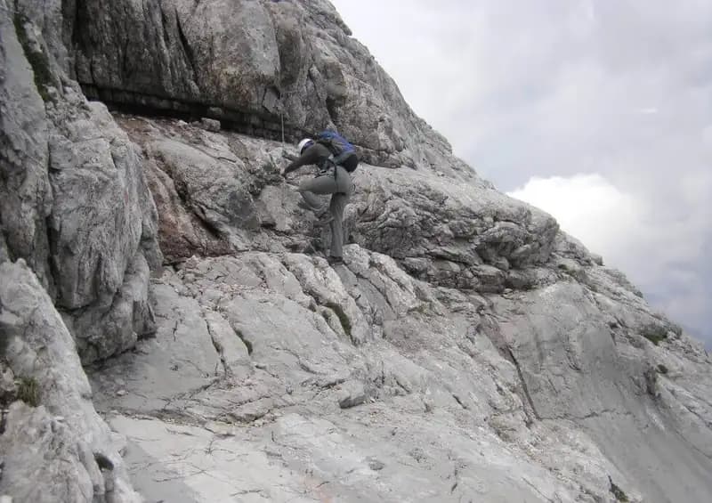
The route begins with a series of metal staples on a vertical slab. You climb traversing to the right on pegs, then tackle a new succession of vertical staples, followed by long horizontal traverses to the left. You quickly gain height and exposure until reaching a metal ladder in a very airy position. The pace is sustained and the exposure increases, with the ferrata initially developing over compact slabs. You then enter a vertical chimney with solid rock and plenty of excellent natural holds, allowing for easy climbing, assisted in a couple of spots by metal pegs on the right. Exiting the chimney, following the numerous red paint marks, you bend left across a slab towards a second chimney, similar to the previous one in character and ease of progression. The climb continues inside this groove, using the abundant natural holds and a generous series of metal staples, before exiting thanks to some iron fixtures. This first section is technical and continuous, predominantly vertical but on excellent rock.
Once this phase is over, the environment opens up and the summit becomes visible. You begin to ascend smooth, hold-poor slabs, where you proceed partly by friction and partly using the metal pegs. The panorama expands dramatically, ranging from the imposing Punta Tissi to the opposite side, where Lago Coldai lies almost a thousand meters below. This is a relatively easy section, with a few short vertical steps and some transfer sections on ledges. Reaching a ledge, you arrive on the ridge with passages of no substantial difficulty. You walk a stretch of ridge, then stay just below the crest, on the left side, on an equipped and exposed ledge. The route here takes on a more horizontal and panoramic character, offering a moment of relative physical rest.
After this easier sequence, you encounter a new climbing section over quite demanding rock steps and slabs, made more difficult by the polished rock. You proceed, alternating between smooth sections and others that are well-holded and easy to climb. You emerge onto a broad ridge with rocky steps, where you need to be careful not to dislodge stones and to watch for any residual snow patches, which lead to the final section of the route. The pace becomes more technical and discontinuous again, with passages requiring greater precision.
This last sector demands maximum concentration, more due to accumulated fatigue than the technical difficulty of the individual passages. You tackle a final step of about a hundred meters before the summit conclusion. You start from a panoramic terrace with a view of the Pelmo, climbing a vertical but hold-rich wall. You then bend left, reaching some vertical steps, which lead to a traverse to the left, very exposed but not technically demanding. You bend right again to gain the final meters with a series of passages on polished rock that may require some arm strength. With the last of your energy, you gain the ridge. The crest, broad and with a clear trail, continues left, offering a remarkable view of the east face towards Alleghe, with over a thousand meters of drop. In about five minutes you reach the summit cross of Monte Civetta (3220 m). The climbing time from the start of the ferrata is about three hours and thirty minutes, for a total of six hours and thirty minutes from the parking lot. The entire ascent is characterized by an alternation of vertical sections on gullies and slabs with more horizontal stretches on ridges and ledges, demanding prolonged physical effort and constant exposure.
Descent
From the summit cross, a trail marked with red paint descends the east face towards the Rifugio Torrani below, visible and reachable in about twenty minutes with no technical difficulty. From the hut, following the descending trail, you arrive at a marked junction: to the right descends the demanding Ferrata Tissi towards the Forcella delle Sasse, to the left the via normale, also equipped. This description considers the descent via the normal route.
It is important to emphasize that the descent via the normal route is demanding and requires maximum concentration. You follow the red paint marks, which soon lead to a first downclimbing passage in a chimney without protection, not prohibitive but requiring a steady foot. Continuing, on a small ledge you encounter the first section of cable, usable mainly as a handrail. After a few steps, you arrive on a flat area, from which the main difficulties begin. The descent unfolds on the northeast side, on rock that is often more friable and prone to water seepage.
You descend a long series of rock steps, followed by a more demanding vertical step, requiring careful searching for footholds, which are nonetheless present. You continue on a sloping slab under a rocky roof, often damp from water coming from the snowfield above. The descent continues with some challenging passages on slabs and short chimneys, then over slabs and ledges until reaching the snowfield. Here the technical difficulties and metal equipment end, leaving room for admiration of the imposing wall you have just descended. The pace is slow and deliberate, with downclimbing passages on sometimes slippery rock that demand great attention, especially at the end of the day.
From this point, you take the Sentiero Tivan to the left, which skirts the east walls of the Civetta until rejoining the approach path you left for the ferrata. You then retrace your steps, passing by the Rifugio Coldai and descending to Palafavera. The descent from the summit takes about four hours, for a total of about ten hours and thirty minutes, excluding breaks. The return is long and physically draining, especially after the many hours of effort that preceded it.
Useful Notes
The Ferrata degli Alleghesi is one of the most iconic routes in the Dolomites. The technical difficulty of the individual passages is moderate, making it one of the most popular routes in the Dolomiti Bellunesi. However, the length, elevation gain, and overall duration are considerable, requiring excellent fitness and endurance; it is possible to consider splitting the itinerary over two days, staying overnight at the Rifugio Coldai or Torrani. The ferrata is generally in good condition, with abundant and well-placed equipment where needed. The scenery and environment are of exceptional beauty, with continuous views of the major Dolomite peaks.
The route allows you to climb Monte Civetta, a historic testing ground for world mountaineering, offering from its summit one of the most beautiful views in the Dolomites. The construction of this itinerary was a colossal undertaking: work began in 1949 and was only completed in 1966, testifying to the effort required to trace such an articulated route on the face.
Often the Ferrata degli Alleghesi is combined with the nearby and more difficult Ferrata Tissi, taken in descent due to its shorter length. In the Civetta area, there are other important and generally challenging ferratas, such as the Ferrata Gianni Costantini on the Moiazza and the Ferrata Fiamme Gialle in the Pelsa. Moving towards Agordo, you can tackle the demanding Ferrata Stella Alpina which climbs the Agner, while descending towards Belluno you encounter other interesting routes like the Ferrata Sperti, the Sentiero Attrezzato Marino Guardiano, and the Ferrata Zacchi.
Track and weather
Plan the route
Preview the GPX track from the backend, download it for your GPS device, open parking directions, and check a short forecast before leaving.
Images
FAQ
What level of commitment does this via ferrata require?
ferrata.faqAnswers.commitment
How much elevation gain should I plan for?
The listed ferrata elevation gain is 870 m. Also consider approach, return and maximum altitude, because they can matter more than the equipped section alone.
Where is the route located?
Ferrata degli Alleghesi al Civetta is located in Civetta, Belluno, Italy. Before leaving, check parking, access and current local conditions.
When is the best time to climb it?
The best season depends on altitude, aspect and lingering snow. Avoid storms, wet rock and uncertain conditions; start early and keep a margin for the return.
Gear and safety planning
Use the technical data on this page to plan equipment, timing and offline navigation. For a general checklist, read the equipment guide before opening the route in the app.
Video
Watch the route
Useful YouTube videos for getting a real feel for the route before you go.
Logbook
Route condition reports
Recent community notes about closures, snow, equipment damage, trail issues and current conditions.
Community
Reviews, check-ins and photos
-
0 reviews
0
0 climbers
0
Shared by the community
Community photos
Recent images uploaded by Sferrati members.
No community photos yet
Open this route in the app to add the first photo.
Reviews
Recent impressions from climbers who know the route.
No reviews yet
Be the first to review this via ferrata from the app.
Continue in the app
Track the climb, save maps offline, and sync this route to your personal profile.
Use the app to climb
Offline maps, tracking, saves, and profile sync.
Scan the code before leaving, install the app, and keep your route data ready when reception fades.
