
Ferrata del Camoscio al Palombino
Monte Palombino · Belluno · Italy
Technical data
- Difficulty
- Moderatamente Difficile
- Status
- aperta
- Distance
- 14 km
- Total duration
- 6 h
- Approach
- 2 h 30 min
- Ferrata time
- 1 h 15 min
- Elevation gain
- 400 m
- Max altitude
- 2589 m
Route planning
How to plan Ferrata del Camoscio al Palombino
Ferrata del Camoscio al Palombino is in Monte Palombino, Belluno, Italy and is rated Moderatamente Difficile. Available route data lists about 6 h total time, 14 km of distance, 400 m of elevation gain.
For day planning, consider an approach of about 150 min, about 75 min on the cable, a maximum altitude near 2589 m. Reported route features include: Scale, Itinerario lungo, Interesse Storico.
The page includes a parking or driving-directions reference. A GPX track is available to review and download.
As with every via ferrata, evaluate season, lingering snow, storms, crowds and equipment condition. Page last updated on 7/4/2026.
Features
Description
Overview
The Ferrata Camoscio is the most spectacular access route to Monte Palombino, a border summit in the Carnic Alps. Classified as moderate difficulty, this itinerary combines quality climbing progression with a strikingly beautiful natural setting, offering a complete and rewarding experience.
Approach
The route begins in the Val Visdende, in the province of Belluno. From the south, after Santo Stefano di Cadore, follow signs for Sappada; about 7 km further on, before a tunnel, turn left onto a bridge marked for the Val Visdende. Drive up the road, and at the first junction keep left for about 800 meters to the main parking area (approximately 1300 m). An alternative is to continue by car to the second parking lot at Bivio Ciadon, in the Val di Londo. Important: paid parking devices are active in the valley lots. For a full day, the cost is 8 euros (2024). It is advisable to have cash on hand, as the main parking device may not accept contactless or card payments.
From the main parking lot, take the wide forest road (trail marker 167) that winds through dense vegetation to Bivio Ciadon. Here, turn right onto the CAI 170 trail (Strada delle Malghe), which climbs at a steady gradient through the woods, offering the first views of the imposing mass of Palombino. After passing Malga Dignas (1676 m), you reach a junction where you leave the CAI 170 to keep left toward Forcella Dignas. Just before the pass, a left turn onto the CAI 172 leads, across broad grassy slopes and then a compact scree field, to the start of the via ferrata. The approach time is approximately 2 hours and 30 minutes.
Via Ferrata
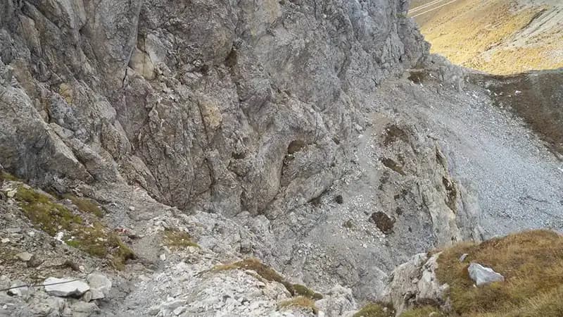
The via ferrata begins with a diagonal ramp that leads into a narrow gully, climbed toward the left. Exiting the gully, you move left again to tackle a sequence of easy rocky steps, very climbable, and a wooden ladder. The route is extremely logical, following the natural fracture lines of the wall. This first section, using ledges and dihedrals, has a continuous and pleasant rhythm. After rounding a corner, follow the numerous trail markers as you ascend a few modest rock steps. The limestone rock is compact and offers excellent holds, making progression smooth and secure. The itinerary balances lateral traverses with altitude gain, maintaining a predominantly vertical character without severe technical passages; the exposure is noticeable but never overwhelming.
After about thirty minutes of via ferrata progression, the steel cables end. To reach the summit, you follow a trail that tackles some easy rock steps alternating with meadows and scree slopes. The path eventually leads to the border ridge, marked by two crosses: the one on the Austrian side stands out for its size and grandeur. The time for the via ferrata and the subsequent ridge ascent is about 1 hour and 30 minutes, for a total of approximately 3 hours from the start.
Descent
From the summit cross, descend a few dozen meters back along the Italian side until you intercept the CAI 142 trail. The descent runs along the so-called "Muri del Palombino", a broad, debris-covered and rocky slope, down to a pass where a sign indicates the return route (along the way, you can see remnants of trenches). Continue south along the ridge trail to a fork; here, keep right onto the descending path into the Valle del Palombino, known as the "Traversata Carnica". This route, which passes through a gentler, pastoral landscape, leads back to Malga Dignas, from where you return to the parking lot by retracing the approach trail. The total loop duration is approximately 6 hours.
Useful Notes
The itinerary is extremely enjoyable as a whole, characterized by good elevation gain and a panoramic summit with sweeping views. The Ferrata Camoscio is inherently climbable, never extremely difficult but exposed in sections, with a progression that rewards rock movement technique. The ridge sections, both after the via ferrata and during the descent, lack protection and therefore require attention and sure-footedness on varied terrain. It is absolutely to be avoided in wet rock or bad weather, conditions that would make the rock slippery and the exposure dangerous. The Carnic Alps area offers numerous other possibilities for via ferratas and equipped trails of varying difficulty, making this region a true paradise for alpine hiking.
Track and weather
Plan the route
Preview the GPX track from the backend, download it for your GPS device, open parking directions, and check a short forecast before leaving.
Images
FAQ
What level of commitment does this via ferrata require?
ferrata.faqAnswers.commitment
How much elevation gain should I plan for?
The listed ferrata elevation gain is 400 m. Also consider approach, return and maximum altitude, because they can matter more than the equipped section alone.
Where is the route located?
Ferrata del Camoscio al Palombino is located in Monte Palombino, Belluno, Italy. Before leaving, check parking, access and current local conditions.
When is the best time to climb it?
The best season depends on altitude, aspect and lingering snow. Avoid storms, wet rock and uncertain conditions; start early and keep a margin for the return.
Gear and safety planning
Use the technical data on this page to plan equipment, timing and offline navigation. For a general checklist, read the equipment guide before opening the route in the app.
Video
Watch the route
Useful YouTube videos for getting a real feel for the route before you go.
Logbook
Route condition reports
Recent community notes about closures, snow, equipment damage, trail issues and current conditions.
Community
Reviews, check-ins and photos
-
0 reviews
0
0 climbers
0
Shared by the community
Community photos
Recent images uploaded by Sferrati members.
No community photos yet
Open this route in the app to add the first photo.
Reviews
Recent impressions from climbers who know the route.
No reviews yet
Be the first to review this via ferrata from the app.
Continue in the app
Track the climb, save maps offline, and sync this route to your personal profile.
Use the app to climb
Offline maps, tracking, saves, and profile sync.
Scan the code before leaving, install the app, and keep your route data ready when reception fades.
