Overview
The Ferrata Gamma 1 is a classic and heavily trafficked route on the cliffs of Pizzo d'Erna in Lombardy. The route is defined by an intense succession of metal ladders, particularly concentrated in the early and final sections. The technical difficulties are generally moderate, with a few more demanding passages that are short in length. The itinerary offers considerable exposure right from the start, unfolding across slabs and ledges on the south face. About halfway along the route, there is an option to bail out toward the Rifugio Stoppani, which adds to its logistical safety.
Approach
The starting point is the large parking lot for the Piani d'Erna cable car in Lecco. After reaching the city via the Valtellina superhighway, at the exit of a tunnel follow signs for "Piani d'Erna," driving up a winding road with switchbacks to the arrival square. From the right side of the parking lot (facing the lifts), Trail 1 begins, heading toward the Rifugio Stoppani. Follow this easy path for about 20 minutes to a marked junction. Here, take the steep trail that climbs to the left, reaching the start of the Ferrata Gamma 1 in about 10 minutes, for a total of 25 minutes from the parking lot.
Via Ferrata
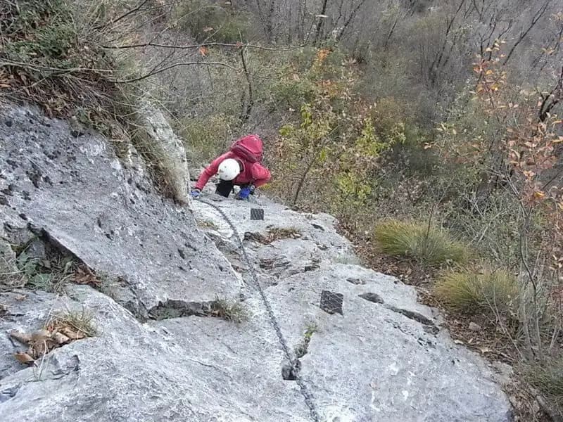
From the start, the first few meters of cable help you ascend a short chimney well-supplied with natural holds. The route then bends to the right to overcome a small limestone wall, equipped with good holds and some metal stirrups (watch out for rock that can be slippery due to moisture or polish). Gaining elevation, you traverse diagonally to the left across a smooth slab, aided by some old stirrups, until you reach the first long metal ladder. After climbing it, continue to the right on a traverse with good footholds that leads to an equipped ledge. This ends against an exposed wall, fitted with stirrups, which you ascend along a crack to a pulpit. From here begins a new series of ladders, a succession of metal structures that allow you to gain height quickly on an otherwise very vertical section. After a few easy rock faces, you tackle a dihedral with a crack, climbable using both natural and artificial holds. Exiting the dihedral, you climb some steps to the left to another long ladder. The cable, after an equipped slab, bends to the right, leading to the base of another imposing ladder, interrupted by a short connecting section. Once this climb is finished, you follow an exposed traverse to the left with a double cable, which leads to the last series of ladders before the end of the first section of the ferrata. At this point, you can take an escape route toward the Rifugio Stoppani, or, keeping left, follow a connecting trail to the second section. You climb a series of rock steps first to the right and then to the left, up to the route's crux: a wall with few holds and a slight overhang. The passage is short but requires more effort than the average on the route, with a more careful search for footholds. Continuing on the well-equipped wall, you skirt a rocky pulpit to the right and arrive at the monkey bridge, a double suspended rope of about 8 meters (avoidable via a comfortable trail). Beyond the bridge, you encounter two metal ladders and a pleasant succession of rock steps. You then proceed along the ridge to the second suspension bridge, this time a solid metal walkway. The climb continues on rocky steps along the ridge, alternating short equipped sections, ladders, and trail, approaching the final tower before the end. This is overcome with a tight series of metal ladders that lead to a summit ridge and the large cross of Pizzo d'Erna (1375 m). The panorama spans Lecco, Lake Como, and the plains; on a clear day, you can even spot the distant Matterhorn. The climbing time from the start is about 3 hours (3 hours and 30 minutes from the parking lot).
Descent
From the cross, a trail descends quickly to the buildings of Piani d'Erna. Here you have two options: descend rapidly via the cable car to the parking lot, or set off along the trail that descends from the north side toward the Rifugio Stoppani and then continues to the parking lot (about 1 hour and 30 minutes from Piani d'Erna, for a total of about 5 hours).
Useful Notes
The Ferrata Gamma 1 has a first part that is very exposed and full of ladders, with generally modest technical difficulties. The vertical development is significant and can be tiring if you are not sufficiently fit. The possibility of retreating halfway to the Rifugio Stoppani is a safety element to consider. The second section includes a technically more difficult passage, though not extreme, and a suspension bridge. Be careful in some spots where the anchor bolts are spaced out: a fall could generate a significant impact factor.