
Technical data
- Difficulty
- Facile
- Status
- aperta
- Distance
- 6,6 km
- Total duration
- 3 h 30 min
- Approach
- 1 h
- Ferrata time
- 1 h
- Elevation gain
- 174 m
- Max altitude
- 2574 m
Route planning
How to plan Ferrata Ra Gusela al Nuvolau
Ferrata Ra Gusela al Nuvolau is in Gruppo del Nuvolau, Belluno, Italy and is rated Facile. Available route data lists about 3 h 30 min total time, 6,6 km of distance, 174 m of elevation gain.
For day planning, consider an approach of about 60 min, about 60 min on the cable, a maximum altitude near 2574 m. Reported route features include: Scale, Interesse Storico.
The page includes a parking or driving-directions reference. A GPX track is available to review and download.
As with every via ferrata, evaluate season, lingering snow, storms, crowds and equipment condition. Page last updated on 7/4/2026.
Features
Description
Overview
The Ra Gusela Via Ferrata is an ideal introductory route to protected climbing, traversing the southern flank of the Nuvolau Group in the Ampezzo Dolomites. The itinerary stands out for its lack of significant technical difficulty, offering safe progression and a remarkable panoramic payoff. The complete route, including approach and descent, is suitable for a half-day outing. The hiking approach can be shortened by using the lifts at Passo Falzarego or Passo Giau.
Approach
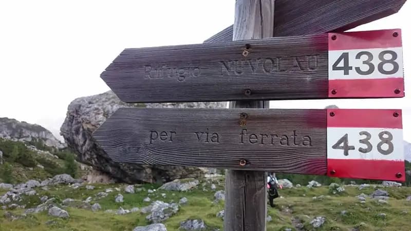
The most logical and complete access starts from Passo Giau (2236 m), reachable from Cortina d'Ampezzo or Selva di Cadore, allowing a loop without mechanical lifts. From the parking lot, a wide trail heads north toward Nuvolau. In less than ten minutes you reach a junction: to ascend the via ferrata, take the right fork onto trail 443 (the return will be via trail 452 on the left). Continuing northeast, another junction indicates trail 438 to the left, signed for the via ferrata and Rifugio Nuvolau. This track climbs steeply until it meets the first steel cable of a simple ledge, the route's start. The approach from Passo Giau takes about an hour.
Via Ferrata
From the first cable, the equipped ledge runs to the right, offering a wide, obstacle-free passage with the cable serving as a convenient handrail. After rounding a corner, you face the characteristic yellowish eastern wall of Ra Gusela, a compact dolomite formation. The goal is a clear narrow gully that cuts diagonally across the mountain, reached after crossing some easy rock steps. Entering the gully marks the start of the most distinctive section: the terrain becomes more crumbly, and progression, initially on the left side, is secured by the cable. A steeper step is overcome with the help of a short metal ladder. Exiting the gully, after a few easy vertical moves, you traverse a new ledge that leads to a small notch. Beyond this, you find yourself on a plateau: ahead, about 100 meters of elevation gain away, stands Rifugio Nuvolau, while to the left rises the profile of Ra Gusela.
Crossing the plateau (follow the trail markers carefully) you reach the opposite ridge. From here, to gain the refuge, you must tackle the final 60 meters of elevation gain. The last section runs toward the crest, first along a ledge, then rounding a corner that introduces greater exposure. You climb a first metal ladder, tackle a couple of moves on rock steps (exposed but not difficult) with the aid of another ladder, and shortly, following the trail trace, you emerge at Rifugio Nuvolau (2575 m). The via ferrata takes about an hour from the start, for a total of two hours from Passo Giau.
Descent
The return follows the scenic and touristy trail that descends gently northward, passing Forcella Nuvolau and reaching Rifugio Averau. From here, to return to Passo Giau (about 1 hour and 30 minutes from the end of the via ferrata), take trail 464/452 to the left. Alternatively, for those needing to return toward Rifugio Scoiattoli, take trail 439 to the right (about 1 hour from the end of the via ferrata). The total loop hike time is about 3 hours and 30 minutes.
Useful Notes
The Ra Gusela Via Ferrata is confirmed as an easy-level route, with challenging passages only in a few sections and limited exposure. It is a perfect choice for an introductory or half-day excursion in the Ampezzo Dolomites. For planning, use detailed maps of the Cortina area and the Nuvolau Group. The itinerary lends itself well to being combined with the nearby Averau Via Ferrata. The area offers numerous other opportunities for enthusiasts, such as the easy Sass de Rocia Via Ferrata toward Selva di Cadore, or the more challenging via ferratas of the Civetta Group (Alleghesi, Tissi, Fiamme Gialle al Pelsa, Costantini alla Moiazza). Continuing instead toward Cortina, you reach the access to the Sci Club 18 Via Ferrata on Monte Faloria.
Track and weather
Plan the route
Preview the GPX track from the backend, download it for your GPS device, open parking directions, and check a short forecast before leaving.
Images
FAQ
What level of commitment does this via ferrata require?
ferrata.faqAnswers.commitment
How much elevation gain should I plan for?
The listed ferrata elevation gain is 174 m. Also consider approach, return and maximum altitude, because they can matter more than the equipped section alone.
Where is the route located?
Ferrata Ra Gusela al Nuvolau is located in Gruppo del Nuvolau, Belluno, Italy. Before leaving, check parking, access and current local conditions.
When is the best time to climb it?
The best season depends on altitude, aspect and lingering snow. Avoid storms, wet rock and uncertain conditions; start early and keep a margin for the return.
Gear and safety planning
Use the technical data on this page to plan equipment, timing and offline navigation. For a general checklist, read the equipment guide before opening the route in the app.
Video
Watch the route
Useful YouTube videos for getting a real feel for the route before you go.
Logbook
Route condition reports
Recent community notes about closures, snow, equipment damage, trail issues and current conditions.
Community
Reviews, check-ins and photos
-
0 reviews
2
2 climbers
0
Shared by the community
Community photos
Recent images uploaded by Sferrati members.
No community photos yet
Open this route in the app to add the first photo.
Reviews
Recent impressions from climbers who know the route.
No reviews yet
Be the first to review this via ferrata from the app.
Continue in the app
Track the climb, save maps offline, and sync this route to your personal profile.
Use the app to climb
Offline maps, tracking, saves, and profile sync.
Scan the code before leaving, install the app, and keep your route data ready when reception fades.
