
Nairb Otisol
Nov 6, 2025
Panoramica e rilassante
Preferisco Ferrate più difficili, ma ero vicino e ho scelto ti dargli una possibilità, non me ne pento, bella ferrata e splendidi scenari.
2

Route planning
Ferrata Ra Pegna is in Dolomiti Ampezzane, Belluno, Italy and is rated Facile. Available route data lists about 2 h 15 min total time, 1,5 km of distance, 100 m of elevation gain.
For day planning, consider an approach of about 60 min, about 45 min on the cable, a maximum altitude near 2241 m. Reported route features include: Scale, Funivia all'andata, Funivia al ritorno.
The page includes a parking or driving-directions reference. A GPX track is available to review and download.
As with every via ferrata, evaluate season, lingering snow, storms, crowds and equipment condition. Page last updated on 7/4/2026.
The Ferrata Ra Pegna is a short, easily accessible route that climbs the namesake rock monolith in the Cortina d'Ampezzo area, situated between the Rifugio Duca d'Aosta and the Rifugio Pomedes. This is a via ferrata of elementary difficulty, ideal for beginners or families with older children. The route unfolds on an isolated tower, offering a concentrated vertical experience in an open, panoramic setting without requiring any particular athletic preparation.
Access to the base of the route can be made from two distinct points, depending on the type of hike planned.
The first option involves driving up from Cortina d'Ampezzo toward the Passo Falzarego and taking the road to the Rifugio Dibona. Continuing on the asphalt, you reach a junction: turning right, you follow the rough dirt road to the Rifugio Duca d'Aosta. It is recommended to park in the large open area near the junction. This starting point is ideal for creating a loop route, combining the Ferrata Ra Pegna with the Sentiero Attrezzato Astaldi and the return to the initial parking area.
The second possibility is to park at the large lot of the Baita Piè Tofana, at 1675 m, where the chairlift to the Rifugio Duca d'Aosta begins. This choice reduces approach times by using the lift and is suitable for those planning a wider loop that includes, for example, the Sentiero Attrezzato Olivieri.
To reach the start of the ferrata, you need to get to the Rifugio Duca d'Aosta (2098 m). Depending on the parking chosen:
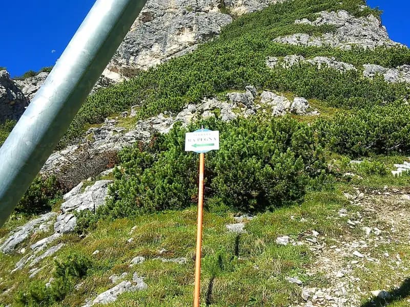
From the Rifugio Duca d'Aosta, looking at the valley served by the chairlift to the Rifugio Pomedes, you can spot two monoliths: on the right, Ra Bujela, and on the left, Ra Pegna. The start is located beneath a rocky rib on the left side of Ra Pegna. Briefly ascend toward the ski slopes until you find, on the left, a sign indicating the start of the approach path. With a modest climb, you reach the start of the ferrata in about 10 minutes from the refuge.
The route winds along the dihedral formed between a sloping slab and a rocky rib. The environment is typically Dolomitic, with solid rock and well-defined vertical structures. The itinerary begins with a climb over small rocks and easy steps for about ten minutes, with no challenging passages. At a rocky overhang, the route veers to the right along a ledge, then climbs diagonally, still to the right.
Here you encounter the key passage of the route: a fairly well-holded vertical step, nonetheless well-protected. This section represents the moment of greatest technical commitment, though it is short and decisive. Once past this point, you continue alternating short rocky sections with segments of equipped trail. The pace is pleasantly varied, with continuous but not hurried progression, allowing you to enjoy the increasing exposure. The final meters are without difficulty and lead to the summit of the Ra Pegna monolith, from where you enjoy an exceptional panorama of the Tofane and Punta Anna.
Once at the top, it is advisable to keep your harness on, as the descent on the opposite side includes some equipped sections. Follow a path heading east, descending a few equipped rocky steps until you reach a metal ladder that overcomes a more pronounced drop. This concludes the Ferrata Ra Pegna. The time to complete the route is about 45 minutes from the start, for a total of about 1 hour from the Rifugio Duca d'Aosta.
After finishing the equipped section, turn right and descend along a steep ski slope that leads directly to the Rifugio Duca d'Aosta, already visible from the exit of the ferrata. This descent section takes about 15 minutes. From the refuge, return to your vehicle by retracing the approach path used on the way up. The total time for the entire loop (approach, ferrata, and return to the refuge) is about 1 hour and 15 minutes from the Rifugio Duca d'Aosta.
The Ferrata Ra Pegna is a short, easy route, perfect for an initial introduction to the activity or for a family outing, thanks to the limited duration of both the approach and the return. Its character is predominantly panoramic and educational, offering a taste of verticality in complete safety.
The area around the Rifugio Duca d'Aosta and the Rifugio Pomedes is extremely rich in options for lovers of equipped terrain. The ferrata can be easily combined with the nearby and more challenging Ferrata Maria e Andrea Ferrari at Ra Bujela. Other possible itineraries in the vicinity include the Sentiero Attrezzato Astaldi, the Ferrata Olivieri, and the Ferrata Aglio for climbing the Tofane (the latter being much longer and more strenuous), as well as a series of via ferratas toward the Passo Falzarego, such as the Tomaselli, the Fusetti at Sass de Stria, the one at Col dei Bos, and the one at Averau.
For orientation, the use of a detailed map of the Cortina d'Ampezzo area and the Ampezzane Dolomites is recommended.
Track and weather
Preview the GPX track from the backend, download it for your GPS device, open parking directions, and check a short forecast before leaving.
ferrata.faqAnswers.commitment
The listed ferrata elevation gain is 100 m. Also consider approach, return and maximum altitude, because they can matter more than the equipped section alone.
Ferrata Ra Pegna is located in Dolomiti Ampezzane, Belluno, Italy. Before leaving, check parking, access and current local conditions.
The best season depends on altitude, aspect and lingering snow. Avoid storms, wet rock and uncertain conditions; start early and keep a margin for the return.
Use the technical data on this page to plan equipment, timing and offline navigation. For a general checklist, read the equipment guide before opening the route in the app.
Video
Useful YouTube videos for getting a real feel for the route before you go.
Logbook
Recent community notes about closures, snow, equipment damage, trail issues and current conditions.
Community
4.0
1 reviews
0
0 climbers
0
Shared by the community
Recent images uploaded by Sferrati members.
No community photos yet
Open this route in the app to add the first photo.
Recent impressions from climbers who know the route.
Nov 6, 2025
Preferisco Ferrate più difficili, ma ero vicino e ho scelto ti dargli una possibilità, non me ne pento, bella ferrata e splendidi scenari.
2
Track the climb, save maps offline, and sync this route to your personal profile.
Use the app to climb
Scan the code before leaving, install the app, and keep your route data ready when reception fades.
