
Technical data
- Difficulty
- Facile
- Status
- aperta
- Distance
- 5,2 km
- Total duration
- 4 h 45 min
- Approach
- 40 min
- Ferrata time
- 1 h 15 min
- Elevation gain
- 350 m
- Max altitude
- 2778 m
Route planning
How to plan Sentiero Attrezzato Kaiserjager
Sentiero Attrezzato Kaiserjager is in Lagazuoi, Belluno, Italy and is rated Facile. Available route data lists about 4 h 45 min total time, 5,2 km of distance, 350 m of elevation gain.
For day planning, consider an approach of about 40 min, about 75 min on the cable, a maximum altitude near 2778 m. Reported route features include: Ponti sospesi, Funivia al ritorno, Interesse Storico, Galleria.
The page includes a parking or driving-directions reference. A GPX track is available to review and download.
As with every via ferrata, evaluate season, lingering snow, storms, crowds and equipment condition. Page last updated on 7/4/2026.
Features
Description
Overview
The Kaiserjager Via Ferrata is an introductory route that leads to the summit of Piccolo Lagazuoi. Designed for beginners, it offers an accessible and enjoyable experience set within a historically and scenically evocative context. The itinerary, of moderate length and elevation gain, winds along the Austrian side of the World War I front, dotted with wartime relics. The return can be made via the convenient cable car or through the challenging war tunnels carved into the mountain, adding an exploratory character to the descent.
Approach
The usual starting point is Passo di Valparola, reachable via the road connecting Cortina d'Ampezzo to Val Badia, passing through Passo Falzarego. At the pass, near a bar-restaurant, there is a large parking area. An alternative option to shorten the approach by about fifteen minutes is to park in a lot further down, along the road between Passo di Valparola and Passo Falzarego, from which a secondary track connects directly to the main trail.
From the main parking area, descend slightly and take a trail that, with a moderate gradient, heads toward the imposing southern walls of Lagazuoi. After a few minutes, a marked left turn leads decisively toward the mountain. During the approach, you can spot the characteristic gully topped by a suspension bridge high above, the visual target of the first part of the route. The trail proceeds over moraines and debris, approaching the base of the wall. Following the track, you eventually reach an equipped ledge: here begins the actual Kaiserjager Via Ferrata. The approach time from the parking lot is about 45 minutes.
Via Ferrata
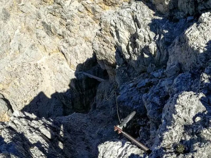
The route starts on the ledge and quickly leads to a small gully to ascend. Progress is aided by some wooden beams forming artificial steps, followed by a series of metal rungs fixed into the rock. It is important to note that these rungs are not accompanied by a continuous steel cable; if necessary, you can clip directly into them. This initial section, though short, introduces the typical progression on Dolomitic rock, compact but often sharp-edged. Once past the gully, you emerge onto another equipped ledge that bends to the right.
The ledge, exposed in places, skirts the wall and leads to the suspension bridge, a sturdy structure to cross with confidence. The bridge spans a notch in the rock, offering the first open views of the valley. On the opposite side, the climb resumes over an initial series of easy rock steps, then tackles a steeper vertical pitch. This passage, though equipped, requires greater physical effort and introduces a more discontinuous rhythm, with sequences of climbing alternating with short horizontal sections. Once past it, the view opens majestically onto the Lagazuoi wall and the continuation of the route.
The trail now becomes more comfortable but remains equipped in exposed or slippery sections. Watch out for possible residual snow patches, even late in the season. The climb, while not technically difficult, can be quite strenuous due to the accumulated elevation gain. The route now develops over a debris-covered and rocky flank, with a more regular but consistently uphill gradient. As you ascend, the final objective appears above: Rifugio Lagazuoi. The last meters of trail, in a pleasant Dolomitic setting, lead to the ridge; a right turn brings you to the final easy passages up to the summit cross of Piccolo Lagazuoi at 2778 meters. The time from the start of the via ferrata is about 1 hour and 15 minutes (2 hours total from the parking lot).
Descent
From the summit, descend along the ridge toward the busy Rifugio Lagazuoi, reachable in 15 minutes. From the hut, there are two distinct return options.
The first is to descend by cable car to Passo Falzarego below. From there, walk the 2 kilometers of paved road (or the trail that runs alongside it) to return to Passo di Valparola. This option takes about 40 minutes from the pass (1 hour and 15 minutes from the summit), for a total of about 3 hours and 15 minutes from the start of the hike.
The second, longer and more adventurous option is the return through the Lagazuoi Tunnel. From Rifugio Lagazuoi, descend a steep trail to the entrance of the first, long war tunnel. This tunnel, excavated during the conflict, extends for about 1100 meters in total darkness, and a headlamp is absolutely essential. The tunnel is equipped with a continuous steel cable. Progress is monotonous and requires caution due to the lack of light and the often damp, uneven floor. In the final section, you'll notice some loopholes before emerging onto an exposed equipped ledge in a marked descent. A short drop then leads to a second, much shorter tunnel. Continuing the descent on a less steep trail, you reach a junction after about 1 hour and 15 minutes from the hut. Keeping right on trail 402 and cutting below the cable car, continue on a gentle grade until you reach Passo di Valparola in about 2 hours and 30 minutes from the hut, for a total hike of about 4 hours and 45 minutes.
Useful Notes
This via ferrata is perfect for beginners looking to approach the world of ferratas. While it features exposed sections, it never requires special technical skills, and the vertical passages are few and well-equipped. The itinerary has a predominantly hiking-mountaineering character, with a sustained but non-technical pace, interspersed with panoramic viewpoints. The descent through the tunnel is a unique but challenging experience: it is dark, long, and in places rough. The route offers exceptional views from the summit of Lagazuoi and continuous contact with the history of World War I. For navigation, we recommend using detailed maps of the Cortina d'Ampezzo and Dolomites area or Val Badia. The Passo Falzarego and Valparola area is rich with other equipped itineraries for all levels, such as the Ferrata Fusetti on Sass de Stria, the Tomaselli, the Brigata Alpina, the Averau, and the Ra Gusela.
Track and weather
Plan the route
Preview the GPX track from the backend, download it for your GPS device, open parking directions, and check a short forecast before leaving.
Images
FAQ
What level of commitment does this via ferrata require?
ferrata.faqAnswers.commitment
How much elevation gain should I plan for?
The listed ferrata elevation gain is 350 m. Also consider approach, return and maximum altitude, because they can matter more than the equipped section alone.
Where is the route located?
Sentiero Attrezzato Kaiserjager is located in Lagazuoi, Belluno, Italy. Before leaving, check parking, access and current local conditions.
When is the best time to climb it?
The best season depends on altitude, aspect and lingering snow. Avoid storms, wet rock and uncertain conditions; start early and keep a margin for the return.
Gear and safety planning
Use the technical data on this page to plan equipment, timing and offline navigation. For a general checklist, read the equipment guide before opening the route in the app.
Video
Watch the route
Useful YouTube videos for getting a real feel for the route before you go.
Logbook
Route condition reports
Recent community notes about closures, snow, equipment damage, trail issues and current conditions.
Community
Reviews, check-ins and photos
-
0 reviews
2
2 climbers
0
Shared by the community
Community photos
Recent images uploaded by Sferrati members.
No community photos yet
Open this route in the app to add the first photo.
Reviews
Recent impressions from climbers who know the route.
No reviews yet
Be the first to review this via ferrata from the app.
Continue in the app
Track the climb, save maps offline, and sync this route to your personal profile.
Use the app to climb
Offline maps, tracking, saves, and profile sync.
Scan the code before leaving, install the app, and keep your route data ready when reception fades.
