Overview
The Ferrata Rio Secco is a fixed-rope route that winds through a deep gorge carved by the seasonal flow of a stream. The route combines athletic progression with accessible technique, making it ideal for those who already have some familiarity with vertical terrain. The morphology of the canyon-with its tall, closely spaced walls-ensures constant shade, keeping the environment cool even on the hottest summer days, despite the relatively modest elevation.
Approach
The starting point is the hamlet of Cadino, in the province of Trento. To reach it, take the Brenner Highway exit at San Michele all'Adige, then head up the state road on the eastern side of the Val d'Adige for about four kilometers toward Bolzano. Ample parking is available near the Ristorante Al Cadino. Across from the parking lot, the white-and-red CAI trail markers indicate the start of the path, which immediately plunges into a forest on a steep slope. At the first junction, keep right (the left trail is the return route). The sustained, continuous climb takes about 20 minutes to reach a wooden bench-a strategic spot to calmly put on your harness and helmet before entering the gorge.
Via Ferrata
The fixed-rope route begins with a fairly easy descending ledge, a horizontal band that allows you to comfortably drop down to the streambed, which is usually dry. The environment quickly becomes more vertical as you climb the opposite bank, where you face a smooth, slightly overhanging wall. Progression is secured by a series of solid metal stirrups and two fixed ropes, enabling you to overcome this section safely. After this first vertical obstacle, a short traverse to the right-using natural holds and a stirrup-leads to a ledge that offers a first moment of rest.
Here begins the section known as the "Salto dei Caprioi", which opens with the ascent of a wide dihedral. This structural channel, formed by the meeting of two walls, is climbed by alternating excellent natural holds with numerous metal stirrups in a continuous and enjoyable sequence. After climbing the dihedral, you turn left to follow a ledge that skirts a corner, bringing you to the base of a vertical wall. This wall develops around a deep crack, a line of weakness in the rock that offers good holds-both natural and artificial-for hands and feet, making the climb technical but fluid. Once this section is completed, you arrive at a small plaque marking the "Belvedere," a viewpoint that suddenly opens onto the Rotaliana Plain.
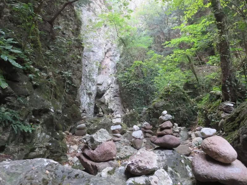
A short section of fixed-rope trail in a slight descent then leads into a characteristic rocky amphitheater, a hollow with a floor scattered with small cairns. From here, you climb the left bank of the stream (orographic left) through a crevice with water-polished rock, then tackle a long traverse to the left that ascends the course of the stream. This horizontal, continuous traverse requires attention to posture. Once the traverse is complete, the cable rises vertically and leads onto a fixed-rope path through the woods, which brings you to the "Passaggio dei Gabbiani". This passage, once very difficult without stirrups, is now manageable with moderate effort; after overcoming the airy corner, a long, gently ascending traverse begins, alternating short rocky steps with sections of medium difficulty, maintaining a steady rhythm.
You then cross to the right bank of the stream (orographic right), where the wall narrows and becomes vertical, heightening the sensation of being in the heart of the gorge. You climb it with the aid of stirrups, follow a short traverse, and reach an escape route. Those who wish to shorten the itinerary can take the left (CAI trail 490A, 30 minutes for the return); otherwise, continue to the right (about 45 minutes from the start; total time about 1 hour).
The path continues through the woods, presenting some easy rock steps and simple fixed-rope passages, until it enters a second rocky amphitheater, the "Grotta del Basalisc." Here the route changes character, becoming more physical and technical due to the smooth, compact rock. The first section of the climb is decidedly athletic: you ascend a diagonal wall on smooth rock, devoid of natural holds, relying solely on the metal stirrups. The passage, though pushing you a bit away from the cable, is of medium difficulty and requires some muscular effort. You reach the summit register and continue with a couple of easy traverses to the left, then skirt a very exposed corner where the stirrups are crucial for overcoming the obstacle safely.
You then approach the Grotta della Mariotta, climbing a vertical wall well-equipped with stirrups and natural holds. This point marks the end of the metal fixtures and therefore of the actual fixed-rope route (about 1 hour and 15 minutes from the start; total time about 1 hour and 30 minutes). A steep path through the woods climbs for another five minutes to a sign indicating the return to Cadino on the left.
Descent
The return path soon emerges from the woods, offering wide views of the Val d'Adige about six hundred meters below. The descent is steep and continuous, with a rapid, constant loss of elevation that puts strain on the joints (a pair of trekking poles can be useful). You encounter a long metal ladder and a few easy fixed-rope sections on the way down, for which it is advisable to keep your harness on. Beyond the ladder, you continue descending through the woods until you reach the junction encountered on the approach. Keep right for the final descent that leads back to the parking lot (about 1 hour from the end of the ferrata; total loop time about 2 hours and 30 minutes).
Useful Notes
The stream's flow varies depending on the season. In spring and winter, water is often present, sometimes even abundant. In summer and autumn, unless after recent rains, the bed is typically dry. The equipment is recent and plentiful, with stirrups and cables in excellent condition. The route, of medium difficulty, is rewarding, varied, and moderately challenging, offering a good mix of vertical technique and horizontal progression on ledges. The gorge environment is particularly evocative, with dark rock walls rising sheer, and thanks to the perpetual shade, it is an ideal destination even during the summer season. For maps, we recommend the Val di Non or the Strada del Vino and Monte Corno area maps. The Ferrata Rio Secco, with its short approach and contained duration, lends itself well to being combined with other fixed-rope routes in the Valle d'Adige and neighboring valleys.