
Technical data
- Difficulty
- Facile
- Status
- aperta
- Distance
- 13 km
- Total duration
- 6 h 15 min
- Approach
- 4 h
- Ferrata time
- 30 min
- Elevation gain
- 150 m
- Max altitude
- 2199 m
Route planning
How to plan Sentiero Attrezzato Cuestalta
Sentiero Attrezzato Cuestalta is in Cuestalta, Udine, Italy and is rated Facile. Available route data lists about 6 h 15 min total time, 13 km of distance, 150 m of elevation gain.
For day planning, consider an approach of about 240 min, about 30 min on the cable, a maximum altitude near 2199 m. Reported route features include: Itinerario lungo, Interesse Storico.
The page includes a parking or driving-directions reference. A GPX track is available to review and download.
As with every via ferrata, evaluate season, lingering snow, storms, crowds and equipment condition. Page last updated on 7/4/2026.
Features
Description
Overview
The Sentiero Attrezzato Cuestalta is a ridgeline route that culminates on the namesake summit straddling the Italian-Austrian border. It's a long, multi-faceted itinerary, but never extreme, with cables safeguarding the vertical and exposed sections. The result is a hiking experience steeped in history and offering 360-degree panoramas.
Approach
The starting point is Malga Pramosio (1521 m), in the municipality of Paluzza (UD). Reach it by taking the unpaved road from Claulis into the Foresta di Pramosio-passable by car-which ends at the parking area near the malga, where overnight stays are also available.
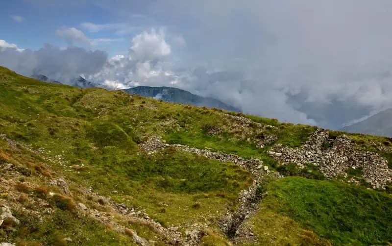
From here, head east along trail 407. Continue past the turnoff for trail 404, and after passing the Sella di Cercevesa with the ruins of the casera, you'll reach a junction in about 1 hour and 15 minutes. At this point, leave trail 407 and switch to trail 448, marked as exposed, which traverses diagonally across the slope of the Cuestalta ridge. This section has no technical difficulties (though the ground can be slippery after heavy rain) and leads to another junction. Leave trail 448 to the left-it continues toward the normal Italian route-and follow the 448a branch toward Rifugio Fabiani.
Trail 448a heads toward Creta Rossa (1770 m), reachable after a moderately exposed but non-technical ridge segment, about 1 hour from the junction on trail 407 (total 2h 15'). The terrain opens up here, with the track following grassy and rocky ridges. From Creta Rossa, descend a steep, direct slope to Rifugio Fabiani (1539 m), reached about 2 hours and 40 minutes total from the start.
From the rifugio, take trail 454, which climbs steadily toward Passo Pecol di Chiaula (1797 m, border crossing, 3h total). This area is an open-air museum of the Great War, dotted with tunnels, trenches, and barracks.
Descend briefly into Austrian territory toward a visible rifugio with an attached chapel. After a few minutes of descent, you can follow tracks to the left, or-the recommended option-descend to a well-marked junction. Here, turn left onto the trail for Kleiner Trieb 421, tackling a steep, sustained climb that leads to Punta Medatte (2095 m), marked by a cross, reached about 1 hour from Passo Pecol di Chiaula (total 4h).
Via Ferrata
The actual equipped section begins after Punta Medatte (Kleiner Trieb). It is separated from the summit of Cuestalta (Hoher Trieb) by a saddle, reachable in 10 minutes by descending along the ridge crest, where a steel cable protects the most exposed spots.
From the saddle, the short via ferrata begins. First, scramble over some boulders and small rock steps without protection until you reach the steel cable. This guides you first across small slabs, then up a short wall, traversing diagonally from left to right. The ferrata, rated easy (F) , then continues by climbing a well-structured, hold-rich rocky ridge-pleasant and intuitive to follow. Though it runs entirely along the ridge and is naturally exposed, the exposure never feels intimidating. The straightforward ascent ends just below the summit of Cuestalta (2199 m), marked by a metal cross and reachable via a final short trail section. The via ferrata takes about 20 minutes from the saddle (30 minutes from Punta Medatte), for a total hiking time of about 4 hours and 30 minutes.
Descent
From the summit of Cuestalta, descend along the main ridge, where the steepest sections are secured with cable. The route is lined with the ruins of trenches and positions. You'll reach the junction between trail 448 (the normal Italian route) and the ridge trail toward Passo Pramosio. Continue on the latter, which runs along a broad ridge, only locally exposed, with no further climbing sections. Passing near Monte Scarniz (reachable via a short detour), stay on the ridge trail until Passo Pramosio (1785 m), reached about 1 hour and 15 minutes from the summit (total 5h 30').
From the pass, with Malga Pramosio already visible a few hundred meters below, follow a trail that connects to the unpaved road, reaching the malga for a total hike time of about 6 hours and 15 minutes.
Useful Notes
The Sentiero Attrezzato Cuestalta is part of a sweeping itinerary that traverses a significant stretch of the border ridge, rich in historical remnants from the Great War. The hike is long but not overly demanding from a technical standpoint, with the equipped section easing the climb through the ridge's most vertical and exposed parts. The area offers numerous other via ferratas, generally of higher difficulty, such as the Ferrata Steinbergerweg on the Cellon, the Ferrata al Coglians, and the Ferrata Senza Confini, or lower down the Ferrata Cinquanta del Clap, the Ferrata Cassiopea, and the Ferrata Adventure Climb.
Track and weather
Plan the route
Preview the GPX track from the backend, download it for your GPS device, open parking directions, and check a short forecast before leaving.
Images
FAQ
What level of commitment does this via ferrata require?
ferrata.faqAnswers.commitment
How much elevation gain should I plan for?
The listed ferrata elevation gain is 150 m. Also consider approach, return and maximum altitude, because they can matter more than the equipped section alone.
Where is the route located?
Sentiero Attrezzato Cuestalta is located in Cuestalta, Udine, Italy. Before leaving, check parking, access and current local conditions.
When is the best time to climb it?
The best season depends on altitude, aspect and lingering snow. Avoid storms, wet rock and uncertain conditions; start early and keep a margin for the return.
Gear and safety planning
Use the technical data on this page to plan equipment, timing and offline navigation. For a general checklist, read the equipment guide before opening the route in the app.
Video
Watch the route
Useful YouTube videos for getting a real feel for the route before you go.
Logbook
Route condition reports
Recent community notes about closures, snow, equipment damage, trail issues and current conditions.
Community
Reviews, check-ins and photos
-
0 reviews
0
0 climbers
0
Shared by the community
Community photos
Recent images uploaded by Sferrati members.
No community photos yet
Open this route in the app to add the first photo.
Reviews
Recent impressions from climbers who know the route.
No reviews yet
Be the first to review this via ferrata from the app.
Continue in the app
Track the climb, save maps offline, and sync this route to your personal profile.
Use the app to climb
Offline maps, tracking, saves, and profile sync.
Scan the code before leaving, install the app, and keep your route data ready when reception fades.
