
Technical data
- Difficulty
- Medio
- Status
- aperta
- Distance
- 14,4 km
- Total duration
- 6 h
- Approach
- 2 h 30 min
- Ferrata time
- 30 min
- Elevation gain
- 200 m
- Max altitude
- 2267 m
Route planning
How to plan Ferrata delle Crete Rosse
Ferrata delle Crete Rosse is in Creta di Aip, Udine, Italy and is rated Medio. Available route data lists about 6 h total time, 14,4 km of distance, 200 m of elevation gain.
For day planning, consider an approach of about 150 min, about 30 min on the cable, a maximum altitude near 2267 m. Reported route features include: Via ferrata breve, Panorami mozzafiato, Attrezzatura di media difficoltà, Roccia arrampicabile.
The page includes a parking or driving-directions reference. A GPX track is available to review and download.
As with every via ferrata, evaluate season, lingering snow, storms, crowds and equipment condition. Page last updated on 7/4/2026.
Features
Description
Overview
The Ferrata delle Crete Rosse is a modest yet enjoyable equipped route that ascends to the Creta di Aip from the Italian side. The full itinerary is completed by descending the Austrian side via the Ferrata Uiberlacher, a medium-difficulty via ferrata. Though the overall route is quite long, it offers continuous rewards without ever becoming extreme, making it a well-rounded and complete outing in the Carnic Alps.
Approach
The starting point for the Ferrata delle Crete Rosse is the Passo del Cason di Lanza (1552 m) in the province of Udine. The pass can be reached from both Paularo and Pontebba, with similar driving times; the paved road is generally in better condition coming from Pontebba, which is easily accessible from the A23 motorway. There is ample parking at the pass, along with options for food and overnight stays.
From the parking area, head up the forest road behind the large mountain hut. Shortly after, at a switchback, turn right onto trail 439. The gradient increases sharply as you head toward Casera di Val Dolce, reached in about thirty minutes, with the silhouette of the Creta di Aip clearly visible ahead. You then rejoin the forest road you left earlier, continuing on it to a signed junction at 1750 m (about 1 hour from the parking).
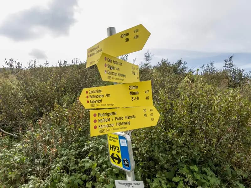
From here, the trail climbs steeply toward the eastern and southern face of the mountain. Looking back, the imposing Zermula comes into view. Proceed east along trail 403, skirting the steep walls, to another signed junction. Keeping left on the ascent, you reach the obvious start of the via ferrata, marked by a small metal plaque placed a few meters above the beginning of the fixed cables, at 1961 m. The approach from the parking takes about 2 hours and 30 minutes. The approach is mostly on forest trail and then on scree slopes, offering a continuous and physically demanding progression, with the terrain gradually opening up toward the rocky walls of the objective.
Via Ferrata
The first fixed cables are just a few meters from the start. Easily reaching the cable, you begin climbing a few vertical meters on rock rich in natural holds. After some easy scrambling on rock slabs, you arrive at a small grassy terrace. Continuing, you encounter a narrow gully with the cable on the right, featuring excellent holds. The central section of the chimney narrows; staying to the right, you pass the tightest point and then continue into the upper part of the chimney, a very climbable section. It is in this sector that the dolomitic rock displays the typical reddish coloration that gives the route its name.
Exiting the chimney, you climb a vertical wall to access a new chimney, initially quite narrow. Excellent holds are found on the left side of the crack, while the cable runs on the right. After passing the crack, the cable continues to the left, leading to the base of some rock slabs. You then climb a vertical wall with some stirrups and, via a short sloping ramp, reach a small ledge where the summit register is located. You set off again vertically, with good exposure, along a narrow gully that leads to the end of the fixed cables at 2095 m. The via ferrata takes about 30 minutes to complete. The route is compact and continuous, alternating short vertical sections with chimneys and gullies on solid, well-shaped rock. The itinerary is predominantly climbing-oriented and vertical, with increasing exposure but always well-graded difficulty, offering a pleasant and technical progression.
You then follow the trail across the summit plateau, a path that winds between rocks and meadows along a slope to the right, opening up views of the Austrian valley and the top of the cable car. After crossing some rock slabs and the state border, you reach a junction: to the right, you descend via the Ferrata Uiberlachersteig (which you will use for the return), while continuing straight brings you in a few meters to the metal summit cross of the Creta di Aip (2279 m), with its summit register. From the end of the fixed cables to the summit takes about 30 minutes. This final section, horizontal and panoramic, offers a clear change of pace after the technical progression of the via ferrata, leading with a relaxed step along the broad summit ridge.
Descent
From the summit, return to the junction encountered on the ascent (5 minutes). Keeping left, begin the descent along the Ferrata Uiberlacher. The route starts on a trail, then with some scrambling over rock slabs you reach the first fixed cables. The first descent passage is an easy chimney; after a ledge and some rock slabs, you encounter a series of ladders. Descending along a large gully, you reach the lower part of the via ferrata, which ends with a final, short ladder. The descent from the summit to the end of the fixed cables takes about 45 minutes. The equipped descent is more linear and less vertical than the ascent, often developing along ledges and gullies, with a rhythm broken by short technical sections and long trail stretches.
Continue on a slightly exposed traverse trail to a junction in Austrian territory. Keeping right, you cross the border and quickly join trail 403. Following it to the right, you return to the junction from the outward leg in about 30 minutes from the end of the fixed cables. From here, retracing the approach trail in reverse, you reach the parking at Passo Cason di Lanza in about 1 hour and 45 minutes. The total descent time from the summit is about 3 hours, for a total excursion of about 6 hours. The final descent along trail 403, first in Austrian and then Italian territory, is a long walking section that requires endurance, closing the loop in a high dolomitic mountain environment.
Useful Notes
The Ferrata delle Crete Rosse is rated as medium difficulty, pleasantly climbable on solid, hold-rich rock. The difficulties are always moderate, and the route exploits the mountain's natural features like chimneys, narrow gullies, and rock slabs. Although the excursion is long, it does not feature excessively difficult passages and allows you to combine an interesting equipped trail on the Austrian side for the descent. The route was built by the CAI Pontebba and inaugurated in 1980, with a significant renovation in 2001 that replaced the old chains with steel cables. From the Passo del Cason di Lanza, other via ferratas in the Carnic Alps are possible, such as those on Monte Zermula or Zuc della Guardia. The itinerary effectively combines a technical, vertical ascent on red rock with a long ridge traverse and a more horizontal equipped descent, offering a comprehensive overview of the morphologies of this portion of the Carnic Alps.
Track and weather
Plan the route
Preview the GPX track from the backend, download it for your GPS device, open parking directions, and check a short forecast before leaving.
Images
FAQ
What level of commitment does this via ferrata require?
ferrata.faqAnswers.commitment
How much elevation gain should I plan for?
The listed ferrata elevation gain is 200 m. Also consider approach, return and maximum altitude, because they can matter more than the equipped section alone.
Where is the route located?
Ferrata delle Crete Rosse is located in Creta di Aip, Udine, Italy. Before leaving, check parking, access and current local conditions.
When is the best time to climb it?
The best season depends on altitude, aspect and lingering snow. Avoid storms, wet rock and uncertain conditions; start early and keep a margin for the return.
Gear and safety planning
Use the technical data on this page to plan equipment, timing and offline navigation. For a general checklist, read the equipment guide before opening the route in the app.
Video
Watch the route
Useful YouTube videos for getting a real feel for the route before you go.
Logbook
Route condition reports
Recent community notes about closures, snow, equipment damage, trail issues and current conditions.
Community
Reviews, check-ins and photos
-
0 reviews
0
0 climbers
0
Shared by the community
Community photos
Recent images uploaded by Sferrati members.
No community photos yet
Open this route in the app to add the first photo.
Reviews
Recent impressions from climbers who know the route.
No reviews yet
Be the first to review this via ferrata from the app.
Continue in the app
Track the climb, save maps offline, and sync this route to your personal profile.
Use the app to climb
Offline maps, tracking, saves, and profile sync.
Scan the code before leaving, install the app, and keep your route data ready when reception fades.
