
Technical data
- Difficulty
- Difficile
- Status
- aperta
- Distance
- 5,5 km
- Total duration
- 5 h
- Approach
- 1 h
- Ferrata time
- 50 min
- Elevation gain
- 200 m
- Max altitude
- 2316 m
Route planning
How to plan Ferrata Bivacco Borelli
Ferrata Bivacco Borelli is in Alpi Graie, Aosta, Italy and is rated Difficile. Available route data lists about 5 h total time, 5,5 km of distance, 200 m of elevation gain.
For day planning, consider an approach of about 60 min, about 50 min on the cable, a maximum altitude near 2316 m. Reported route features include: Scale.
The page includes a parking or driving-directions reference. A GPX track is available to review and download.
As with every via ferrata, evaluate season, lingering snow, storms, crowds and equipment condition. Page last updated on 7/4/2026.
Features
Description
Overview
This equipped route, compact in length but rich in challenges, reaches the distinctive Bivacco Borelli, nestled in the rugged environment of the Val Veny. The itinerary covers a total elevation gain of about 200 meters, combining via ferrata sections with unprotected trail segments. The climb culminates in some demanding passages, including a highly exposed traverse in the final stages before the destination.
Approach
Access begins from the locality of Purtud in Val Veny, reachable from Courmayeur. On the main road, the sign "Peuterey" marks a right turn: cross a bridge over the stream and immediately turn left, continuing to the hamlet of Purtud and the parking area. From the parking lot, take trail marker 19 for Bivacco Borelli. The path crosses extensive pastures before entering the Peterey forest. After leaving the woods and passing a waterworks structure, follow a dirt road up the small valley flanked by Monte Rouge on the left and Monte Noire on the right. The trail leads to the bank of a stream, which you ascend keeping to the right bank, ignoring any side paths. After passing a spectacular waterfall, turn left following yellow markings, leaving the red dots that continue to the right. Here you encounter the first rocky outcrops (1890 m), reached about one hour from the start.
Via Ferrata
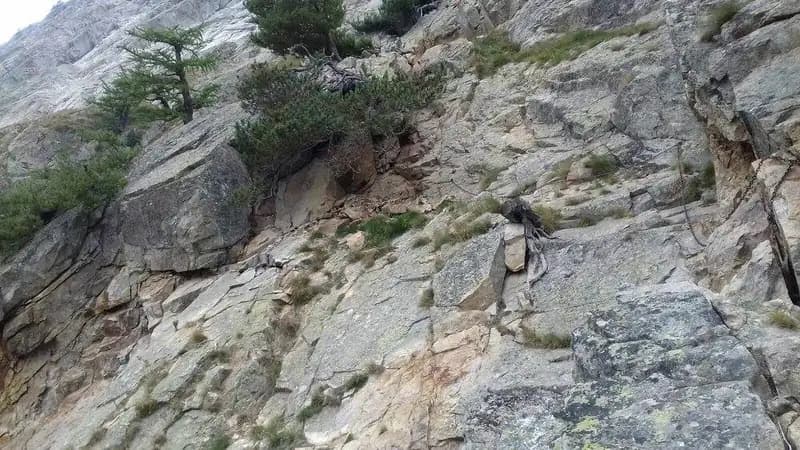
The start of the via ferrata unfolds across sloping rock slabs with no significant technical difficulties. The route winds along ledges and short rises, with cables leading to an airy but manageable gully. You then reach a chimney that is easily climbed thanks to good natural holds. This is followed by an unroped trail section over loose, unstable terrain that requires caution. Next comes a second chimney, more challenging than the first due to fewer handholds, demanding careful progression. After overcoming this passage, you face the first vertical ladder, about five meters high, exposed but straightforward to climb. The via ferrata continues with a highly exposed traverse, reached after rounding a corner with the aid of a cable and pegs. This segment is psychologically demanding and requires an absolute absence of vertigo, while offering exceptional views of the Val Veny. Beyond the traverse, you ascend a second ladder. You then follow an equipped section along a rocky ramp, exposed but not difficult. This leads to the crux of the entire via ferrata: a second traverse, sloping, on smooth rock and extremely exposed, where a few natural spikes provide essential support for the ascent. After the final equipped rock steps, the via ferrata ends about one hour from the start (two hours total from the parking lot). Finally, cross a debris-filled valley, passing beneath the imposing south face of the Aiguille Noire de Peuterey, to reach Bivacco Borelli, tucked under the rock. This last stretch takes about 40 minutes, for a total ascent time of 2 hours and 40 minutes.
Descent
The return follows the same route as the ascent, so you descend the entire via ferrata in reverse. The complete itinerary takes about 5 hours. Maximum caution is required when descending the equipped sections, especially the last sloping traverse, which heavily taxes arm strength.
Useful Notes
Though not particularly long, this via ferrata in Val Veny should not be underestimated. The environment, while not at high altitude, is demanding, and the equipped sections are exposed, with a couple of complex passages. The cable is not always optimally tensioned, especially on the traverses, which increases difficulty and effort during progression. It is essential to undertake the hike only in stable weather, as the basin of Bivacco Borelli is often shrouded in fog when conditions deteriorate. From the bivouac, it is possible to continue toward Col Chasseur, visible from the structure, by ascending the debris-filled valley on the left side (opposite the bivouac) to a small equipped gully at the steepest points. This section is less demanding than the main via ferrata and allows you to reach Rifugio Monzino, the endpoint of the Ferrata Garda, on a two-day hike that requires experience in alpine terrain. Given its duration, the excursion to Bivacco Borelli typically takes a full day. For those wanting to combine other activities, the area offers equipped routes such as the Ferrata Marguerettaz, the Ferrata al Rifugio Monzino, the Sentiero Attrezzato al Mont de la Brenva, or the equipped trail to Bivacco Boccalatte.
Track and weather
Plan the route
Preview the GPX track from the backend, download it for your GPS device, open parking directions, and check a short forecast before leaving.
Images
FAQ
What level of commitment does this via ferrata require?
ferrata.faqAnswers.commitment
How much elevation gain should I plan for?
The listed ferrata elevation gain is 200 m. Also consider approach, return and maximum altitude, because they can matter more than the equipped section alone.
Where is the route located?
Ferrata Bivacco Borelli is located in Alpi Graie, Aosta, Italy. Before leaving, check parking, access and current local conditions.
When is the best time to climb it?
The best season depends on altitude, aspect and lingering snow. Avoid storms, wet rock and uncertain conditions; start early and keep a margin for the return.
Gear and safety planning
Use the technical data on this page to plan equipment, timing and offline navigation. For a general checklist, read the equipment guide before opening the route in the app.
Video
Watch the route
Useful YouTube videos for getting a real feel for the route before you go.
Logbook
Route condition reports
Recent community notes about closures, snow, equipment damage, trail issues and current conditions.
Community
Reviews, check-ins and photos
-
0 reviews
0
0 climbers
0
Shared by the community
Community photos
Recent images uploaded by Sferrati members.
No community photos yet
Open this route in the app to add the first photo.
Reviews
Recent impressions from climbers who know the route.
No reviews yet
Be the first to review this via ferrata from the app.
Continue in the app
Track the climb, save maps offline, and sync this route to your personal profile.
Use the app to climb
Offline maps, tracking, saves, and profile sync.
Scan the code before leaving, install the app, and keep your route data ready when reception fades.
