
Technical data
- Difficulty
- Moderatamente Difficile
- Status
- aperta
- Distance
- 10 km
- Total duration
- 10 h
- Approach
- 3 h 30 min
- Ferrata time
- 2 h 45 min
- Elevation gain
- 350 m
- Max altitude
- 2860 m
Route planning
How to plan Ferrata Brentari
Ferrata Brentari is in Cima d'Ambiez, Trento, Italy and is rated Moderatamente Difficile. Available route data lists about 10 h total time, 10 km of distance, 350 m of elevation gain.
For day planning, consider an approach of about 210 min, about 165 min on the cable, a maximum altitude near 2860 m. Reported route features include: Ghiacciaio, Scale, Itinerario lungo.
The page includes a parking or driving-directions reference. A GPX track is available to review and download.
As with every via ferrata, evaluate season, lingering snow, storms, crowds and equipment condition. Page last updated on 7/4/2026.
Features
Description
Overview
The Ferrata Ottone Brentari is a wonderfully scenic alpine link between Rifugio Agostini and Rifugio Pedrotti, traced at the foot of the sheer walls of Cima d'Ambiez in the Brenta Group. It is an accessible route with no complex climbing passages and can be traveled in either direction. The recommended progression, from Agostini to Pedrotti, allows you to tackle the route uphill, making it easier to read the line and enjoy the most significant views.
Approach
To access the via ferrata in the suggested direction, the logical starting point is the parking area at the Ristorante Ristoro Dolomiti (768 m), above Dorsino. From here begins a long and physically demanding approach with a positive elevation gain of about 1700 meters. Take the CAI trail 325, initially a gravel road that gradually evolves into a more challenging mountain path, heading to Rifugio al Cacciatore (1820 m), reachable in about 2 hours and 15 minutes. From the rifugio, continue on the same trail (Sentiero Dallago) for another hour and a half until you reach Rifugio Agostini (2410 m). The total approach time from the parking area is around 3 hours and 30 minutes. Given the considerable length of this first stage, it is often wise to consider an overnight stay at altitude to tackle the via ferrata in fresh condition.
Via Ferrata
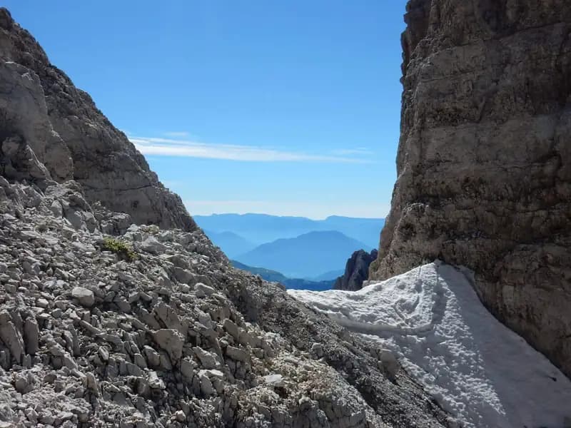
From Rifugio Agostini, head north, ascending the valley that leads to Bocca d'Ambiez. After passing the left junction with CAI 321 for the Ferrata Castiglioni, continue climbing on the left side of the valley, tackling a few short equipped sections on slabs and ledges. In about 45 minutes you reach the Vedretta d'Ambiez (around 2800 m). Here, while the CAI 304 trail continues straight toward the bocca, the Brentari route deviates to the right to cross the glacier. This passage requires particular attention: the difficulty is linked to residual snow and the condition of the snowpack; the use of crampons is strongly recommended even in summer. The crossing follows some markings, heading toward the right side, and extreme caution is needed near the glacier edge.
You then arrive at the true start of the via ferrata, marked by a sign. The route initially develops on a wall eased by wide metal stirrups, then unfolds into an ascending traverse to the left. After another series of steps, you encounter a fork: to the left branches the route to Bocca d'Ambiez and the Sentiero dell'Ideale, to the right continues the ascent of the Brentari. In this section, you gain altitude quickly and the exposure becomes more pronounced, though the passages always remain manageable. The route, which mainly runs on slabs and ledges of solid dolomite, offers a continuous and pleasantly varied rhythm. You then meet a metal ladder, first vertical and then more sloping, followed by a few equipped rocky steps. After a wide ledge to the right and a stretch of easy rock, an exceptional view opens over the Vedretta d'Ambiez and the trails below. The route continues on a second ledge and tackles a series of fairly sloping metal ladders. After another uphill stretch and a short ledge with a new ladder, you traverse a long ledge that finally leads to Bocca di Tosa (2845 m). From here, a descending ladder allows you to bypass a corner. In the past, a suspension bridge was crossed; today you follow a short exposed ledge that leads to Sella di Tosa (2860 m). This point marks the end of the Ferrata Brentari. The time from the start at Rifugio Agostini is about 1 hour and 30 minutes, for a total of about 5 hours from the starting parking area.
Descent
From Sella di Tosa, descend toward Rifugio Pedrotti following obvious trail traces, with the majestic south face of Cima Tosa ahead and splendid views of Campanil Basso and the Sfulmini. Descend a few un-equipped rocky steps and move onto the left side of the Vedretta di Tosa, tackling any snowfields. After a short climb, on the left you encounter in succession the junctions for the Sentiero Attrezzato Apolloni and the Sentiero Palmieri, both valid options for the return. Continuing instead downhill on CAI 304, you round Cima di Brenta Bassa and finally reach Rifugio Pedrotti (2491 m). The descent from Sella di Tosa to the rifugio takes about 1 hour, for a total of about 6 hours and 15 minutes from the start of the hike.
Useful Notes
The Ferrata Ottone Brentari presents no significant technical difficulties, but it is quite exposed on the section from the Vedretta d'Ambiez up to Sella di Tosa, thus requiring good confidence with high altitude. The glacier crossings, a distinctive feature of the route, demand experience and a careful assessment of snow conditions; crampons are considered essential equipment. Like many other via ferratas in the Dolomiti di Brenta, it lends itself perfectly to being combined with other equipped routes to create multi-day loop itineraries, in which case overnight stays at altitude are necessary. Given the overall length of the excursion, including approach and descent, careful planning, excellent fitness, and a very early morning start are essential.
Track and weather
Plan the route
Preview the GPX track from the backend, download it for your GPS device, open parking directions, and check a short forecast before leaving.
Images
FAQ
What level of commitment does this via ferrata require?
ferrata.faqAnswers.commitment
How much elevation gain should I plan for?
The listed ferrata elevation gain is 350 m. Also consider approach, return and maximum altitude, because they can matter more than the equipped section alone.
Where is the route located?
Ferrata Brentari is located in Cima d'Ambiez, Trento, Italy. Before leaving, check parking, access and current local conditions.
When is the best time to climb it?
The best season depends on altitude, aspect and lingering snow. Avoid storms, wet rock and uncertain conditions; start early and keep a margin for the return.
Gear and safety planning
Use the technical data on this page to plan equipment, timing and offline navigation. For a general checklist, read the equipment guide before opening the route in the app.
Video
Watch the route
Useful YouTube videos for getting a real feel for the route before you go.
Logbook
Route condition reports
Recent community notes about closures, snow, equipment damage, trail issues and current conditions.
Community
Reviews, check-ins and photos
-
0 reviews
0
0 climbers
0
Shared by the community
Community photos
Recent images uploaded by Sferrati members.
No community photos yet
Open this route in the app to add the first photo.
Reviews
Recent impressions from climbers who know the route.
No reviews yet
Be the first to review this via ferrata from the app.
Continue in the app
Track the climb, save maps offline, and sync this route to your personal profile.
Use the app to climb
Offline maps, tracking, saves, and profile sync.
Scan the code before leaving, install the app, and keep your route data ready when reception fades.
