
Ferrata del bicentenario al Mont Chetif
Mont Chetif · Aosta · Italy
Technical data
- Difficulty
- Facile
- Status
- aperta
- Distance
- 10,4 km
- Total duration
- 5 h
- Approach
- 40 min
- Ferrata time
- 1 h 45 min
- Elevation gain
- 550 m
- Max altitude
- 2343 m
Route planning
How to plan Ferrata del bicentenario al Mont Chetif
Ferrata del bicentenario al Mont Chetif is in Mont Chetif, Aosta, Italy and is rated Facile. Available route data lists about 5 h total time, 10,4 km of distance, 550 m of elevation gain.
For day planning, consider an approach of about 40 min, about 105 min on the cable, a maximum altitude near 2343 m.
The page includes a parking or driving-directions reference. A GPX track is available to review and download.
As with every via ferrata, evaluate season, lingering snow, storms, crowds and equipment condition. Page last updated on 7/4/2026.
Description
Overview
The Ferrata del Bicentenario, set into the slopes above Courmayeur, represents the most distinctive section of a full and rewarding hike to the summit of Mont Chetif. The route offers exceptional views of the Mont Blanc massif, with a modest technical commitment that places it in the easy via ferrata category. The hiker's attention should focus primarily on the terrain's morphology-often composed of polished rock slabs and grassy ledges that become treacherous when wet-and on correctly following the trail in the final approach to the summit, where waymarking can be less obvious.
Approach
Access begins from Courmayeur, in the Aosta Valley, immediately adjacent to the Palazzetto del Ghiaccio (ice rink). It is recommended to park along Via dello Stadio, a strategic spot for intersecting the loop return trail. From the parking area, take trail marker 4, which climbs behind the sports hall, passes a climbing wall, and enters a deciduous forest. The ascent unfolds in a steady series of switchbacks through a shaded, sheltered environment, reaching the start of the ferrata in about 40 minutes. This preparatory section, though continuous, is moderate and allows for a gradual warm-up.
Via Ferrata
The equipped route begins with a traverse heading east, a natural ledge that offers the first panoramic openings. Midway, you cross a rocky cleft via a distinctive wooden footbridge. The chains present, while not technically essential, provide a valuable handhold and safety point, especially on wet rock. Progress continues by climbing a few steps carved into the rock, then briefly re-enters a conifer forest-a typical alternation between exposure and visual rest.
Next comes a rocky step equipped with metal stirrups, emerging onto a scree slope. The rhythm changes: after a more horizontal section, you encounter a vertical slab of modest height, followed by another footbridge. This leads to a final short wall of about three meters, aided by a chain. The character of the route here is more technical and vertical, though only for brief stretches. The equipped trail then continues along two grassy gullies, potentially slippery, and a short traverse below the summit of Chetif, with more pronounced exposure.
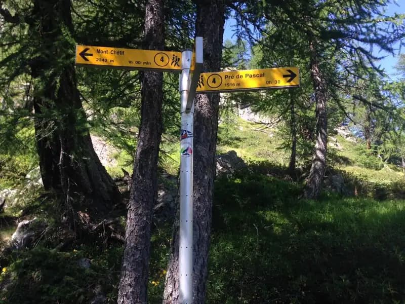
Reaching the junction with the trail coming up from Prè de Pascal, keep left and proceed along the hillside. A short descending section, assisted by a fixed rope, leads to a repeater tower. The route continues as a normal trail until it intersects the path from Curba Dzeleuna; finally, following a well-defined ridge trail, you reach the summit, crowned by a majestic panorama of Mont Blanc. The total ascent time from the start is approximately 2 hours and 45 minutes. The itinerary thus unfolds as a well-paced sequence of short equipped passages, forest trail sections, and expansive scenic views.
Descent
From the summit, retrace the ridge trail back to the last junction encountered on the ascent. From here, take trail 5 toward Corba Dzeleuna. The descent begins with a steep section through a debris-filled gully, then eases onto a gentler slope heading toward the Pra Neyron alpine pasture. Veering left, the trail returns toward the village of Dolonne and then to the starting parking area, for a total duration of about 2 hours and 15 minutes from the summit. The descent is continuous but not demanding, mostly on a well-trodden path.
Useful Notes
The Ferrata del Bicentenario of Mont Chetif is best understood as a via attrezzata (equipped trail) set within a broader hiking context, rather than a classic, continuous via ferrata. The ascent, though considerable in duration, is not particularly strenuous thanks to the long forested sections that offer shade and regulate the pace. It is essential to note that the red and yellow waymarks are not always easily visible in the sector near the summit, and the sections with cables or chains are not continuous but interspersed with normal mountain trails. For proper planning, the use of a detailed map of the Mont Blanc area is strongly recommended.
Track and weather
Plan the route
Preview the GPX track from the backend, download it for your GPS device, open parking directions, and check a short forecast before leaving.
Images
FAQ
What level of commitment does this via ferrata require?
ferrata.faqAnswers.commitment
How much elevation gain should I plan for?
The listed ferrata elevation gain is 550 m. Also consider approach, return and maximum altitude, because they can matter more than the equipped section alone.
Where is the route located?
Ferrata del bicentenario al Mont Chetif is located in Mont Chetif, Aosta, Italy. Before leaving, check parking, access and current local conditions.
When is the best time to climb it?
The best season depends on altitude, aspect and lingering snow. Avoid storms, wet rock and uncertain conditions; start early and keep a margin for the return.
Gear and safety planning
Use the technical data on this page to plan equipment, timing and offline navigation. For a general checklist, read the equipment guide before opening the route in the app.
Video
Watch the route
Useful YouTube videos for getting a real feel for the route before you go.
Logbook
Route condition reports
Recent community notes about closures, snow, equipment damage, trail issues and current conditions.
Community
Reviews, check-ins and photos
-
0 reviews
0
0 climbers
0
Shared by the community
Community photos
Recent images uploaded by Sferrati members.
No community photos yet
Open this route in the app to add the first photo.
Reviews
Recent impressions from climbers who know the route.
No reviews yet
Be the first to review this via ferrata from the app.
Continue in the app
Track the climb, save maps offline, and sync this route to your personal profile.
Use the app to climb
Offline maps, tracking, saves, and profile sync.
Scan the code before leaving, install the app, and keep your route data ready when reception fades.
