
Technical data
- Difficulty
- Facile
- Status
- aperta
- Distance
- 5,4 km
- Total duration
- 1 h 30 min
- Approach
- 5 min
- Ferrata time
- 1 h
- Elevation gain
- 380 m
Route planning
How to plan Ferrata di San Silvestro
Ferrata di San Silvestro is in Dolomiti di Primiero, Trento, Italy and is rated Facile. Available route data lists about 1 h 30 min total time, 5,4 km of distance, 380 m of elevation gain.
For day planning, consider an approach of about 5 min, about 60 min on the cable. Reported route features include: Avvicinamento corto.
The page includes a parking or driving-directions reference. A GPX track is available to review and download.
As with every via ferrata, evaluate season, lingering snow, storms, crowds and equipment condition. Page last updated on 6/4/2026.
Features
Description
Panoramica
Sulle pendici del Monte Totoga, a mezza altezza del versante, sorge la Chiesetta di San Silvestro, elemento distintivo che dà nome alla Ferrata di San Silvestro. Il percorso attrezzato si caratterizza per uno sviluppo contenuto e per una difficoltà complessivamente “facile”, interrotta da alcuni brevi passaggi classificabili come “moderatamente difficili”.
L’itinerario è suddiviso in due sezioni consecutive. Il primo tratto, della durata di circa 20 minuti, presenta un avvio “moderatamente difficile” che si attenua progressivamente fino a diventare “facile”. Il secondo segmento, percorribile in circa 25 minuti, mantiene un livello generalmente facile ma include due passaggi più esposti, anch’essi di grado “moderatamente difficile”. L’attacco delle attrezzature si raggiunge in meno di 5 minuti dal parcheggio.
Lo sviluppo avviene a quota 600 m slm, con dislivello complessivo contenuto e rientro rapido. L’insieme di questi elementi — breve avvicinamento, impegno fisico limitato, esposizione moderata e continuità delle protezioni — rende il tracciato adatto a principianti e a escursionisti che cercano una via ferrata facile nel Primiero, senza lunghe verticalità o tratti tecnicamente impegnativi.
L’accesso si trova lungo la Strada Statale 50 del Grappa e del Passo Rolle, salendo da Feltre verso l’Altipiano del Primiero. Superato il lago di Schenér e prima della rotatoria per Imer, nonché prima della galleria per Canal San Bovo, è presente uno slargo con indicazione “Falesia San Silvestro”; un parcheggio più ampio è situato sul lato opposto della strada.
Avvicinamento
Dal parcheggio la parete è immediatamente visibile sopra il bosco e consente di individuare il promontorio su cui sorge la Chiesetta di San Silvestro, punto di arrivo dell’escursione. Si segue la segnaletica con indicazione “Falesia di Sal Silvestro” fino a un cartello sulla destra che segnala l’inizio della via, identificato dal classico pannello rosso. Il tempo necessario è di circa 5 minuti.
Il breve tratto nel bosco introduce alla morfologia del versante: roccia compatta articolata da gradoni e piccole cenge naturali. L’andamento diagonale della futura salita è leggibile già dal basso e sfrutta linee di progressione logiche, evitando interruzioni brusche o cambi improvvisi di direzione.
Via Ferrata
La prima sezione attrezzata inizia con un tratto verticale ben protetto, dove staffe, appigli naturali e gradini in roccia si alternano in successione regolare. Dopo questo avvio più sostenuto, la linea piega progressivamente verso sinistra con sviluppo diagonale, sfruttando balzi rocciosi e gradoni attrezzati con cambre.
La progressione rimane continua, con incremento di quota costante. Una sequenza di cambre verticali precede una breve paretina attrezzata; alcuni metri su sentiero e gli ultimi gradini staffati conducono al pianoro boschivo che segna la conclusione della prima parte. Il dislivello superato è di circa 150 mt rispetto al parcheggio. L’intera sezione può essere distinta in una fase iniziale “moderatamente difficile” e in una successiva “facile”.
Seguendo il sentiero per circa 5 minuti si raggiunge un bivio nei pressi di un traliccio dell’alta tensione. A sinistra è indicato il percorso per ragazzi “Sandokan”; proseguendo diritti si entra nella seconda sezione della ferrata (20' dall’attacco), leggermente più sviluppata ma con difficoltà analoghe alla precedente. È presente un primo rientro su sentiero, collegato alla discesa finale.
Dopo circa 15 minuti nel sottobosco si incontrano le nuove attrezzature. L’inizio è caratterizzato da tre tratti di sentiero attrezzato quasi pianeggiante a ridosso della parete. Seguono roccette semplici con alcune staffe e un traverso verso sinistra.
Si raggiunge quindi una parete verticale di circa 10 mt attrezzata con numerose cambre: rappresenta il primo dei due punti più esposti dell’intero percorso, pur mantenendo una classificazione “moderatamente difficile”. Un piccolo terrazzino panoramico offre vista sulla vallata: a destra il lago di Schenér con la Strada Statale; a sinistra l’inizio degli abitati di Imer e Mezzano.
La salita prosegue con brevi tratti verticali alternati a sezioni più semplici fino a un traverso verso destra che precede una lunga serie di staffe irregolarmente distribuite per circa 15 mt. Questo è il secondo tratto maggiormente esposto e consente di recuperare rapidamente ulteriore dislivello.
Seguono passaggi su roccette e scalini naturali, con alternanza tra brevi verticalità e traversi. Un lungo tratto laterale semplice, protetto anche dalla vegetazione sottostante, aggira la parete. Una traccia obliqua su terreno, in salita e assistita da un cordino sulla sinistra, permette di superare un ulteriore balzo. Un breve segmento su fondo terroso — potenzialmente fangoso dopo piogge abbondanti — precede gli ultimi metri di sentiero attrezzato in salita.
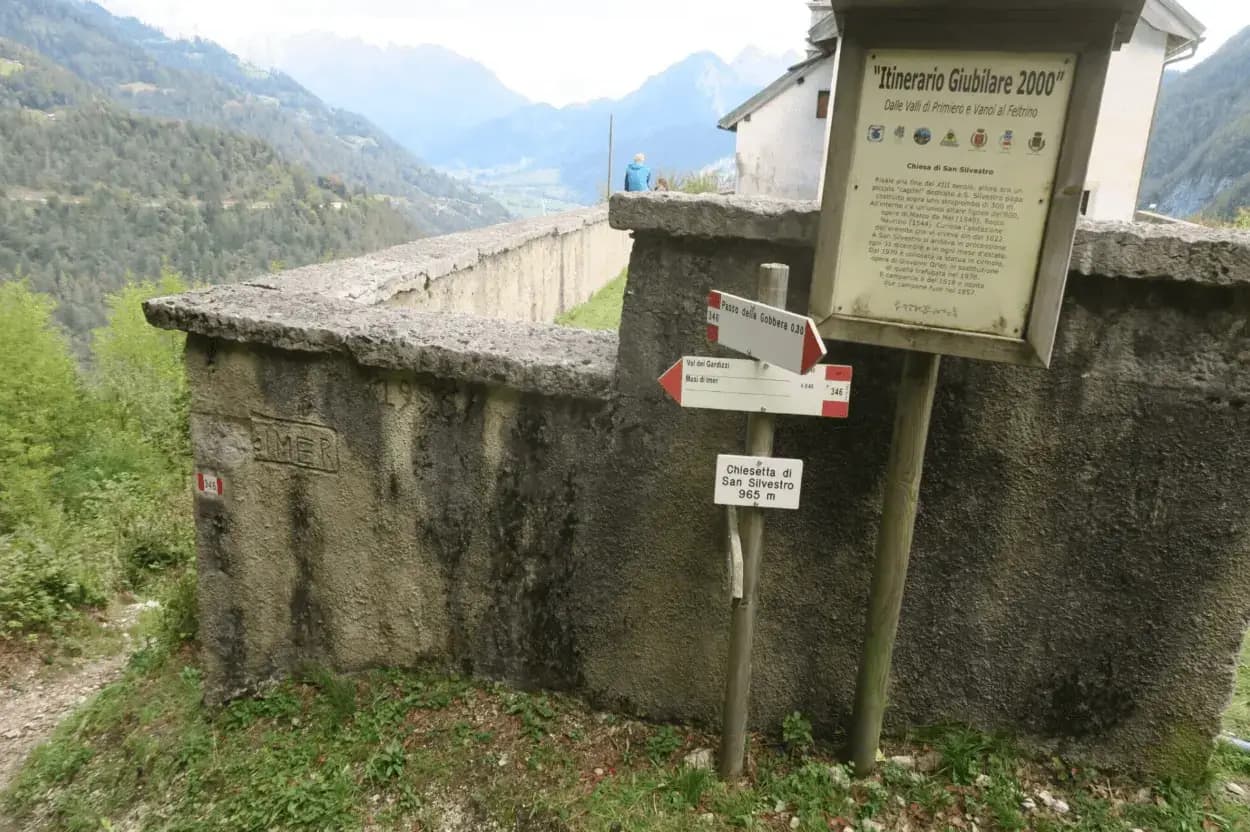
Il cartello rosso segnala la fine delle attrezzature presso la Chiesetta di San Silvestro, punto panoramico dominante la vallata (25' dall’inizio della seconda sezione, circa 1h dall’attacco, circa 1h 5' dal parcheggio).
Discesa
Dal termine della ferrata un cartello indica due modalità di rientro.
Opzione consigliata: il sentiero 349 conduce in circa 40 minuti alla strada provinciale ai Masi di Imer, nei pressi del ristorante “Al Bus”; in ulteriori 10 minuti si rientra al parcheggio attraversando la strada asfaltata e la rotatoria davanti al tunnel (50 minuti dal termine della ferrata).
Alternativa: seguire il sentiero 346 fino alla località Passo Gobbera e scendere poi lungo la provinciale verso Imer oppure lungo la strada sterrata/sentiero che si ricollega più in basso all’opzione precedente. Tempo complessivo circa 1h e 30'.
Note
La quota contenuta consente la percorrenza durante tutto l’anno, con attenzione a possibili condizioni di neve o ghiaccio nel periodo invernale. L’esposizione a sud-est comporta forte irraggiamento nelle giornate estive particolarmente calde, anche se parte del tracciato beneficia della protezione della vegetazione.
Una tradizione locale narra che la Chiesetta di Sal Silvestro avrebbe dovuto essere edificata poco sopra le abitazioni dei Masi di Imer. Le pietre trasportate a mano venivano però ritrovate ogni mattina più in alto, sulla rupe soprastante. Interpretato l’evento come segno della volontà del Santo, si scelse di costruire l’edificio nel punto attuale, a protezione simbolica della vallata.
Track and weather
Plan the route
Preview the GPX track from the backend, download it for your GPS device, open parking directions, and check a short forecast before leaving.
Images
FAQ
What level of commitment does this via ferrata require?
ferrata.faqAnswers.commitment
How much elevation gain should I plan for?
The listed ferrata elevation gain is 380 m. Also consider approach, return and maximum altitude, because they can matter more than the equipped section alone.
Where is the route located?
Ferrata di San Silvestro is located in Dolomiti di Primiero, Trento, Italy. Before leaving, check parking, access and current local conditions.
When is the best time to climb it?
The best season depends on altitude, aspect and lingering snow. Avoid storms, wet rock and uncertain conditions; start early and keep a margin for the return.
Gear and safety planning
Use the technical data on this page to plan equipment, timing and offline navigation. For a general checklist, read the equipment guide before opening the route in the app.
Video
Watch the route
Useful YouTube videos for getting a real feel for the route before you go.
Logbook
Route condition reports
Recent community notes about closures, snow, equipment damage, trail issues and current conditions.
Community
Reviews, check-ins and photos
-
0 reviews
2
2 climbers
0
Shared by the community
Community photos
Recent images uploaded by Sferrati members.
No community photos yet
Open this route in the app to add the first photo.
Reviews
Recent impressions from climbers who know the route.
No reviews yet
Be the first to review this via ferrata from the app.
Continue in the app
Track the climb, save maps offline, and sync this route to your personal profile.
Use the app to climb
Offline maps, tracking, saves, and profile sync.
Scan the code before leaving, install the app, and keep your route data ready when reception fades.
