Overview
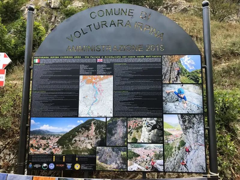
The Via Ferrata of Volturara Irpina, also known as the Ferrata di Maroia, marks a milestone for Campania as the region's first officially certified via ferrata route, inaugurated in 2019. The route unfolds along the compact wall of Monte Costa, an area that also hosts a sport climbing crag and multi-pitch climbing routes, making it a complete mountaineering hub. Its defining feature is the three distinct routes graded by difficulty: a base itinerary of easy level (marked in blue), a medium-difficulty variant (red, called Ferrata Maroia), and an extreme-difficulty variant (black, named Variante del Mulo), featuring athletic moves and overhanging sections. Located in an area still little frequented by via ferrata tourism, this route represents a valuable and interesting discovery for enthusiasts.
The environment is dominated by a well-structured limestone wall, developing with varied morphology that alternates between compact slabs, ledges, and sharp arêtes. The presence of three climbing options allows you to choose a tailor-made experience, from a family-friendly, panoramic route to a more technical and physically demanding one, offering a modulable pace of progression.
Approach
The starting point is the center of Volturara Irpina, in the province of Avellino. Arriving in the town along state road 7 from Avellino, the southeast face of Monte Costa is clearly visible. After parking your car, head toward the rock. Once you reach the intersection of Via Sibilla, Via Candragone, and Via Pasquale de Feo, take a small road heading toward the wall, following the appropriate signage. Ignoring the multi-pitch routes on the left, continue straight ahead: the start of the via ferrata, easily recognizable, is located on the left after a few meters. The approach time from the town center is about 10 minutes.
The short and direct approach leads quickly to the heart of the rocky environment, allowing you to immediately assess the structure of the wall and choose your route. The transition from the town to the mountain is immediate, with no tiring approach sections.
Via Ferrata
The via ferrata develops on the west face of Monte Costa and offers three options, with a possible escape route after the first common section. The itinerary runs on solid limestone rock, shaped into arêtes, ledges, and vertical sections, offering technical and varied progression.
Blue Route (Easy) The base itinerary begins with a ramp heading right that leads to the base of a jagged arête, to be climbed using the numerous natural holds. Proceed with a short descent of a couple of meters to the left along an exposed but manageable traverse, which offers a beautiful view of the town below, using footholds. Once this first equipped section is finished, the red and black routes branch off to the right. The blue route instead turns left onto a path through the woods, where you encounter an escape route. Continuing uphill on the path, you find the equipment for the final section: a succession of ledges and easy steps leads to the summit crest, where the route ends.
The blue route is characterized by a predominantly horizontal and oblique development, with few significant vertical sections. The progression is calm and continuous, suitable for a panoramic approach and gaining confidence with exposed terrain. The rock offers generous handholds and footholds, making the experience pleasant and non-technical.
Red Route - Ferrata Maroia (Moderately Difficult) From the junction with the blue path, keep right, traversing a wide, earthy ledge. After passing the start of the black route, you reach the sign marking the beginning of the red route. The climb starts leftward over easy steps, then continues vertically for a few meters, not difficult and well provided with holds. Then begins a demanding diagonal traverse to the right, with well-equipped sections interspersed with a couple of more delicate points where the cable provides assistance. You arrive at an overhanging section: the cable starts vertically and requires an athletic move to overcome the bulge. Proceed on compact rock to the right and then vertically, through exposed and demanding but enjoyable passages. Reaching a small earthy terrace, the black route converges from the left. From this point, the progression becomes less demanding and, with a nice vertical climb, you join the blue route for the conclusion.
The red route introduces a more discontinuous rhythm, alternating vertical climbing on compact rock with exposed traverses and an athletic overhanging passage. It is a physically demanding itinerary that requires good movement technique and endurance, with constant exposure that enhances its mountaineering character.
Black Route - Variante del Mulo (Extremely Difficult) This variant, short but athletic, starts from the ledge separating the blue and red routes. After an initial step and a ledge to the right with no significant difficulty, the challenging part begins. You face a series of difficult walls that lead to a difficult vertical overhang. This overhanging passage, about two quickdraws in length, is characterized by a scarcity of holds and requires moving quickly and decisively to avoid excessively tiring your arms. Once past the overhang, a few more difficult passages lead to the junction with the red route, with which you continue.
The Variante del Mulo is a concentration of technical and athletic difficulties on vertical and overhanging rock. The progression is discontinuous and requires explosive strength and excellent effort management, with marked exposure that makes it a route for experienced via ferrata climbers. The rock, though compact, offers few rests, accentuating the physical nature of the undertaking.
Descent
From the summit of the via ferrata, follow the CAI trail markers 145 and 145a. Descending to the left (north), you cross the woods to return to the start ledge of the route. Descending to the right (south), you instead reach the alleys of the town. Both options lead back to the center of Volturara Irpina in about 20 minutes. The total time for the entire outing is about 2 hours.
The descent follows comfortable forest paths, offering a pleasant cool-down and a different perspective on the wall just climbed. The return is quick and logical, closing the loop without any challenging sections.
Useful Notes
The installation is recent and the equipment is in excellent condition. The presence of three routes makes it suitable for different levels of preparation. For those tackling the Variante del Mulo (black), classified as extremely difficult, it is strongly recommended to bring a sling to simulate a belay, a useful tool in case of fatigue to avoid finding yourself in difficulty. The Via Ferrata of Volturara Irpina is an excellent base for exploring other via ferratas in the area, such as those in nearby Basilicata and the Gran Sasso massif.
The itinerary, as a whole, combines the accessibility of a short approach with the technical variety offered by the different difficulty grades. The quality of the rock and the excellent condition of the installations ensure safety and climbing pleasure, while the choice of routes allows you to modulate the experience between the panoramic-exploratory aspect and the more technical-mountaineering one.