
Technical data
- Difficulty
- Difficile
- Status
- aperta
- Distance
- 6,7 km
- Total duration
- 5 h
- Approach
- 40 min
- Ferrata time
- 2 h 30 min
- Elevation gain
- 424 m
- Max altitude
- 1875 m
Route planning
How to plan Ferrata Gamma 2
Ferrata Gamma 2 is in Prealpi Bergamasche, Lecco, Italy and is rated Molto Difficile. Available route data lists about 5 h total time, 6,7 km of distance, 424 m of elevation gain.
For day planning, consider an approach of about 40 min, about 150 min on the cable, a maximum altitude near 1875 m. Reported route features include: Funivia all'andata, Funivia al ritorno.
The page includes a parking or driving-directions reference. A GPX track is available to review and download.
As with every via ferrata, evaluate season, lingering snow, storms, crowds and equipment condition. Page last updated on 7/4/2026.
Features
Description
Overview
The Ferrata Gamma 2, which climbs the Dente del Resegone in the mountain group above Lecco, represents one of the most technically and physically demanding challenges in the Italian alpine scene. Following the 2020 renovation that integrated the steel cable, its difficulty is rated as Very Difficult, and it unfolds progressively: the first section is noticeably more manageable than the second, where the key passages are concentrated. For this reason, it is essential to manage your energy wisely, prioritizing free climbing where the rock allows and reserving use of the cable for the mandatory sections. The route is strongly not recommended for beginners, anyone lacking excellent fitness, or those who suffer from vertigo.
Approach
The starting point is the large parking lot for the cable car to the Piani d'Erna, in Lecco. Access by car is via the well-signed exit for Piani d'Erna from the Lecco-Ballabio expressway, following the uphill road to its end.
For the approach on foot, you have several options. The quickest is to take the cable car up to Piani d'Erna, saving about an hour and a half of walking. From there, follow Sentiero 5 toward the Rifugio Azzoni until the junction with Sentiero 1, which you take to the left uphill. Following the signs, you'll tackle some easy rock steps and reach the start of the Ferrata Gamma 2 in about 40 minutes from the top station.
If you prefer to hike all the way from the parking lot, take Sentiero 1, pass near the Rifugio Stoppani, and continue toward the Rifugio Azzoni, reaching the same junction described above.
For a more challenging and scenic approach, you can climb the Ferrata Gamma 1 (about 3h 30' from the parking lot) and then head toward the start of the Gamma 2, for a total of about 4h 15'. In this case, you must calculate your remaining energy very carefully to tackle the second via ferrata, which is of much higher difficulty.
Via Ferrata
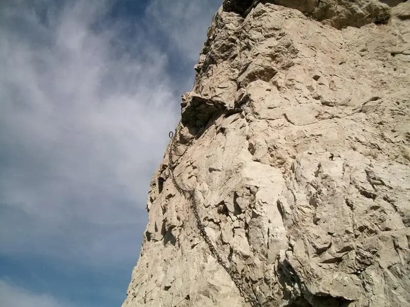
The route develops on the southern side of the Dente del Resegone, characterized by a complex morphology of limestone walls and chimneys. The via begins with a first vertical wall, marked by excellent natural holds, which invites you to proceed by climbing. A short trail leads to a second similar small wall. You then reach a first chimney, which can be climbed using a stem technique, aided by a few stirrups, before emerging onto a path. After a couple of short rock steps, you arrive at the base of a second, more demanding chimney. The cable runs to the right, and two stirrups help with the stem entry; once inside, it's advisable to proceed on the right side, paying attention to the stability of the rock. Climbing this chimney, which ends by crossing it in the upper part, is already a clear indicator of the route's technical level. You continue on well-holded walls, where the cable often runs freely, allowing for a climbing progression, until a path with a handrail on the right concludes the first section. The pace in this phase is discontinuous, alternating short climbs with trail sections, but the exposure is still contained.
The second part marks a sharp increase in difficulty and vertical character. It begins with two vertical meters and immediately after a dihedral to tackle. The cable is on the left, but you can also look for holds on the right, though they are not large. The climb is strenuous and leads to a narrow ledge for a rest. After another five meters, the first part of the dihedral ends. The second section of the dihedral features very polished rock in the first few meters, which may require pulling on the cable; as you ascend, you encounter some artificial stirrups and points for climbing. A short equipped section uphill leads to a vertical and exposed wall, which progressively turns into a dihedral with a pronounced crack. The cable runs to the right, but good holds are found on the left. After overcoming the dihedral, you turn left, climbing an exposed wall of about ten meters, with some protruding rocks useful as footholds. You reach a ledge that, to the right, introduces the first key passage: an exposed diagonal traverse to the left on polished rock that forces continuous use of the cable. Climbing diagonally, you reach a very exposed arête, to be ascended using the few available holds. This section requires arm strength, an absence of vertigo, and patience in searching for holds. In the final part of the tower, you climb to the right, initially pulling on the cable, then finding footholds. After overcoming the pillar, you traverse an equipped ridge and a small path that introduces the final section. The environment now becomes more airy, unfolding on ledges and arêtes that offer dizzying views of Lecco and the lake.
The final part begins with high difficulty: a vertical wall initially poor in holds, then eased by some metal stirrups and, in the upper part, by a stem progression using a boulder on the right. A path skirts a gully, you traverse a ledge, and tackle a series of rock steps to be climbed. After a trail section and one last small wall, you reach the second key passage, a long chimney of about 30 meters of absolute difficulty. It is advisable to regain your strength well before tackling it, as any retreat would be extremely complicated and dangerous. You attack on the left side of the chimney, aided by a couple of metal handles. As you climb, the right side also becomes useful for stemming and finding balance points. You reach a point where the cable crosses the chimney; you continue climbing a vertical and exposed wall on the right side, up to a providential handle. The cable recrosses the chimney, returning to the left. At this point, be careful not to get stuck as you exit the crack. Although the cable is on the left, the right wall of the chimney often offers more holds. You arrive at a technical point that requires stemming; pulling only on the cable would tire your arms greatly. Climbing the crack, you reach a slightly wider point where you can place both feet. The cable crosses the chimney again, and you proceed on the final section staying to the right, overcoming a last vertical and smooth section with the help of some stirrups. A panoramic ledge precedes the last ten meters that lead, with great satisfaction, out of the chimney. A final slope leads to the end of the climb, with the cross of the Resegone and the view of Lecco. The climbing time is about 2h 30' from the start, for a total of 3h 15' from the top station of the cable car. The final pace is slow and deliberate, dominated by stem climbing technique and the management of physical and mental fatigue.
Descent
The easiest descent involves reaching the Rifugio Azzoni in about 15 minutes from the end of the via ferrata, heading west-northwest and overcoming some ups and downs. From the refuge, descend via Sentiero 1 to the junction with Sentiero 5. At this point, you choose:
- Take Sentiero 5 to the right to reach the Piani d'Erna and the cable car (about 1h 45' from the end of the via ferrata, 5h total).
- Ignore the junction and continue descending on Sentiero 1 to the Rifugio Stoppani and then to the parking lot (about 2h 15' from the end of the via ferrata, 5h 30' total).
An alternative for experts, starting from the end of the via ferrata, is to head north (left) to intercept the Canale Bobbio and descend via the Sentiero Attrezzato Carlo Villa.
Useful Notes
Unlike other via ferratas of maximum difficulty, the Gamma 2 has a relatively moderate start, with difficulty increasing progressively until it peaks in the exposed diagonal traverse and the long technical chimney, where climbing ability is a great help. A crucial aspect is the placement of the cable: in many points, it is positioned to ensure safety in case of a fall, but not to facilitate progression. Excessive use for pulling would unnecessarily tire your arms. An exception is the traverse, where the polished rock requires constant use. Also note that in some sections, such as the end of the dihedral, the distance between anchor bolts is considerable, which would result in a long fall in the event of a slip. For the most challenging sections, it can be useful to know techniques for simulating a belay on the via ferrata.
For hikers still with energy after the climb, there are alternative and challenging descent options such as the Sentiero Attrezzato del Canale Bobbio (about 1h to return to Piani d'Erna) or, descending from Sentiero 1, the Sentiero Attrezzato del Buco della Carlotta. On the ascent of the Resegone, for those seeking less difficult routes, the Ferrata del Centenario and the Ferrata Silvano de Franco are available.
Track and weather
Plan the route
Preview the GPX track from the backend, download it for your GPS device, open parking directions, and check a short forecast before leaving.
Images
FAQ
What level of commitment does this via ferrata require?
ferrata.faqAnswers.commitment
How much elevation gain should I plan for?
The listed ferrata elevation gain is 424 m. Also consider approach, return and maximum altitude, because they can matter more than the equipped section alone.
Where is the route located?
Ferrata Gamma 2 is located in Prealpi Bergamasche, Lecco, Italy. Before leaving, check parking, access and current local conditions.
When is the best time to climb it?
The best season depends on altitude, aspect and lingering snow. Avoid storms, wet rock and uncertain conditions; start early and keep a margin for the return.
Gear and safety planning
Use the technical data on this page to plan equipment, timing and offline navigation. For a general checklist, read the equipment guide before opening the route in the app.
Video
Watch the route
Useful YouTube videos for getting a real feel for the route before you go.
Logbook
Route condition reports
Recent community notes about closures, snow, equipment damage, trail issues and current conditions.
Community
Reviews, check-ins and photos
-
0 reviews
0
0 climbers
1
Shared by the community
Community photos
Recent images uploaded by Sferrati members.
Reviews
Recent impressions from climbers who know the route.
No reviews yet
Be the first to review this via ferrata from the app.
Continue in the app
Track the climb, save maps offline, and sync this route to your personal profile.
Use the app to climb
Offline maps, tracking, saves, and profile sync.
Scan the code before leaving, install the app, and keep your route data ready when reception fades.
