
Ferrata Guerino Rossi al Pizzo Strinato
Pizzo Strinato · Bergamo · Italy
Technical data
- Difficulty
- Difficile
- Status
- aperta
- Distance
- 23,5 km
- Total duration
- 10 h
- Approach
- 4 h 30 min
- Ferrata time
- 1 h 30 min
- Elevation gain
- 406 m
- Max altitude
- 2836 m
Route planning
How to plan Ferrata Guerino Rossi al Pizzo Strinato
Ferrata Guerino Rossi al Pizzo Strinato is in Pizzo Strinato, Bergamo, Italy and is rated Difficile. Available route data lists about 10 h total time, 23,5 km of distance, 406 m of elevation gain.
For day planning, consider an approach of about 270 min, about 90 min on the cable, a maximum altitude near 2836 m. Reported route features include: Itinerario lungo, Itinerario Alpinistico.
The page includes a parking or driving-directions reference. A GPX track is available to review and download.
As with every via ferrata, evaluate season, lingering snow, storms, crowds and equipment condition. Page last updated on 7/4/2026.
Features
Description
Overview
WARNING: VIA FERRATA DISMANTLED IN JULY 2020
The Ferrata Guerino Rossi once formed the central section of a complete ascent of Pizzo Strinato, set in the rugged, panoramic landscape of the Bergamasque Alpi Orobie. This route was best understood as an integral mountaineering journey, where progression along the steel cable blended with the remote, severe mountain environment. While it did not present extreme technical difficulties, it was defined by sustained exposure and a frequently unstable rock substrate, elements that gave it a demanding character. The ascent should be avoided in uncertain weather conditions. Given the considerable overall length, an overnight stay at the Rifugio Barbellino was strongly recommended to tackle the climb safely and with sufficient energy.
Approach
The starting point is the hamlet of Grumetti, in the municipality of Valbondione in the upper Val Seriana (Bergamo). From Valbondione, continue straight to Grumetti, where the drivable road ends; park in the available space, from which the trail begins.
From the parking area, follow trail 332 heading toward the Lago artificiale Barbellino (Barbellino artificial lake). After about 2 hours and 15 minutes, you reach the Curò hostel, located on its shores. Then skirt the southern shore of the lake and take trails 308/324, which lead, after roughly an hour and a quarter, to the Rifugio Barbellino (3h 30' total from the parking area). The refuge sits in a beautiful mountain basin dominated, to the southeast, by the silhouette of Pizzo Strinato.
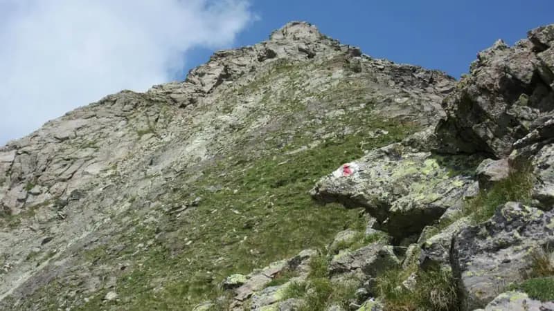
From the refuge, follow the signs to the right for the trail leading to the start of the via ferrata. Ascend a moraine following red markers and cairns in a southeast direction, pass a boulder with the indication for Pizzo Strinato, and at a junction, leave the main trail to veer left following white-red markings. The start of the Ferrata Guerino Rossi was marked by a white plaque and is reached in about an hour from the refuge (4h 15' total). The considerable length of the approach suggested staying overnight at the refuge to begin the climb early in the morning.
Via Ferrata
The Ferrata Guerino Rossi was divided into two distinct sections in terms of morphology and exposure: the first cut across the north face, the second ascended the exposed northeast ridge. Beyond the technical difficulties of the ferrata itself (of a moderate level), the route required a steady step, the ability to move over short unroped sections of Grade I and II, and solid physical fitness. The pace was continuous, with constant physical and mental effort, without long horizontal breaks.
The first section began with a long wall of slabby rocks, where you climbed while paying attention to local instability. The logical, vertical line gained height quickly across inclined slabs, small rock steps, diagonal sections, and ledges, developing mainly across terraces and gullies of compact but occasionally friable sandstone. After the first wall, you turned right, ascending diagonally for about fifty meters over rock steps. You then reached a section where the cable could be covered by residual snow; in that case, you climbed a small gully for about twenty meters until you rejoined the cable on the upper wall, a few meters to the left. This brought you to the technically most challenging passage: a dihedral with the cable on the left, initially climbable with a straddle technique, which in its upper part opened up into a vertical wall. Exiting the dihedral, you ascended a gently sloping ridge that faded into a slabby wall of rock and grass, concluding the first section.
The second section was immediately recognizable: the steel cable gave way to a fixed rope and you left the shady north face to emerge onto the northeast ridge, fully sunlit and spectacularly exposed. You ascended the ridge, alternating easy sections with those of moderate difficulty, keeping in mind that the fixed rope had spaced-out anchors and was naturally less taut than a steel cable, requiring more careful use of your equipment. The wall then steepened toward a rocky gendarme, which you partially bypassed by descending slightly. From here began the final, very exposed stretch: you overcame several rocky steps until the fixed rope ended a few meters from a cross. The last free meters led to the cross itself (1h 30' from the start; 5h 45' total). This final section was the most panoramic, offering a dizzying view of the Val Seriana below.
The route continued beyond with an airy and adrenaline-filled ridge. Following cairns and white-red marks, in about 20 minutes you gained the summit of Pizzo Strinato (6h total), tackling some unroped Grade I and II passages on occasionally loose rock, concluding the ascent in a context of great exposure.
Descent
The descent followed the southwest ridge. You descended, often staying on the right side of the ridge, over rock that was at times unstable, with short sections of Grade I downclimbing. Proceed carefully across some exposed and unstable traverses until you reach the Forcella del Lago. From the notch, descend to the right toward the refuge, following the red markers that lead below the wall of Pizzo Strinato. This long and tiring descent brings you to the Rifugio Barbellino in about 1 hour and 30 minutes from the summit (7h 30' total). From the refuge, return to the parking area via the approach trail in about 2 and a half hours (10h total). The pace of the descent was slow and deliberate, requiring constant attention to the terrain.
Useful Notes
The first section, developing on the north face, could present snow until late in the season; it was therefore advisable to assess the possible need for crampons and ice axe. The austere and remote environment dictated that the ascent be undertaken only in stable and clear weather conditions.
The rock was compact sandstone, but in some sections of the first part it was unstable. The cable was often loose and the pitons spaced out, making any slip absolutely to be avoided. The overall experience was thus more physical and mental than purely technical, with constant exposure.
The descent deserved particular attention: it was long, exposed, and especially in the first thirty minutes, required maximum concentration due to the instability of the terrain, perhaps proving more demanding than the ascent itself in terms of psychological commitment and movement control.
Track and weather
Plan the route
Preview the GPX track from the backend, download it for your GPS device, open parking directions, and check a short forecast before leaving.
Images
FAQ
What level of commitment does this via ferrata require?
ferrata.faqAnswers.commitment
How much elevation gain should I plan for?
The listed ferrata elevation gain is 406 m. Also consider approach, return and maximum altitude, because they can matter more than the equipped section alone.
Where is the route located?
Ferrata Guerino Rossi al Pizzo Strinato is located in Pizzo Strinato, Bergamo, Italy. Before leaving, check parking, access and current local conditions.
When is the best time to climb it?
The best season depends on altitude, aspect and lingering snow. Avoid storms, wet rock and uncertain conditions; start early and keep a margin for the return.
Gear and safety planning
Use the technical data on this page to plan equipment, timing and offline navigation. For a general checklist, read the equipment guide before opening the route in the app.
Video
Watch the route
Useful YouTube videos for getting a real feel for the route before you go.
Logbook
Route condition reports
Recent community notes about closures, snow, equipment damage, trail issues and current conditions.
Community
Reviews, check-ins and photos
-
0 reviews
0
0 climbers
0
Shared by the community
Community photos
Recent images uploaded by Sferrati members.
No community photos yet
Open this route in the app to add the first photo.
Reviews
Recent impressions from climbers who know the route.
No reviews yet
Be the first to review this via ferrata from the app.
Continue in the app
Track the climb, save maps offline, and sync this route to your personal profile.
Use the app to climb
Offline maps, tracking, saves, and profile sync.
Scan the code before leaving, install the app, and keep your route data ready when reception fades.
