
Technical data
- Difficulty
- Difficile
- Status
- aperta
- Distance
- 9,9 km
- Total duration
- 4 h 15 min
- Approach
- 2 h
- Ferrata time
- 50 min
- Elevation gain
- 200 m
- Max altitude
- 1695 m
Route planning
How to plan Ferrata Corno del Bene
Ferrata Corno del Bene is in Monte Guglielmo, Brescia, Italy and is rated Difficile. Available route data lists about 4 h 15 min total time, 9,9 km of distance, 200 m of elevation gain.
For day planning, consider an approach of about 120 min, about 50 min on the cable, a maximum altitude near 1695 m.
The page includes a parking or driving-directions reference. A GPX track is available to review and download.
As with every via ferrata, evaluate season, lingering snow, storms, crowds and equipment condition. Page last updated on 7/4/2026.
Description
Overview
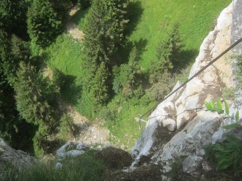
The Ferrata Corno del Bene is a recently built route, short but intense, athletic, and characterized by remarkable exposure. The path follows a logical line along a rocky ridge, with a progression that gradually increases in steepness and sense of emptiness. The quality and placement of the equipment, all brand new, make the climb fluid and engaging, but it is strongly not recommended for beginners or those without solid experience. The summit rewards with an exceptional panorama.
Approach
The starting point is the village of Zone, on the eastern shore of Lake Iseo in the province of Brescia. From Marone, along the road that leads from Brescia to Valcamonica, turn off for Zone. At the entrance to the village, on the right, take Corso Europa. After a short stretch, turn right onto via Monte Guglielmo, and follow it to an intersection. Here, continue right along the narrow via Monte Guglielmo (also signposted for the Bosco degli Gnomi), until you reach a parking area just before a bridge, where the asphalt ends.
From the parking area, ascend along a dirt track, initially unpaved, which coincides with the CAI 227 trail. Continue uphill to a fork: ignoring the branch to the right (CAI 230), keep left following the 227 in the direction of Monte Guglielmo and Corno del Bene. Upon reaching a subsequent fork, you can opt for the direct route to the via ferrata or, if desired, briefly continue to Malga Palamrusso di Basso, which has a fountain. Choosing the via ferrata, cross wide meadows to another junction: leave the trail that continues straight toward the summit and turn right toward the rocky ridge. At the next junction, ignore the path that descends to the right toward Casentiga and turn decisively left, entering the woods and aiming for the unmistakable silhouette of Corno del Bene. Shortly, you reach the start of the via ferrata. The approach takes about 2 hours from the parking area.
The approach unfolds over varied terrain, alternating wooded sections with grassy clearings, with a constant but never excessive gradient that gradually prepares you for the effort ahead. The pace is steady, allowing for an adequate warm-up before the technical start.
Via Ferrata
The equipped route begins with a short horizontal traverse to the right, of moderate difficulty. The progression soon becomes vertical: the first meters offer good natural holds, though sometimes a bit dirty with soil. The cable bends slightly to the right, introducing a first overhanging section overcome with well-placed metal stirrups. After this passage, traverse horizontally to the left, then diagonally with the help of more stirrups, to resume a decidedly vertical climb.
In this section, natural holds become scarce, but the taut steel cable and some artificial handles facilitate progress. Follow a narrow ledge to the right and ascend a vertical wall, finding a small terrace halfway for a rest. After the break, the wall continues vertically, with handles on either side of the cable; then bend left, continuing on this exposed slab, aided by stirrups on the smoothest sections. This is a very physical and airy stretch, among the most adrenaline-pumping on the route.
The via ferrata develops mainly on solid limestone rock, shaped into edges and compact slabs. The pace is relentless, with few effective rest spots, and the exposure becomes constant from the first vertical sections, characterizing the entire ascent as a concentrated and technical experience.
After the wall, tackle a dihedral, first vertical then diagonal, with the aid of stirrups. You arrive below a dihedral about ten meters high which, despite the exposure, presents no particular technical difficulties; the cable runs to the right and good holds are found on the same side (watch out for some grassy and unstable sections). Exiting the dihedral, climb a couple of meters diagonally to the right, then ascend vertically using a split rock, then traverse two meters to the left and attack a new vertical wall. This culminates in a slight overhang that requires pulling on the cable to surmount it with your legs.
Continue with the cable zigzagging among rocks, overcome a small four-meter wall with few holds, and follow a rocky ramp to the right that leads to a chimney. This fissure is well-stepped; the greatest difficulties are in the first moves, after which you proceed in a split using excellent artificial holds and good natural grips. In the second part, the chimney bends left, presenting a smooth slab on the right that forces you to move left and, where holds are lacking, use the cable to ascend. Exiting the chimney in strong exposure, make a traverse to the right then resume verticality, climbing to the right and then diagonally to the left.
You now find yourself below a final vertical wall rich in stirrups, whose upper part features a rocky overhang requiring greater physical effort to overcome. After this demanding section, traverse to the right along a passage that can be uncomfortable for shorter people as it passes under a short roof. You are now in the final phase: ascend a small wall with holds on an edge until reaching the top of the edge itself, composed of easier rocks. A short stretch of grassy terrain, a final horizontal traverse to the right, and the last rocks bring you to the ridge, where the equipment ends. The via ferrata takes about 50 minutes from the start, for a total of about 3 hours from the parking area. The summit offers a magnificent view of Lake Iseo.
The route skillfully alternates technical vertical passages with short rest sections on ledges, maintaining a high level of physical and mental commitment. The character is decidedly athletic and airy, with continuous progression requiring endurance and good management of exposure.
Descent
From the end of the via ferrata, descend to the north, first following a track through the meadows and then joining the CAI 227 trail. At this point you can choose: turn right to continue toward Monte Guglielmo (reachable in about 45 minutes, passing by Rifugio Almici), or return to the parking area by following the outward route to the left (about 1 hour and 15 minutes from the summit). The total time for the excursion, including the return to the parking area, is about 4 hours and 15 minutes.
Useful Notes
The equipment is new and in excellent condition, a crucial detail for such a vertical and in some sections challenging climb. The via ferrata is short, exposed, and intense, offering a good variety of passages: walls, chimneys, dihedrals, traverses, ledges, and short overhanging sections, with stirrups well-positioned to support progression. The route was temporarily closed due to a large landslide, clearly visible at the start, which partially altered the original path.
In 2018, the nearby Ferrata Corna delle Capre was equipped, similar in characteristics to Corno del Bene. For those wanting to do both in a day, it is suggested to climb Corna delle Capre first, descend on the north side, and then reach the start of Corno del Bene.
The area of Lake Iseo and the Brescian Prealps offers numerous alternatives for enthusiasts of via ferratas and technical hiking, with routes of varying difficulty and commitment.
Track and weather
Plan the route
Preview the GPX track from the backend, download it for your GPS device, open parking directions, and check a short forecast before leaving.
Images
FAQ
What level of commitment does this via ferrata require?
ferrata.faqAnswers.commitment
How much elevation gain should I plan for?
The listed ferrata elevation gain is 200 m. Also consider approach, return and maximum altitude, because they can matter more than the equipped section alone.
Where is the route located?
Ferrata Corno del Bene is located in Monte Guglielmo, Brescia, Italy. Before leaving, check parking, access and current local conditions.
When is the best time to climb it?
The best season depends on altitude, aspect and lingering snow. Avoid storms, wet rock and uncertain conditions; start early and keep a margin for the return.
Gear and safety planning
Use the technical data on this page to plan equipment, timing and offline navigation. For a general checklist, read the equipment guide before opening the route in the app.
Video
Watch the route
Useful YouTube videos for getting a real feel for the route before you go.
Logbook
Route condition reports
Recent community notes about closures, snow, equipment damage, trail issues and current conditions.
Community
Reviews, check-ins and photos
-
0 reviews
0
0 climbers
0
Shared by the community
Community photos
Recent images uploaded by Sferrati members.
No community photos yet
Open this route in the app to add the first photo.
Reviews
Recent impressions from climbers who know the route.
No reviews yet
Be the first to review this via ferrata from the app.
Continue in the app
Track the climb, save maps offline, and sync this route to your personal profile.
Use the app to climb
Offline maps, tracking, saves, and profile sync.
Scan the code before leaving, install the app, and keep your route data ready when reception fades.
