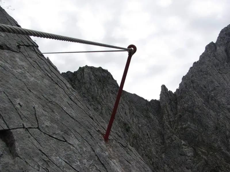
Overview
The Ferrata Tordini-Galligani, also known as the Foce Siggioli Via Ferrata, is a classic historic route in the Apuan Alps, unfolding at the base of the imposing northern face of Pizzo d'Uccello. This is a route of moderate difficulty that, once completed, offers two options: continue toward the summit along a challenging trail for experienced hikers, or complete a more accessible yet equally spectacular loop descent.
Approach
The ideal starting point is the village of Ugliancaldo, in the municipality of Fivizzano. Given the poor maintenance of the trail leading back from the quarries to the parking area, it is not recommended to leave your car directly at the Cantonaccio Quarries. Instead, start from Ugliancaldo, taking the dirt road heading toward the quarries. After about one kilometer, pass a barrier and follow several switchbacks on a wide track, first passing some buildings and then the marble quarries themselves. Once inside the forest, it is crucial to spot a junction: ignore the right-hand turn for the Sentiero Attrezzato Zaccagna (currently closed) and continue uphill, then make a sharp left turn eastward. Following the numerous CAI trail markers, you will eventually reach the start of the Tordini-Galligani ferrata at the base of the rock wall. The approach from Ugliancaldo takes about one hour and thirty minutes.
Via Ferrata
The route is divided into two main sectors of considerable length. The first section runs across a long, sloping slab of marble, where progression is primarily by friction, taking advantage of the exceptional grip offered by the compact rock typical of the Apuans. Numerous artificial holes in the stone serve as excellent footholds. The passage is continuous but not physically exhausting, with a few steps where you can climb freely without using the cable. The slab-a classic Apuan morphological feature-develops along an oblique ledge that gradually leads to the crest line, offering a steady and engaging progression.
The second sector winds for nearly four hundred meters along the sharp crest, heading toward Foce Siggioli. The most iconic passage is the famous "Naso" (Nose), a highly exposed arête that, though impressive to the eye, proves safely surmountable thanks to excellent handholds carved into the rock. The gradient is constant but never vertical, with the final stretch feeling particularly airy despite its lesser incline. The progression along the crest is rhythmic and continuous, offering a predominantly horizontal but very exposed experience, with breathtaking views on both sides. The ferrata ends at Foce Siggioli (1390 m), about two hours from the start. The total time from the beginning of the hike is approximately three hours and thirty minutes.
Descent
From Foce Siggioli, those who do not wish to continue to the summit of Pizzo d'Uccello (a trail for experienced hikers with climbing passages of upper Class I difficulty) can take the return route. The recommended option is to follow the airy Cresta di Capradossa (CAI trail marker 181), recently equipped, which leads toward Poggio Baldozzana. Here, turn right, retracing the easy trail 181 until you return directly to Ugliancaldo. This descent takes about one hour and thirty minutes from the end of the ferrata. The left-hand turn onto the CAI trail 192 is not recommended, as it is poorly marked and difficult to locate.
Useful Notes
The Apuan Alps demand the utmost respect: despite their modest altitudes, they have an alpine character and potentially very rapid weather changes. The proposed itinerary offers the thrill of traversing part of the northern crest of Pizzo d'Uccello in a magnificent setting. The equipment on the ferrata and the equipped trail on the return crest are new and in excellent condition.
For optimal planning, you might consider leaving your car at Ugliancaldo and using the CAI trail 181 for the entire return (about 2 hours from the end of the ferrata). Along this path, near a small religious building in the woods, you will encounter a junction: ignore the left-hand trail marker and continue straight on a gentle false flat, where the 181 markings will resume, leading to the paved road and, in five minutes, to the village.
The ferrata was built in 1971 and dedicated to Brunello Tordini and Pierluigi Galligani, members of the CAI of Pisa who died the previous year. Its construction was driven by the need to create a quick access route to the base of the north face of Pizzo d'Uccello for climbers, which is why you may sometimes encounter hikers descending it.