
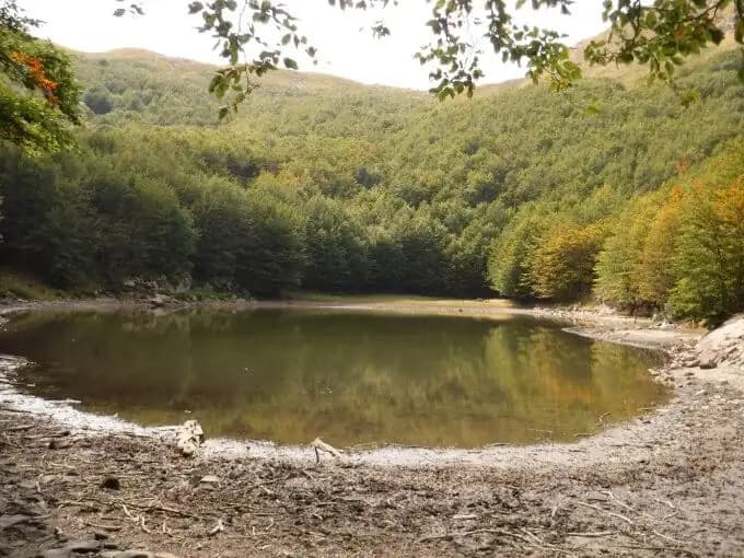
Groppi di Camporaghena e Monte Alto
Monte Alto · Reggio Emilia · Italy
Technical data
- Difficulty
- Moderatamente Difficile
- Status
- aperta
- Distance
- 16 km
- Total duration
- 9 h
- Approach
- 3 h
- Ferrata time
- 2 h 30 min
- Elevation gain
- 100 m
- Max altitude
- 1904 m
Route planning
How to plan Groppi di Camporaghena e Monte Alto
Groppi di Camporaghena e Monte Alto is in Monte Alto, Reggio Emilia, Italy and is rated Moderatamente Difficile. Available route data lists about 9 h total time, 16 km of distance, 100 m of elevation gain.
For day planning, consider an approach of about 180 min, about 150 min on the cable, a maximum altitude near 1904 m. Reported route features include: Itinerario lungo.
The page includes a parking or driving-directions reference. A GPX track is available to review and download.
As with every via ferrata, evaluate season, lingering snow, storms, crowds and equipment condition. Page last updated on 7/4/2026.
Features
Description
Overview
The Apennine ridge between Passo del Cerreto and Passo del Lagastrello is one of the most distinctly alpine itineraries in the entire northern sector of the range. This route, which winds around Monte Alto and culminates with the ascent of Alpe di Succiso (2017 m, the second-highest peak in the province of Reggio Emilia), falls into the category of serious hiking. Its three equipped sections present no high technical difficulties, but the overall itinerary is long and physically demanding, requiring solid athletic conditioning and constant attention, especially in conditions of wet rock or bad weather. The terrain is dominated by rocky crests and broad ledges, with a variable pace that alternates between smooth stretches and more technical, vertical passages, ensuring a continuous and sweeping panoramic experience.
Approach
Access to the route can be made from three distinct points: Succiso Nuovo, Passo del Lagastrello, or Passo del Cerreto. This description assumes a start from Succiso Nuovo, a village in Reggio Emilia near the border between the provinces of Reggio Emilia, Parma, and Massa-Carrara, easily reachable from Reggio, Parma, or Aulla (A15 motorway). Choosing Passo del Lagastrello adds a final uphill return section, while starting from Passo del Cerreto adds at least an hour of walking and the crossing of a ridge trail (00) with Grade II free climbing passages before Monte Alto.
From Succiso Nuovo, leave your vehicle near the church and take trail CAI 653. At the first junction, keep right (markers 653/673), ignoring the left branch for trail 655 that leads to Rio Pascolo. At the next intersection, turn downhill following trail 653, which leads to the ford of the Torrente Liocca: it is essential to assess the water flow in winter and spring, where trekking poles can be very useful. Continuing on trail 653, ignore the turnoff for 653B and proceed with a steady but never steep climb to the junction with trail CAI 657. This trail first leads to Rifugio Città di Sarzana (1580 m, reachable in about 2h30') and finally to the Apennine ridge at Sella di Monte Acuto (1742 m, 3 hours from the start). This approach unfolds through a forested environment, offering a gradual progression that prepares you for the subsequent exposure of the ridge.
Via Ferrata
Once on the ridge, turn left onto a trail that is initially easy but gradually becomes steeper and, in some sections, equipped, heading toward Punta Buffanaro (reached in about 3h30'). This sector, known as the Groppi di Camporaghena, alternates between trail sections and exposed, equipped passages on compact limestone rock. First, you touch Sella di Punta Buffanaro (1752 m) and then, via a steep trail, gain the summit of Punta Buffanaro (1879 m, 4h30' total). Continuing on a partially equipped trail, you descend onto a broader ridge to finally reach the summit of Monte Alto (1904 m, 5 hours). This peak is an excellent rest stop, with a 360-degree panorama stretching from the Ligurian Sea and Palmaria Island to the west, to the Apuan Alps to the south, and up to Alpe di Succiso to the north. The pace in this section is uneven, with constant ups and downs that require adaptability and a sure foot.
From Monte Alto, descend toward Passo di Pietratagliata (1779 m). You can opt for the quicker descent via CAI 673 (about 20 minutes) or, as recommended, stay on the crest and traverse the three equipped sections known as the Ferrata di Monte Alto, all to be tackled in downclimbing. The first section is the most exposed and technically demanding, of moderate difficulty, unfolding over vertical slabs and chimneys. After the equipped sections, you reach Passo di Pietratagliata (5h30' total). This technical descent along the ridge offers a climbing experience on solid rock, requiring concentration and control of movement.
From here, rather than returning to Succiso Nuovo via CAI 673, it is recommended to continue uphill toward Alpe di Succiso. A first short equipped section (about 10 meters) helps overcome a rocky spur. Once past this, the exposed and equipped parts of the route can be considered finished. The environment gradually changes, from the exposed rocks of the ridge to more grassy slopes.
Descent
The final part of the hike is a challenging hiking trail that first leads to the summit of Alpe di Succiso (2017 m, 6h45' total), then to Sella del Monte Casarola (1963 m, 7h15'), and finally, along the long and monotonous trail CAI 655 descending, back to Succiso Nuovo (total time about 9 hours). This last stretch, though lacking technical difficulty, is physically draining due to its length and repetitive terrain, requiring endurance and motivation to complete.
Useful Notes
The equipped sections at the Groppi di Camporaghena, the Ferrata di Monte Alto, and Passo di Pietratagliata are embedded within a sweeping hike in one of the most rugged and remote sectors of the northern Apennines. The considerable length (over 22 km) demands excellent physical fitness. The technical difficulties are overall modest, but the itinerary is strongly discouraged in case of uncertain weather forecasts, given its length and the near-total absence of support points, except for Rifugio Città di Sarzana (open in June, July, August, and on weekends).
Due to its length and commitment, it is not possible to combine other hikes on the same day. However, starting from Passo del Cerreto, on adjacent days you can link up with the Sentiero Attrezzato del Monte Gendarme. From Succiso Nuovo, you can reach Castelnovo ne' Monti for the via ferratas of the Pietra di Bismantova (Ferrata degli Alpini and Ferrata dell'Ultimo Sole). Also in the province of Reggio Emilia, notable are the Ferrata del Monte Penna and the Ferrata del Barranco del Dolo. Descending on the Tuscan side, in Lunigiana, you can reach the Apuan Alps, where the first via ferrata you encounter is the Ferrata Tordini Galligani at Pizzo d'Uccello.
Track and weather
Plan the route
Preview the GPX track from the backend, download it for your GPS device, open parking directions, and check a short forecast before leaving.
Images
FAQ
What level of commitment does this via ferrata require?
ferrata.faqAnswers.commitment
How much elevation gain should I plan for?
The listed ferrata elevation gain is 100 m. Also consider approach, return and maximum altitude, because they can matter more than the equipped section alone.
Where is the route located?
Groppi di Camporaghena e Monte Alto is located in Monte Alto, Reggio Emilia, Italy. Before leaving, check parking, access and current local conditions.
When is the best time to climb it?
The best season depends on altitude, aspect and lingering snow. Avoid storms, wet rock and uncertain conditions; start early and keep a margin for the return.
Gear and safety planning
Use the technical data on this page to plan equipment, timing and offline navigation. For a general checklist, read the equipment guide before opening the route in the app.
Video
Watch the route
Useful YouTube videos for getting a real feel for the route before you go.
Logbook
Route condition reports
Recent community notes about closures, snow, equipment damage, trail issues and current conditions.
Community
Reviews, check-ins and photos
-
0 reviews
2
2 climbers
0
Shared by the community
Community photos
Recent images uploaded by Sferrati members.
No community photos yet
Open this route in the app to add the first photo.
Reviews
Recent impressions from climbers who know the route.
No reviews yet
Be the first to review this via ferrata from the app.
Continue in the app
Track the climb, save maps offline, and sync this route to your personal profile.
Use the app to climb
Offline maps, tracking, saves, and profile sync.
Scan the code before leaving, install the app, and keep your route data ready when reception fades.
