
Technical data
- Difficulty
- Difficile
- Status
- aperta
- Distance
- 7 km
- Total duration
- 6 h
- Approach
- 1 h 30 min
- Ferrata time
- 1 h 30 min
- Elevation gain
- 200 m
- Max altitude
- 2079 m
Route planning
How to plan Ferrata Torre Clampil
Ferrata Torre Clampil is in Torre di Clampil, Udine, Italy and is rated Molto Difficile. Available route data lists about 6 h total time, 7 km of distance, 200 m of elevation gain.
For day planning, consider an approach of about 90 min, about 90 min on the cable, a maximum altitude near 2079 m.
The page includes a parking or driving-directions reference. A GPX track is not available yet, so bring an alternative map source.
As with every via ferrata, evaluate season, lingering snow, storms, crowds and equipment condition. Page last updated on 7/4/2026.
Description
Overview
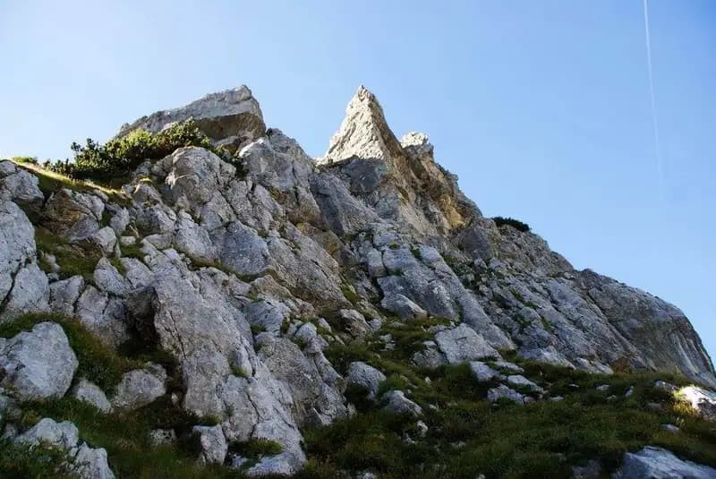
The Ferrata dell'Amicizia on Torre di Clampil is a modern route that demands serious physical commitment. It unfolds across the severe north face of the peak, offering a technical experience defined by continuous exposure and sustained difficulty. The progression builds relentlessly on often polished and overhanging rock, making it a complete test for experienced climbers.
Approach
Access is near the Passo di Pramollo, on the border between the province of Udine and Austria. Parking is at a disused white barracks, located at the second-to-last hairpin before the pass. From Pontebba, after exiting the A23 motorway, follow signs for the pass, driving about 12 kilometers of switchbacks in twenty minutes. From the car (1568 m), take trail 433, which crosses the woods with moderate ups and downs for about one kilometer. After crossing a small bridge over the Rio Winkel and spotting the colorful Baita Winkel (1470 m), continue on trail 433, ignoring the left fork for the Alta Via Cai Pontebba. The path, alternating between sparse woods and scrub, gradually climbs the valley toward the imposing terminal walls. After passing the junction for the Sentiero Alpinistico Schiavi, you reach a crucial fork marked by a CAI sign and markings on a boulder: to the left starts the Ferrata Contin, to the right the Ferrata Torre Clampil. The two towers, Winkel and Clampil, are clearly visible. Keeping right, traverse diagonally across a debris slope following obvious orange markers, until you reach the powerful rock bastion of Torre di Clampil. Here, also indicated by a descriptive image of the route, you find the start of the via ferrata (1 hour 30 minutes from the parking).
Via Ferrata
A few meters to the right of the sign, following the orange markers, you encounter the steel cable. The route is divided into three sections of progressively increasing difficulty. The first section is relatively slabby: a diagonal ramp leads with some moves to the right, beneath the vertical fall line of the tower. You tackle a first vertical slab with decent natural holds and some metal rungs; it's advisable to climb as efficiently as possible to conserve energy for the sections ahead. The grade is moderate, with vertical stretches interspersed with comfortable, debris-covered ledges. Once this introduction is finished, turn decisively right, climbing a small, highly exposed slab that leads to a new ledge. Then ascend a rather smooth wall, followed by a demanding diagonal traverse to the right that significantly taxes the arms. From here, you can see the final part of the route. Resuming the climb, overcome a smooth slab equipped with stirrups, concluding the second section. The third and final section immediately presents itself as very difficult. The rock is polished, often overhanging, and rich in stirrups, handles, and pegs. It begins with an overhanging and vertical passage, where the cable, initially on the left, is aided by stemples and pitons (not always optimally placed). The cable then shifts to the right to overcome a bulge in the rock. You then find yourself beneath a long, exposed sequence of metal stemples in a row; it is essential to control your body position due to the steepness. The athletic climbing continues, with a useful but barely reachable crack on the left. Gaining height and gradually turning left, you face a further difficult overhanging passage, where it's wise to carefully study the placement of the fixtures before moving. The route concludes by ascending a well-equipped gully (1 hour from the start; 2 hours 30 minutes total). Exiting the ferrata, the summit cross of Torre di Clampil is visible directly ahead. Following the trail, you reach the summit (2078 m) in a few minutes (1 hour 15 minutes from the start; 2 hours 45 minutes total). The panorama spans the Creta di Aip to the west and Monte Cavallo to the south. From the summit, following the markers, descend to the saddle that separates Torre di Clampil from Torre Winkel. From here, climbing three short but demanding equipped sections, you gain the summit of Torre Winkel (2041 m), marked by a painted stone and a small metal plaque (15 minutes from Torre di Clampil; 3 hours total).
Descent
For the return, the descent on the Austrian side via the Ferrata Winkelturn is described, which is less demanding than the previous one. From the summit of Torre Winkel, follow the cable descending to the northwest, alternating easy rock passages with sections on grass and earth. You quickly and without particular difficulty lose the roughly 200 meters of equipped elevation, reaching the lake below (45 minutes from Torre Winkel). Skirting the lake on the right, you arrive at the Passo di Madrizze (1919 m). From here, following the markers, descend gently to the right through woods and dwarf pines until you rejoin trail 433 near the Baita Winkel (1 hour from the lake; 1 hour 45 minutes from Torre Winkel). Retracing the approach path, you return to the parking (2 hours 15 minutes from Torre Winkel; about 6 hours total).
Useful Notes
The Ferrata to Torre di Clampil is an extremely demanding, athletic, and exposed route. Although not very long, it is a continuous crescendo of physically challenging passages. It is not recommended for hikers who are not optimally trained, lacking solid familiarity with via ferratas and exposure. The route deliberately seeks out the most exposed slabs, accentuating the difficulty rather than following the mountain's natural lines. The use of a sling with carabiners is strongly recommended to be able to belay safely. A note regarding the in-situ equipment: despite the abundance of stemples and handles, the anchor bolts for the cable are quite far apart, a fact that could amplify the effects of a fall, requiring maximum attention. Depending on the season, it is easy to find snow in the access gully to the start; it may therefore be useful to consider bringing crampons. The via ferrata, inaugurated in 2007 with the name Ferrata dell'Amicizia by the governors of Friuli Venezia Giulia and Carinthia, symbolizes the closeness between the neighboring regions at the Passo di Pramollo. A possible combination is with the nearby Ferrata Contin, possibly descended as a return variant on the Italian side.
Track and weather
Plan the route
Preview the GPX track from the backend, download it for your GPS device, open parking directions, and check a short forecast before leaving.
GPX track unavailable
This route does not include a downloadable track yet.
Images
FAQ
What level of commitment does this via ferrata require?
ferrata.faqAnswers.commitment
How much elevation gain should I plan for?
The listed ferrata elevation gain is 200 m. Also consider approach, return and maximum altitude, because they can matter more than the equipped section alone.
Where is the route located?
Ferrata Torre Clampil is located in Torre di Clampil, Udine, Italy. Before leaving, check parking, access and current local conditions.
When is the best time to climb it?
The best season depends on altitude, aspect and lingering snow. Avoid storms, wet rock and uncertain conditions; start early and keep a margin for the return.
Gear and safety planning
Use the technical data on this page to plan equipment, timing and offline navigation. For a general checklist, read the equipment guide before opening the route in the app.
Video
Watch the route
Useful YouTube videos for getting a real feel for the route before you go.
Logbook
Route condition reports
Recent community notes about closures, snow, equipment damage, trail issues and current conditions.
Community
Reviews, check-ins and photos
-
0 reviews
0
0 climbers
0
Shared by the community
Community photos
Recent images uploaded by Sferrati members.
No community photos yet
Open this route in the app to add the first photo.
Reviews
Recent impressions from climbers who know the route.
No reviews yet
Be the first to review this via ferrata from the app.
Continue in the app
Track the climb, save maps offline, and sync this route to your personal profile.
Use the app to climb
Offline maps, tracking, saves, and profile sync.
Scan the code before leaving, install the app, and keep your route data ready when reception fades.
