
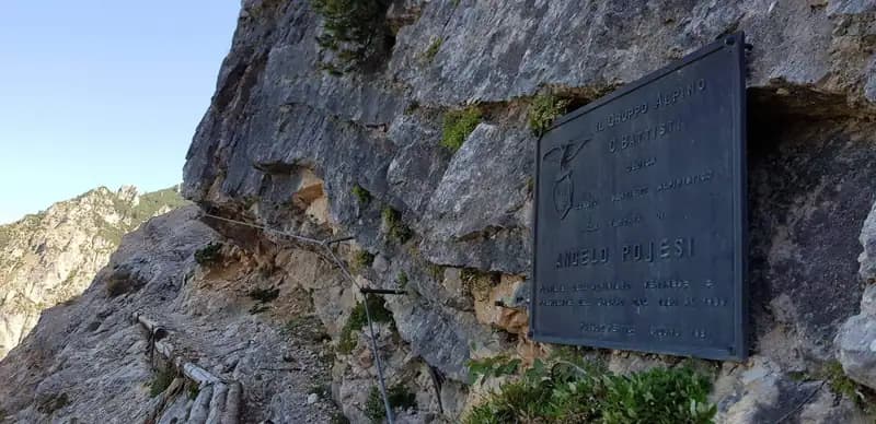
Sentiero Attrezzato Pojesi
Carega · Verona · Italy
Technical data
- Difficulty
- Moderatamente Difficile
- Status
- aperta
- Distance
- 15 km
- Total duration
- 6 h
- Approach
- 30 min
- Ferrata time
- 3 h 30 min
- Elevation gain
- 700 m
- Max altitude
- 2260 m
Route planning
How to plan Sentiero Attrezzato Pojesi
Sentiero Attrezzato Pojesi is in Carega, Verona, Italy and is rated Moderatamente Difficile. Available route data lists about 6 h total time, 15 km of distance, 700 m of elevation gain.
For day planning, consider an approach of about 30 min, about 210 min on the cable, a maximum altitude near 2260 m. Reported route features include: Scale, Avvicinamento corto, Itinerario lungo.
The page includes a parking or driving-directions reference. A GPX track is available to review and download.
As with every via ferrata, evaluate season, lingering snow, storms, crowds and equipment condition. Page last updated on 7/4/2026.
Features
Description
Overview
The recently and completely renovated Sentiero Attrezzato Pojesi offers a varied and rewarding itinerary in the heart of the Piccole Dolomiti. The hike presents predominantly moderate difficulties, ensuring a complete and gratifying mountaineering experience. The route unfolds along long ledges, alternating horizontal sections with short vertical rises, in a typically Dolomitic environment characterized by solid limestone rock but with extensive areas of scree. The overall length, if you include the ascent to the summit of Mount Carega, is considerable, but the effort is compensated by the continuous panorama and the quality of the surroundings. Progression requires constant attention to the often unstable ground, a distinctive feature of the route that dictates its pace.
Approach
The starting point is the Rifugio Revolto (1,355 m), located in the Val d'Illasi. To reach it from the south, exit the A4 motorway at Verona Est or Soave, head towards Selva di Progno, and after passing the town, drive up the valley to Giazza. From here, follow the main road, passing a wide left hairpin turn, then continue for about 7 km along a road that is narrow in places but well-paved, up to the refuge. From the parking lot, to access the via ferrata, you must first climb to the Rifugio al Passo Pertica (1,530 m). The approach can be made via the forest road (30 minutes) or a more direct woodland trail that cuts across it (20 minutes). From the refuge, following the signs, continue northwest along an easy trail that leads in a few minutes to the start of the initial equipped ledge (about 30 minutes total from the parking lot). This first section of approach through the woods gradually prepares you for the more open environment of the via ferrata.
Via Ferrata
The adventure begins on an exposed but comfortable equipped ledge, which develops to the left. The morphology is that of a typical Dolomitic ledge: wide and well-defined, allowing for fluid progression. The route crosses some gangways, short rocky steps, and staircases without any particular technical difficulty. After a short metal ladder, the ledge continues, interrupted only by a section of loose scree, before tackling a short, airy traverse to the left, equipped with metal rungs and pegs. After rounding a corner and overcoming more rungs, a new gangway leads back onto the ledge. The path proceeds in a slight descent over unstable terrain to another traverse, short and easy, without any protection. You then tackle a short descent equipped with rungs, before turning right and climbing without protection, thus ending the first section of the ledge.
Now begins the second part of the long ledge, with a more broken rhythm. You overcome a vertical step of about 4 meters, which introduces a series of boulders and short equipped climbs, interspersed with connecting sections: this constitutes the first truly climbable sector of the route. The rock becomes more compact and vertical. Continuing, you reach a well-equipped chimney, where the cable runs on the left while solid rungs on the right facilitate the ascent. Exiting at the top, you continue on an equipped path in a constant but not difficult ascent, over a scree-covered flank. The route proceeds without a hitch until a section of equipped descent of about fifteen meters: a short wall with rungs, some small rocks, and finally an easy gully lead to a path descending over steep wooden steps. After another short equipped section with rungs and an easy vertical downclimb on well-holded rock, you descend among mountain pines and scree, with short protected sections in exposed spots.
Once the descent is finished, a connecting section leads beneath a beautiful vertical wall. You climb it for about twenty meters, excellently equipped with rungs and rich in natural holds, exiting diagonally onto a stepped ramp. Resuming the path and following the red-and-white trail markers, you reach the summit register. The equipped itinerary, however, is not over. You enter an equipped gully, a fissure in the rock where the ascent is easy, presenting only a few rocky steps of modest difficulty. In the upper part, staying on the left side and using some rungs, you exit the fissure to tackle a beautiful vertical wall of about thirty meters, again with rungs and many natural holds, in a passage of great technical and environmental satisfaction. Exiting by turning right, you access a new equipped gully. Here, the progression, decidedly climbable thanks to the fixed gear, is best done by stemming on the right side, even though the cable is on the left. In the upper part of the gully, more metal rungs assist the climb, which ends on a slabby wall to the right.
You now resume a path with easy rocky steps interspersed with sections through the mountain pines, in a more open and panoramic environment. The route runs above the previously climbed gully, heading left, and after a few short equipped sections, the Sentiero Attrezzato Pojesi ends, joining trail 108 (about 2 hours and 30 minutes from the start, 3 hours from the parking lot). From the junction, taking the right fork, you can return to the Rifugio Pertica in about 1 hour and 15 minutes. If you wish to continue towards Mount Carega, turn left for a beautiful ridge trail that, offering breathtaking views of the Piccole Dolomiti, leads first to the Rifugio Fraccaroli at 2,230 meters (45 minutes from the end of the via ferrata, 3 hours and 45 minutes total) and then, via a steep path, to the nearby summit of Mount Carega at 2,259 meters (4 hours total). This final section is predominantly a hike but has a huge scenic impact.
Descent
From the summit of Mount Carega, you descend back along the path already traveled. Once you reach the junction between the Sentiero Attrezzato Pojesi and trail 108, continue on the latter, which, without technical difficulties, leads back first to the Rifugio Pertica and then, via the approach trail, to the parking lot at the Rifugio Revolto (2 hours from the summit of Mount Carega, for a total of about 6 hours). The descent is therefore logical and direct, retracing the environments already crossed.
Useful Notes
The Sentiero Attrezzato Pojesi, thanks to a recent and careful renovation, is in excellent condition: cables, fixed anchors, gangways, and the path itself have been modernized, with the addition of artificial holds that have made all passages moderately easy. With the exception of three points (the initial traverse and the two final gullies), the itinerary can be considered of easy difficulty, while still maintaining a continuous mountaineering character. It is essential to consider two environmental aspects: in the Piccole Dolomiti, especially in the afternoons of the warm months, fog formation is frequent, so it is advisable to travel the route early in the morning to ensure visibility. Furthermore, given the presence of chamois and other wild animals that can dislodge stones, and more generally due to the often unstable ground that characterizes many connecting and ledge sections, it is essential to always wear a protective helmet. For cartography, the 4Land maps of Pasubio and Vallagarina or the Monti Lessini are recommended. The area is extremely rich in other equipped itineraries, such as the Ferrata Biasin, the Ferrata Campalani, the Ferrata del Vajo Scuro, the Ferrata Viali, the Ferrata Ferrari, the Sentiero Attrezzato del Monte Cornetto, the Ferrata del Vajo Stretto, and the equipped trails Falcipieri and Baglioni, offering multiple possibilities for combination.
Track and weather
Plan the route
Preview the GPX track from the backend, download it for your GPS device, open parking directions, and check a short forecast before leaving.
Images
FAQ
What level of commitment does this via ferrata require?
ferrata.faqAnswers.commitment
How much elevation gain should I plan for?
The listed ferrata elevation gain is 700 m. Also consider approach, return and maximum altitude, because they can matter more than the equipped section alone.
Where is the route located?
Sentiero Attrezzato Pojesi is located in Carega, Verona, Italy. Before leaving, check parking, access and current local conditions.
When is the best time to climb it?
The best season depends on altitude, aspect and lingering snow. Avoid storms, wet rock and uncertain conditions; start early and keep a margin for the return.
Gear and safety planning
Use the technical data on this page to plan equipment, timing and offline navigation. For a general checklist, read the equipment guide before opening the route in the app.
Video
Watch the route
Useful YouTube videos for getting a real feel for the route before you go.
Logbook
Route condition reports
Recent community notes about closures, snow, equipment damage, trail issues and current conditions.
Community
Reviews, check-ins and photos
-
0 reviews
1
1 climbers
0
Shared by the community
Community photos
Recent images uploaded by Sferrati members.
No community photos yet
Open this route in the app to add the first photo.
Reviews
Recent impressions from climbers who know the route.
No reviews yet
Be the first to review this via ferrata from the app.
Continue in the app
Track the climb, save maps offline, and sync this route to your personal profile.
Use the app to climb
Offline maps, tracking, saves, and profile sync.
Scan the code before leaving, install the app, and keep your route data ready when reception fades.
