
Technical data
- Difficulty
- Difficile
- Status
- aperta
- Distance
- 14 km
- Total duration
- 5 h 45 min
- Approach
- 2 h
- Ferrata time
- 45 min
- Elevation gain
- 937 m
- Max altitude
- 2259 m
Route planning
How to plan Ferrata Campalani al Carega
Ferrata Campalani al Carega is in Monte Carega, Verona, Italy and is rated Difficile. Available route data lists about 5 h 45 min total time, 14 km of distance, 937 m of elevation gain.
For day planning, consider an approach of about 120 min, about 45 min on the cable, a maximum altitude near 2259 m. Reported route features include: Itinerario lungo.
The page includes a parking or driving-directions reference. A GPX track is available to review and download.
As with every via ferrata, evaluate season, lingering snow, storms, crowds and equipment condition. Page last updated on 7/4/2026.
Features
Description
Overview
The Ferrata Campalani, the oldest via ferrata in the Piccole Dolomiti, traces its route along the eastern flank of Monte Carega. Despite its modest length, it is defined by technical passages and constant exposure, offering a varied itinerary of great scenic value. At the end of the fixed cables, you can reach the summit of Carega and organize a loop descent back to Passo Pertica. Caution is advised due to the frequent formation of afternoon fog, which can quickly envelop the area.
Approach
The starting point is the Rifugio Revolto (1355 m), reached by ascending the Val d'Illasi. Coming from the south, exit the A4 at Verona Est or Soave, then head toward Selva di Progno and Giazza. Beyond the village, follow the main road for about 7 km (narrow but paved) to the refuge. From the parking area, hike up to the Rifugio al Passo Pertica (1530 m) via a forest trail (20 minutes) or a forestry road (30 minutes). From the pass, take trail 109 toward Rifugio Scalorbi. Just before reaching it, a marked junction indicates trail 19 to the left, which climbs steadily toward Carega. Continuing on, you'll encounter another junction for the Ferrata Campalani: keep left, following a steeper track through the mugo pines until you reach the start below a distinctive yellowish wall. The approach takes about 2 hours from the parking area.
The approach unfolds across a grassy and scree-covered slope, typical of Dolomitic terrain, where limestone rock gradually emerges. The pace is steady, with a constant elevation gain that prepares you for the challenge ahead without any abrupt sections.
Via Ferrata
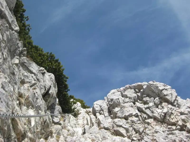
The route begins with the key passage, significantly eased by a 2019 maintenance intervention that installed comfortable iron rungs. You ascend the first 5-6 meters of a dihedral using a steel cable. Reaching a small ledge, you skirt an exposed corner to the right, seeking small footholds, then tackle the ascent of a crack equipped with a metal cable. Exiting the crack on the left side, you overcome an exposed, hold-poor section to another ledge. These first meters are the most demanding part of the Campalani.
The progression unfolds on compact rock, with vertical slabs and cracks requiring precise movement. The environment is dominated by stratified limestone, forming characteristic dihedrals and chimneys. The rhythm is discontinuous: technical, vertical sections are followed by brief pauses on ledges, maintaining constant exposure that heightens the airy character of the route.
You continue with a horizontal traverse to the right, rounding a corner and leading onto a narrow, exposed ledge. The cable then rises diagonally: here the rock can be loose, requiring attention. After this section, a short traverse to the right brings you near a corner, where you follow a chain for a very exposed diagonal traverse. This leads to the entrance of a wide, shady chimney. The chain initially rises vertically before entering the structure; it's advisable to seek holds on both walls to distribute effort. As you climb, stay on the left side to avoid an overhang and overcome a tight passage to exit the chimney.
The chimney represents a change in morphology: a recessed, cool structure where progression becomes more physical and less exposed, but demands good use of opposition moves. The rhythm slows, becoming more methodical and continuous.
You then tackle a diagonal section of rock steps to the right, followed by a short crack between the wall and a spur. With Bocchetta Mosca ahead, you ascend another challenging, exposed crack that ends on an easy horizontal traverse, home to the summit register. You then climb a series of rocky steps on jagged rock, descend a brief airy passage, and find yourself below the final vertical wall, a dihedral. The first meters are the hardest, while the upper part offers more holds and is more slabby. The chain gradually bends to the right, through the mugo pines, marking the final stage. With the last steps to the left and a short traverse, you emerge onto the broad ridge. The climbing time for the via ferrata is about 45 minutes from the start, for a total of 2 hours and 45 minutes from departure.
The upper part of the route becomes more panoramic, with the rock turning more jagged and less compact. The itinerary alternates short vertical rises with traverses, maintaining a technical character but with exposure that progressively opens toward the valley.
Descent
From the end of the via ferrata, follow a rather airy but not difficult ridge that in 20 minutes leads to the Rifugio Fraccaroli (2230 m). From here, you can quickly ascend to the summit of Monte Carega (2259 m), reachable in about 30 minutes from the end of the ferrata (total 3h 15'). For the return, you have three options:
- Descend to Rifugio Scalorbi via trails 157 and 192, then return to the car by the approach route (about 2h 30' from the summit, total 5h 15').
- Take the trail 108 directly down to Passo Pertica, then return to the car (about 2h from the summit, total 4h 45').
- Initially follow trail 108 to the junction with the Sentiero Attrezzato Pojesi and descend it to Passo Pertica. Extreme caution not to dislodge stones that could fall on hikers below. From there, return to the car (about 3h 30' from the summit, total 6h 45').
The final ridge offers an airy experience on solid terrain, with a brisk walking pace. The descent options vary significantly in commitment and character: from the comfortable, fast trail 108 to the more technical and demanding Pojesi route.
Useful Notes
The Ferrata Campalani is a very interesting itinerary that alternates sections of moderate difficulty with two more challenging passages: the diagonal traverse and the chimney. The rock often offers good holds, inviting you to climb, although it is loose in some spots. Compared to other via ferratas in the Piccole Dolomiti, long sections are equipped with chain. The gear, renewed in 2018, is in excellent condition. The risk of typical afternoon fog is emphasized, which can cause problems along the airy final ridge toward the Fraccaroli. The route, inaugurated in 1958 by the Gruppo Alpino Operaio of Verona, is dedicated to the memory of Carlo Campalani. The Piccole Dolomiti area offers numerous possibilities for combining with other equipped itineraries.
The route is characterized by good technical variety and constant exposure, without requiring excessive physical effort. The experience is predominantly vertical and technical in the first part, becoming more panoramic and articulated across ledges and chimneys in the second, offering a complete reading of the slope's morphology.
Track and weather
Plan the route
Preview the GPX track from the backend, download it for your GPS device, open parking directions, and check a short forecast before leaving.
Images
FAQ
What level of commitment does this via ferrata require?
ferrata.faqAnswers.commitment
How much elevation gain should I plan for?
The listed ferrata elevation gain is 937 m. Also consider approach, return and maximum altitude, because they can matter more than the equipped section alone.
Where is the route located?
Ferrata Campalani al Carega is located in Monte Carega, Verona, Italy. Before leaving, check parking, access and current local conditions.
When is the best time to climb it?
The best season depends on altitude, aspect and lingering snow. Avoid storms, wet rock and uncertain conditions; start early and keep a margin for the return.
Gear and safety planning
Use the technical data on this page to plan equipment, timing and offline navigation. For a general checklist, read the equipment guide before opening the route in the app.
Video
Watch the route
Useful YouTube videos for getting a real feel for the route before you go.
Logbook
Route condition reports
Recent community notes about closures, snow, equipment damage, trail issues and current conditions.
Community
Reviews, check-ins and photos
-
0 reviews
3
2 climbers
0
Shared by the community
Community photos
Recent images uploaded by Sferrati members.
No community photos yet
Open this route in the app to add the first photo.
Reviews
Recent impressions from climbers who know the route.
No reviews yet
Be the first to review this via ferrata from the app.
Continue in the app
Track the climb, save maps offline, and sync this route to your personal profile.
Use the app to climb
Offline maps, tracking, saves, and profile sync.
Scan the code before leaving, install the app, and keep your route data ready when reception fades.
