
Francesca Ferrari
May 1, 2026
Ferrate veramente top --- **...
Ferrate veramente top
ModerataEsposizioneVistaAvvicinamentoRientroAttrezzatura

Sojo di Mezzogiorno · Vicenza · Italy
Route planning
Ferrata Anelli delle Anguane is in Sojo di Mezzogiorno, Vicenza, Italy and is rated Moderatamente Difficile. Available route data lists about 4 h 30 min total time, 5,5 km of distance, 300 m of elevation gain.
For day planning, consider an approach of about 25 min, about 180 min on the cable, a maximum altitude near 750 m. Reported route features include: Ponti sospesi.
The page includes a parking or driving-directions reference. A GPX track is available to review and download.
As with every via ferrata, evaluate season, lingering snow, storms, crowds and equipment condition. Page last updated on 7/4/2026.
The Anguane complex, developed on the bastion of the Sojo di Mezzogiorno, represents a unique climbing park in both concept and modularity. The wall, rising roughly 300 meters above the Val d'Astico, offers an ideal morphological structure: a succession of vertical slabs, natural ledges, and gullies that have allowed the creation of a dynamic network of routes. The project, continuously evolving since 2018, integrates classic via ferratas, equipped ledges, and daring variants such as the "Salto delle Anguane" and the recent suspended ladders "Scala Bruna" and "Scala Grazia." The true peculiarity lies in the freedom of composition: numerous connecting sections allow you to combine the loops at will, modulating difficulty and commitment based on experience. The environment is typical of Prealpine limestone, with generally compact rock but with sectors of scree, demanding great attention to the risk of falling rocks.
Access to the park is from San Pietro Valdastico, on the eastern side of the valley. After taking the Valdastico motorway towards Trento, cross the bridge over the Astico River about ten minutes after Piovene Rocchette. Following the signs for San Pietro, pass the church and park in one of the two available spaces, one of which has an information board. From here, a clear white-red trail marker indicates the start of the S1 path.
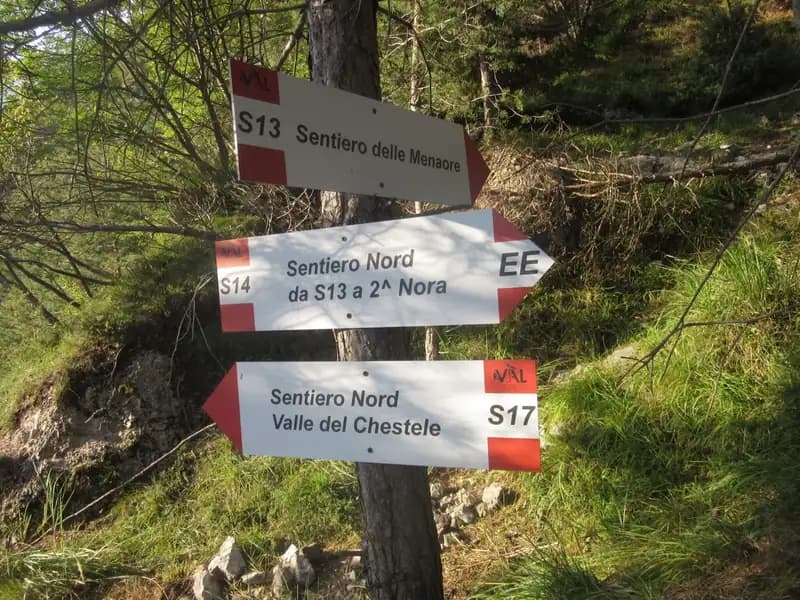
Take the S1 path to the right, proceeding on a slight incline with moderate gradient. The well-marked trail gains elevation gradually until a first marked crossroads. Keeping left, the path becomes steeper until the next junction between S2 and S4. The choice falls on the S2 path to the left, which quickly leads to the start of the via ferrata. The approach from the parking lot takes about 20-25 minutes of walking through wooded terrain.
The description proposes a logical sequence, but the modular nature of the park allows for infinite variations.
Routes F1, F2, F3, and F5 (right side): The start (F1) presents itself as a vertical little wall rich in natural holds, immediately introducing exposure. A traverse to the left on compact slab leads to a panoramic viewpoint. A short section in the woods to the right leads to route F2 (Joa), an easy equipped path that ends in a rocky gully, emerging onto the S4 path. Route F3 begins on a narrow grassy ledge, then becomes vertical on good-quality rock, alternating steps and short traverses until a plateau with a view of the Suspended Bridge. Route F5 crosses this stable 4-rope bridge, about 25 meters long. After crossing it, an escape route descends to the left. Continuing, you climb diagonally to the left with a beautiful vertical ascent, using excellent natural and artificial holds, gaining elevation quickly until a connecting section. You overcome a short, equipped, not-difficult overhang and climb the last wall. The pace of this section is lively, with continuous progression and constant exposure, offering an immediate immersion into the verticality of the complex.
Routes F6, F7, and partial descent: From the end of F5, move to the right to enter a rocky gully equipped for descent (F6). To the left, the F7 ledge branches off, leading to ladders SC4 and SC5. At the end of the descent in the gully, pay attention: do not follow the track that goes straight down (escape route), but keep left on a wide path that skirts the wall. Retrace the approach path to the second junction, where you now follow the signs for the Suspended Bridge. Climb through the woods to a steep terraced gully, which leads to the base of the bridge. This connecting section introduces a change of pace, with a pause from vertical progression before resuming the main route.
Route F4 (Ledge) and F11 (left side): From the bridge, an equipped path runs along the wall downwards. Continuing instead, you enter the long equipped rocky ledge F4. Lacking technical difficulty, this ledge is at times narrow and exposed, with a passage that may require sitting down. In about 30 minutes you reach the start of the second vertical section (F11), of difficult level. About halfway along the ledge, you can also start the F11 variant. This route features diagonal traverses, short vertical steps, and overhanging passages. The abundance of stirrups mitigates the difficulty, but the continuous carabiner changes and some athletic sections require preparation. After an adherence traverse and a vertical section, you go around a large rocky roof. The key passage is the subsequent 6-8 meters in a slight overhang, requiring agility and strength in carabiner changes. Past the roof, a horizontal traverse to the left leads to the base of the last section: a chimney in a slight overhang, made manageable by the wealth of stirrups on both sides. Climb the chimney and finish on a dirt ramp. The F4 ledge offers a horizontal but psychologically challenging experience due to continuous exposure, while F11 introduces a more technical and physical character, with movement sequences requiring precision.
Completing the loop and route F13: From the end of F11, you could continue to the right on another exposed equipped ledge. To complete a loop without repeating passages, it is advisable to continue left on a clear track to the start of route F13. Descend two sections of equipped path that are quite vertical but of moderate difficulty, then tackle a final equipped section that ends near the start of the second route, concluding the equipped routes of the Anelli delle Anguane. This equipped descent closes the circle, offering a decisive pace on the way down and a good retrospective overview of the route taken.
Variant "Salto delle Anguane" (F8): Opened in spring 2019, it is of extremely difficult level. Reach its start by following the S4 path until you spot the steel cable leading to a ledge. The distinctive element is a mobile metal ladder without anchors at the bottom, similar to an aid climbing passage and very demanding on the arms. The route continues with similar vertical characteristics but more difficult than the other sections, requiring good use of legs and arms. Once on the upper ledge, you can finish to the right or left. Continuing, you climb a metal ladder (SC2) and tackle decidedly overhanging sections, first vertical then traversing to the right, demanding strength and technique. After about forty meters of more sloping terrain and a traverse under a yellow roof, you climb a long, leaning metal ladder (SC3). A final rocky pulpit, a traverse to the right towards a dihedral, an ascent, and a new traverse to the left lead to a vertical slab. A ladder leads to a junction: to the left, a long traverse leads to a very taut 15-meter suspended bridge; to the right, you quickly reach the ladders. Past the bridge, an easy edge and some ramps lead to the end of the variant along route F10, a long horizontal ledge used for the descent (F13 to the left or F6 to the right). The "Salto" represents the athletic heart of the park, a succession of continuous and physically draining passages requiring endurance and control of tension.
Ladders "Scala Bruna" (SC4) and "Scala Grazia" (SC5) and "Tetto dei Salbanei" (F12): Built in early 2025, the two suspended metal ladders ("Scala Bruna" at 40m and "Scala Grazia" at 70m) present no significant technical difficulties but are very exposed; it is recommended that no more than two people climb at a time. They are reached by following route F8 (very difficult) or the middle ledge F7 (easy). The Tetto dei Salbanei (F12) is an extreme route, probably among the most challenging in Europe. It is characterized by overcoming a rocky roof which, despite the numerous stirrups, requires arm strength and body positioning comparable to a boulder problem on a steep overhang. The use of a lanyard to rest is absolutely recommended. Exiting the roof, a demanding traverse leads to the F10 ledge. These extreme elements transform the progression into a purely athletic and mental challenge, where exposure and strength are the dominant factors, on rock that in this section becomes particularly compact and vertical.
The return is made by retracing the path used for the approach. The choice of descent route depends on the route or routes taken during the ascent, using the network of connections that lead back to the base paths.
The equipment is in excellent condition, and the abundant installation of stirrups and steps mitigates the difficulties despite the verticality of the passages. It is essential to pay attention to falling rocks: being an interweaving of superimposed routes, the use of a helmet is mandatory due to the risk of rockfall from other hikers, especially on sections with friable rock, as indicated by numerous signs. The extreme variants significantly raise the level of difficulty, and the indicated times are purely indicative, depending heavily on the selection and combination of loops.
Given the modular nature of the complex, it is difficult to give a single judgment on the difficulties. In summary:
Track and weather
Preview the GPX track from the backend, download it for your GPS device, open parking directions, and check a short forecast before leaving.
ferrata.faqAnswers.commitment
The listed ferrata elevation gain is 300 m. Also consider approach, return and maximum altitude, because they can matter more than the equipped section alone.
Ferrata Anelli delle Anguane is located in Sojo di Mezzogiorno, Vicenza, Italy. Before leaving, check parking, access and current local conditions.
The best season depends on altitude, aspect and lingering snow. Avoid storms, wet rock and uncertain conditions; start early and keep a margin for the return.
Use the technical data on this page to plan equipment, timing and offline navigation. For a general checklist, read the equipment guide before opening the route in the app.
Video
Useful YouTube videos for getting a real feel for the route before you go.
Logbook
Recent community notes about closures, snow, equipment damage, trail issues and current conditions.
Community
5.0
3 reviews
3
3 climbers
18
Shared by the community
Recent images uploaded by Sferrati members.
Recent impressions from climbers who know the route.
May 1, 2026
Ferrate veramente top

Feb 13, 2026
Bellissima ferrata molto varia, la scala é una chicca davvero spettacolare! Valutate bene il grado di difficoltà prima di scegliere quella voi più adatta!  da evitare in estate molto esposta e calda!

Feb 5, 2026
Bellissima ferrata con più vie tra le quali scegliere
Track the climb, save maps offline, and sync this route to your personal profile.
Use the app to climb
Scan the code before leaving, install the app, and keep your route data ready when reception fades.
