
Gianluca Granieri
Jul 18, 2026
Tosto abbastanza distanti gli ...
Tosto abbastanza distanti gli attacchi… difficile x chi è basso
DifficileEsposizioneVistaAttrezzatura

Route planning
Ferrata delle Taccole al Baldo is in Monte Baldo, Verona, Italy and is rated Difficile. Available route data lists about 7 h 30 min total time, 11 km of distance, 164 m of elevation gain.
For day planning, consider an approach of about 180 min, about 45 min on the cable, a maximum altitude near 2152 m. Reported route features include: Itinerario lungo, Funivia all'andata, Funivia al ritorno.
The page includes a parking or driving-directions reference. A GPX track is available to review and download.
As with every via ferrata, evaluate season, lingering snow, storms, crowds and equipment condition. Page last updated on 7/18/2026.
The Ferrata delle Taccole is a demanding route on the slopes of Monte Baldo, leading to the Vetta delle Buse summit. This is a physically athletic and technically exposed itinerary that requires solid preparation and familiarity with vertical terrain, despite its modest length and manageable elevation gain. The environment is defined by smooth slabs and narrow cracks, giving the route a predominantly physical, endurance-based character. A critical element is the access gully - a loose, unstable channel that can hold residual snow even into early summer, adding a further technical variable to the approach.
Planning access to the Ferrata delle Taccole depends on whether the lift connecting Prada to Costabella is operational. If running, it saves considerable energy. Otherwise, you must reach the Rifugio Telegrafo at 2200 meters. Two main trails lead there.
The first is the Sentiero CAI 657, which starts from a wide clearing at a hairpin turn on the provincial road. This trail is free of exposure and reaches Punta Sascaga, near the rifugio, in about two and a half hours with a steady, sustained gradient. The second option, more direct but challenging, is the Sentiero CAI 652 (Sentiero Bovi), known for its steep, airy sections over rock ledges and terraces, reaching Punta Telegrafo in about one hour and forty-five minutes. The service road accessing this second trail is often closed during winter.
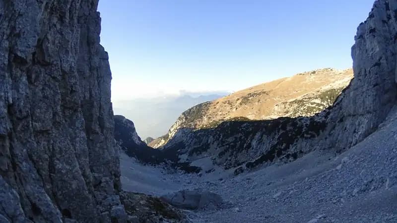
Regardless of your choice, the intermediate goal is a saddle just below the Vetta delle Buse, where the start plaque is fixed. From here, descend briefly westward down a steep, unstable gully - a loose channel that marks the transition into vertical terrain and leads to the actual start of the via ferrata.
The route opens characteristically by entering a rock chimney. The first meters use natural holds, but progression soon requires the use of metal rungs and stirrups, demanding careful reading of the sequence. As the crack develops vertically, it progressively narrows, heightening the sense of exposure, until you emerge onto a small ledge. Clear the final meters of the chimney and exit onto a jumble of boulders - one particularly protruding - which you climb before traversing right along an exposed ledge.
This ledge leads to the base of a long, smooth, steep slab. The cable runs parallel to a crack that provides the only reliable natural holds, while the slab surface is polished and unforgiving. Progression becomes intense and continuous, aided by stirrups placed on both sides of the cable. High on the slab, you encounter an athletic passage requiring you to exit the crack, facilitated by a vertical stirrup positioned above. After a short traverse left, you face a dihedral equipped with stirrups on both sides, followed by a short but overhanging section that leads to a ledge - an ideal spot for a rest.
The final sector begins with a wall similar to the previous ones, then funnels you into a crack that can be damp and cold. Here, two slightly overhanging sections follow in succession, requiring you to pull hard on the cable due to the near-total absence of natural holds. After the second overhang, the crack narrows further until you are forced to exit sideways - a move that may require a "lolotte" technique for the first few meters. Once free of the constriction, a few final meters of slab lead to a dirt path and, after a few rocky steps, to the summit register marking the end of the ferrata. The pace is sustained, and the estimated climbing time is about 45 minutes.
From the finish of the Ferrata delle Taccole, descend along a well-defined trail until you intersect the Sentiero CAI 658. At this junction, the direction depends on your ascent route: turning left heads toward the Rifugio Telegrafo and the descent to the parking areas; turning right leads toward the top station of the Costabella cable car.
This via ferrata on Monte Baldo is a predominantly athletic, endurance-focused route with few opportunities for pure, technical climbing. The rock - compact limestone - is polished by erosion and offers significant natural holds only along edges and cracks. The numerous metal stirrups aid progression, but the intervals between them can be challenging, sometimes requiring decisive use of the cable to advance. This is a ferrata that tests sustained strength and the management of exposure, satisfying the most experienced technical hikers. The panorama from the Vetta delle Buse is magnificent, stretching endlessly over Lake Garda and the surrounding mountain ranges.
Using the cable car, when available, radically transforms the day's commitment, reducing the elevation gain to be tackled and potentially allowing you to combine other nearby routes.
Track and weather
Preview the GPX track from the backend, download it for your GPS device, open parking directions, and check a short forecast before leaving.
ferrata.faqAnswers.commitment
The listed ferrata elevation gain is 164 m. Also consider approach, return and maximum altitude, because they can matter more than the equipped section alone.
Ferrata delle Taccole al Baldo is located in Monte Baldo, Verona, Italy. Before leaving, check parking, access and current local conditions.
The best season depends on altitude, aspect and lingering snow. Avoid storms, wet rock and uncertain conditions; start early and keep a margin for the return.
Use the technical data on this page to plan equipment, timing and offline navigation. For a general checklist, read the equipment guide before opening the route in the app.
Video
Useful YouTube videos for getting a real feel for the route before you go.
Logbook
Recent community notes about closures, snow, equipment damage, trail issues and current conditions.
Community
4.0
1 reviews
1
1 climbers
1
Shared by the community
Recent images uploaded by Sferrati members.
Recent impressions from climbers who know the route.
Jul 18, 2026
Tosto abbastanza distanti gli attacchi… difficile x chi è basso
Track the climb, save maps offline, and sync this route to your personal profile.
Use the app to climb
Scan the code before leaving, install the app, and keep your route data ready when reception fades.
