
Technical data
- Difficulty
- Difficile
- Status
- aperta
- Distance
- 7,1 km
- Total duration
- 3 h 45 min
- Approach
- 1 h 15 min
- Ferrata time
- 1 h
- Elevation gain
- 180 m
- Max altitude
- 2083 m
Route planning
How to plan Ferrata del Canalone
Ferrata del Canalone is in Punta Disperazione, Trento, Italy and is rated Molto Difficile. Available route data lists about 3 h 45 min total time, 7,1 km of distance, 180 m of elevation gain.
For day planning, consider an approach of about 75 min, about 60 min on the cable, a maximum altitude near 2083 m. Reported route features include: Ponti sospesi.
The page includes a parking or driving-directions reference. A GPX track is available to review and download.
As with every via ferrata, evaluate season, lingering snow, storms, crowds and equipment condition. Page last updated on 7/4/2026.
Features
Description
Overview
The Ferrata del Canalone is a vertical, highly climbable route that leads to the rocky spur known as Punta Disperazione, in the heart of Val Canali within the Pale di San Martino group. It stands out for its brevity and technical nature, making it an exception among the typically long via ferratas of this Dolomitic area. The entire route, including the approach and a partially equipped, exposed descent, offers an intense and concentrated experience.
The itinerary unfolds along a compact, solid rocky ridge, characterized by continuous vertical progression. Unlike ferratas that wind along ledges or broad traverses, this route cuts directly into the mountain's structure, offering a decidedly more alpine character. The pace is tight, with constant and marked exposure accompanying the climber from base to summit, without any horizontal resting sections.
Approach
The starting point for the Ferrata del Canalone is in Val Canali. To reach it, take the Strada Statale 347 del Passo Duran. Coming from Fiera di Primiero, follow the direction for Agordo for about five kilometers until you spot a wide, well-marked curve for Val Canali. Turn onto this road and follow it all the way up; ignoring a hairpin turn to the left, continue straight to a junction near a small church. Keeping right, you'll finally reach the area of Malga Canali, where parking is available.
From Malga Canali (1302 m), the approach continues on a wide gravel road that enters the forest with a modest incline. You'll encounter two junctions: one to the right for the Troi del Todesch and one to the left for the Bivacco Minazio. Ignore both, instead continuing on trail 707. This crosses the Canali stream and, staying comfortable but steep, climbs with a long series of switchbacks to the Rifugio Treviso (1631 m), reachable in about an hour from the parking lot.
From the refuge, with the spur of Punta Disperazione clearly visible, ascend to the right on a clear track. From trail 718, the obvious path for the ferrata branches off to the right (to the left is one of the descent routes). With a short but steep climb, you'll reach the start of the route in about fifteen minutes, marked by a distinctive sign. The total time from the car is about one hour and fifteen minutes.
The approach has a steady, progressive pace, with a net elevation gain that physically prepares you for the route itself. The environment gradually changes from the valley-floor forest to the rocky openings at the base of the spur, offering a clear reading of the morphology of the route you are about to tackle.
Via Ferrata
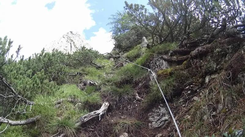
The start of the Ferrata del Canalone immediately reveals the nature of the route: the rock is solid and rich in holds, so much so that the route's creators suggest favoring climbing over pulling on the cable. To reach the first steel rope, in fact, you need to climb about four meters on excellent but unprotected rock.
The initial development is well-defined: you climb vertically on the right side of the spur, then gradually shift toward its crest in the upper section. After the first few meters, you face a wall equipped with some metal rungs that help overcome a short overhanging section. The progression continues by moving left, until you climb in strong exposure right on the crest of the spur. The rock, always excellent, allows for pleasant, airy climbing, with the Rifugio Treviso remaining clearly visible behind you.
Continue the ascent along the spur, seeking natural holds in this highly exposed section. Afterwards, move left toward the side of Punta Disperazione that overlooks the Canalone. This horizontal traverse is facilitated by some stirrups and rungs, after which the cable resumes vertically for the last challenging section.
Climb vertically to an overhanging section that, compared to previous versions, has now been equipped with wider rungs, making it less problematic. After overcoming this demanding and exposed passage, you first turn left and then right in a final series of moves that lead to the end of the ferrata at Punta Disperazione. The climb on the equipped route takes about an hour, for a total of two hours and fifteen minutes from the car.
The progression is technically continuous and physically demanding, with few natural resting points. The vertical character and constant exposure on the crest of the spur require concentration and good management of fatigue. The environment is dominated by compact Dolomitic rock, which allows for reliable climbing but amplifies the sensation of emptiness on either side.
Descent
A short equipped track leads to Punta Disperazione. From here, follow the cables to the left, which descend slightly before traversing horizontally across the rock face. Here you encounter and cross a wooden walkway, very exposed, before passing onto a ledge.
The descent continues, reaching a gully with small rocks to descend, paying particular attention to the ground, which can be unstable. This brings you back to the start of the ferrata and, subsequently, to the Rifugio Treviso. From the refuge, descend back along the approach trail to the parking lot at Malga Canali. The return from the end of the ferrata takes about one hour and thirty minutes, for a total excursion of about three hours and forty-five minutes.
The return alternates sections of technical descent on rock with airy traverses, maintaining a high level of attention. The wooden walkway and the subsequent ledge extend the exposed experience, requiring a steady step. The pace changes compared to the ascent, becoming more discontinuous, with calm moments on the trail alternating with still-challenging passages.
Useful Notes
The Ferrata del Canalone is a short but technical route. The excellent quality of the rock makes it largely climbable, despite the marked exposure present for almost the entire ascent and part of the descent. The equipment has been recently modernized and is in excellent condition.
The relative brevity of the approach and descent makes it an ideal choice for days with not perfectly stable weather, when the longer routes typical of the Pale di San Martino might not be feasible. For the most difficult sections, knowing techniques for safely resting on a via ferrata can be useful.
The route is characterized by its concentrated and technical nature, offering a complete alpine experience in just a few hours. The continuous verticality and constant exposure make it a highly scenic itinerary with great impact, suitable for those seeking intense physical and mental commitment but of limited duration.
Track and weather
Plan the route
Preview the GPX track from the backend, download it for your GPS device, open parking directions, and check a short forecast before leaving.
Images
FAQ
What level of commitment does this via ferrata require?
ferrata.faqAnswers.commitment
How much elevation gain should I plan for?
The listed ferrata elevation gain is 180 m. Also consider approach, return and maximum altitude, because they can matter more than the equipped section alone.
Where is the route located?
Ferrata del Canalone is located in Punta Disperazione, Trento, Italy. Before leaving, check parking, access and current local conditions.
When is the best time to climb it?
The best season depends on altitude, aspect and lingering snow. Avoid storms, wet rock and uncertain conditions; start early and keep a margin for the return.
Gear and safety planning
Use the technical data on this page to plan equipment, timing and offline navigation. For a general checklist, read the equipment guide before opening the route in the app.
Video
Watch the route
Useful YouTube videos for getting a real feel for the route before you go.
Logbook
Route condition reports
Recent community notes about closures, snow, equipment damage, trail issues and current conditions.
Community
Reviews, check-ins and photos
-
0 reviews
0
0 climbers
0
Shared by the community
Community photos
Recent images uploaded by Sferrati members.
No community photos yet
Open this route in the app to add the first photo.
Reviews
Recent impressions from climbers who know the route.
No reviews yet
Be the first to review this via ferrata from the app.
Continue in the app
Track the climb, save maps offline, and sync this route to your personal profile.
Use the app to climb
Offline maps, tracking, saves, and profile sync.
Scan the code before leaving, install the app, and keep your route data ready when reception fades.
