
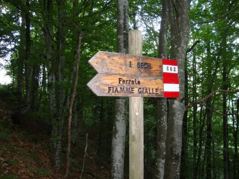
Ferrata Fiamme Gialle alla Palazza Alta
Gruppo del Civetta · Belluno · Italy
Technical data
- Difficulty
- Difficile
- Status
- aperta
- Distance
- 7 km
- Total duration
- 9 h
- Approach
- 1 h
- Ferrata time
- 3 h 30 min
- Elevation gain
- 955 m
- Max altitude
- 2255 m
Route planning
How to plan Ferrata Fiamme Gialle alla Palazza Alta
Ferrata Fiamme Gialle alla Palazza Alta is in Gruppo del Civetta, Belluno, Italy and is rated Molto Difficile. Available route data lists about 9 h total time, 7 km of distance, 955 m of elevation gain.
For day planning, consider an approach of about 60 min, about 210 min on the cable, a maximum altitude near 2255 m. Reported route features include: Itinerario lungo.
The page includes a parking or driving-directions reference. A GPX track is available to review and download.
As with every via ferrata, evaluate season, lingering snow, storms, crowds and equipment condition. Page last updated on 7/4/2026.
Features
Description
Overview
The Ferrata Fiamme Gialle is a highly demanding alpine itinerary, unfolding across the severe southwest face of Palazza Alta in the Civetta Group. The route is defined by its considerable length and substantial physical exertion, earning an overall difficulty rating of "very difficult." It is therefore reserved exclusively for experienced hikers with excellent athletic conditioning and familiarity with sustained technical passages. The logistics of the descent, also long and taxing, require an early start at dawn or, alternatively, splitting the ascent over two days with an overnight stay in a mountain hut.
Approach
The starting point is the hamlet of Bastiani, above Cencenighe Agordino in the province of Belluno. From Cencenighe, heading toward Alleghe, take a steep ramp marked for Bastiani. The road ends in the village, where there is a small parking area. From the parking lot, follow the signs for the Ferrata Fiamme Gialle, ascending a forest trail that features two consecutive junctions: at both, keep left, heading toward the via ferrata. After exiting the woods, you reach another junction where you take the right fork for the ferrata, ignoring the turnoff for Sech. The trail then traverses diagonally at the base of the majestic limestone bastion-an approach that already hints at the route's character with exposed sections protected by handlines-until reaching the start of the via ferrata in about an hour. Though just the approach, this stretch demands attention due to its ledge-like terrain, offering the first views of the wall's compact structure.
Via Ferrata
The itinerary unfolds in four main sections, interspersed with short equipped trail segments that provide a break from the vertical effort. The first section sets the tone immediately: compact rock and vertical development. It begins with a six-meter step, then traverses right and commits to a long slab climb, often requiring active pulling on the cable. After a long traverse to the right and mixed passages, this first stretch concludes in about thirty minutes. A short equipped trail leads to the second section, which features a different morphology, with well-shaped slabs and ledges that allow for smoother, more enjoyable climbing, taking advantage of the excellent dolomite quality typical of Civetta. You ascend to a small notch and, with a brief traverse to the right, finish this part an hour and a half from the start. The environment here is more open, with the ferrata unfolding across a broad band of the wall, offering a sustained but less extreme pace.
Another trail segment leads to the third section, which restores a more technical character with a vertical, demanding slab that bends left. Continue on slab, execute a traverse to the right, and tackle an exposed and difficult ridge with scarce holds, then overcome a final vertical slab and a horizontal traverse before the exit. A trail leads to a fork: to the right, an easy route to the summit; to the left, the fourth section, very difficult. This final part represents the technical heart of the itinerary. It begins with a challenging diagonal traverse to the right toward a ridge, which is ascended in strong exposure. You then find yourself beneath a long and difficult dihedral with minimal holds-a passage requiring continuous use of the cable and seeking footholds in a wide stance. The final moves present a steep wall with better holds, leading at last to the summit of Palazza Alta at 2255 meters. The pace in this last section is discontinuous and deliberate, with pure climbing passages on smooth rock that demand careful reading of the structure. The total time for the via ferrata is approximately three hours and thirty minutes.
Descent
From the summit begins the long and demanding return phase. Descending eastward, you reach a clear marked junction. From here, three options are available. The first, which we recommend, is the long return via the Col Mandro Bivouac, which allows you to complete the loop without needing a second car. At the junction, take the right fork onto trail CAI 562 for "Vazzoler." The trail descends steadily to a junction where you keep left, staying on the 562, with stunning views of Torre Venezia. Continue to Sella Pelsa (1954 m, 1h30' from the ferrata). From here, follow trail 567 to Forcella di Col Madro, with breathtaking panoramas of the Civetta, then begin a long descent that skirts the north faces of Col Mandro on exposed ledges protected by cables. Reach the Col Mandro Bivouac (1844 m, 45' from Sella Pelsa) and continue on the 567, a trail that is at times exposed with a short vertical drop equipped with three stirrups. Arrive at the hamlet of Colaz and, following the paved road, climb back to Bastiani and the parking lot in about nine hours total. The second option is to continue to the Rifugio Vazzoler and descend via a wide gravel road to Capanna Trieste, where you need a car parked. The third option, currently not recommended, is to follow the "Sech" sign at the junction, which descends a steep gully with outdated equipment and unroped downclimbing passages of Grade II, in a complex and very demanding environment.
Useful Notes
The Ferrata Fiamme Gialle is a route of high difficulty, reaching the full "very difficult" grade in the fourth section. The rock, extremely compact and polished, forces climbing that requires careful reading, with numerous Grade III and IV passages, and some in the final section approaching Grade V. Using climbing shoes can significantly aid progression. Even the connecting trails are physically demanding due to their steepness; it's advisable to use them to recover energy before the final, decisive stretch. Built in 1980, this via ferrata is considered a classic of the Belluno Dolomites for its essential equipment, excellent rock, and the pure mountaineering satisfaction it offers, representing a route where technical commitment merges with a severe and panoramic environment.
Track and weather
Plan the route
Preview the GPX track from the backend, download it for your GPS device, open parking directions, and check a short forecast before leaving.
Images
FAQ
What level of commitment does this via ferrata require?
ferrata.faqAnswers.commitment
How much elevation gain should I plan for?
The listed ferrata elevation gain is 955 m. Also consider approach, return and maximum altitude, because they can matter more than the equipped section alone.
Where is the route located?
Ferrata Fiamme Gialle alla Palazza Alta is located in Gruppo del Civetta, Belluno, Italy. Before leaving, check parking, access and current local conditions.
When is the best time to climb it?
The best season depends on altitude, aspect and lingering snow. Avoid storms, wet rock and uncertain conditions; start early and keep a margin for the return.
Gear and safety planning
Use the technical data on this page to plan equipment, timing and offline navigation. For a general checklist, read the equipment guide before opening the route in the app.
Video
Watch the route
Useful YouTube videos for getting a real feel for the route before you go.
Logbook
Route condition reports
Recent community notes about closures, snow, equipment damage, trail issues and current conditions.
Community
Reviews, check-ins and photos
-
0 reviews
0
0 climbers
0
Shared by the community
Community photos
Recent images uploaded by Sferrati members.
No community photos yet
Open this route in the app to add the first photo.
Reviews
Recent impressions from climbers who know the route.
No reviews yet
Be the first to review this via ferrata from the app.
Continue in the app
Track the climb, save maps offline, and sync this route to your personal profile.
Use the app to climb
Offline maps, tracking, saves, and profile sync.
Scan the code before leaving, install the app, and keep your route data ready when reception fades.
