
Ferrata del Velo
Dolomiti delle Pale di San Martino · Trento · Italy
Technical data
- Difficulty
- Medio
- Status
- aperta
- Distance
- 17,6 km
- Total duration
- 5 h 15 min
- Approach
- 2 h 15 min
- Ferrata time
- 1 h
- Elevation gain
- 200 m
- Max altitude
- 2460 m
Route planning
How to plan Ferrata del Velo
Ferrata del Velo is in Dolomiti delle Pale di San Martino, Trento, Italy and is rated Medio. Available route data lists about 5 h 15 min total time, 17,6 km of distance, 200 m of elevation gain.
For day planning, consider an approach of about 135 min, about 60 min on the cable, a maximum altitude near 2460 m.
The page includes a parking or driving-directions reference. A GPX track is available to review and download.
As with every via ferrata, evaluate season, lingering snow, storms, crowds and equipment condition. Page last updated on 7/4/2026.
Description
Overview
A grand loop that combines the ascent to Forcella Porton via the spectacular Ferrata del Velo with the return along the short Ferrata della Vecia. This is a route of moderate difficulty set in a majestic and severe landscape, emblematic of the Pale di San Martino. The itinerary starts and ends at Malga Civertaghe, in the municipality of San Martino di Castrozza, in the province of Trento.
Approach
Access is from San Martino di Castrozza. Follow the main road south to the fourth hairpin turn, where you take a forest road that runs flat. This gravel track, partially maintained but drivable, leads after about 3 km to a junction; keep right uphill to reach the parking area at Malga Civertaghe (1375 m).
From here, the approach trail begins (marked as path 713), heading decisively toward the imposing walls of Cima Val di Roda. The route climbs at a moderate gradient through the woods, passes the ruins of Malga Sopra Ronz, and continues its ascent. At a fork, keep left following path 713, which becomes steeper, while path 724 continues along the contour. Emerging from the forest, the trail advances over scree to a second junction. Here, to the right, path 713 continues toward the rifugio, while to the left, a track for the descent branches off (to be used later). Continue on path 713, which with steady climbing and a few easy equipped sections leads to Rifugio Madonna del Velo (2358 m). The time for this section is about 2 hours and 15 minutes.
The approach offers a gradual introduction to the Dolomite environment, alternating dense spruce forests with debris-strewn clearings. The pace is constant, with no significant ups and downs, physically preparing you for the effort ahead.
Via Ferrata
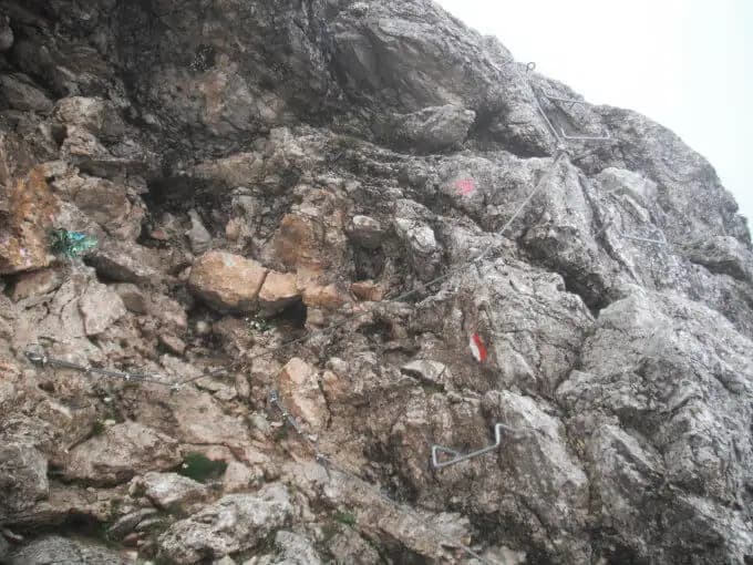
From the rifugio, following a clear track first over scree and then on rock, you reach the start of the Ferrata del Velo. The route opens with a diagonal ramp, then veers left and subsequently right into an athletic passage that introduces the first metal rungs. You then climb vertically up an equipped wall, overcoming a short, slightly overhanging section.
The route continues traversing diagonally across a slab, followed by what many consider the most adrenaline-pumping passage of the climb. After a short descending section, you tackle a long traverse, initially horizontal on rungs and then diagonal, with significant exposure.
You then reach a drop of about three meters equipped with rungs, followed by a vertical section. The difficulties of this exposed passage are mitigated by an abundance of artificial and natural holds. After overcoming a narrow gully, you climb an arête, first on its right side and then on its left.
You then enter a new, gently sloping gully, in whose upper part you encounter more metal rungs. Here begins the final section of the equipped part: a small vertical wall and a first traverse, which gradually widens, transforming into an equipped trail that climbs diagonally to the end of the metal fixtures.
Continuing on a trail with modest ascent and then through a series of switchbacks, you finally reach the distinctive Forcella Porton (2460 m). The view from the notch, dominated by Sasso Maor and Cima Madonna, is magnificent and rewards the effort. The time for the via ferrata is about 1 hour from the rifugio, for a total of 3 hours and 15 minutes from the start.
The ferrata unfolds on solid, compact rock, typical of the Dolomites, with a predominantly vertical development interspersed with airy traverses on ledges. The pace is continuous and sustained, with constant exposure that demands attention but no single passages of extreme technical difficulty. The route is eminently scenic, offering continuous views of the Val di Roda and the surrounding towers.
Descent
Just before Forcella Porton, a signpost indicates directions for the Sentiero Attrezzato Gusella (path 714) and the Val della Vecia (path 739). Descend following path 739 along a valley, first rocky and then gradually grassier, until you reach the upper start of the Ferrata della Vecia.
This short via ferrata descends about 50 meters of elevation, primarily through a long series of metal rungs. Once past the equipped section, continue on the trail, which, veering right, joins path 713 already traveled on the ascent. From here, retrace your steps back to the parking area at Malga Civertaghe. The descent takes about 2 hours from the forcella, for a total of 5 hours and 15 minutes for the entire loop.
The descent offers a clear change of pace: from the verticality of the ascent, you move to a more walkable route, with the short descent ferrata providing a pleasant technical passage on the way down, exposed but brief. The environment shifts rapidly from the severe scree of the forcella to the gentler grassy valley of the Val della Vecia.
Useful Notes
The Ferrata del Velo is classified as moderate difficulty. It has no single passages of high technical complexity, being perfectly equipped with numerous and ample metal rungs that significantly reduce the effort in the more exposed sections. It is a very popular route, often combined on the descent with the nearby Ferrata del Porton to create a more varied itinerary. The area of the Pale di San Martino offers numerous other possibilities for mountain enthusiasts, including the Ferrata Bolver Lugli, the Buzzatti, the Sentiero Attrezzato Gusella, and the short but challenging Ferrata del Canalone.
The overall character of the route is physically demanding due to its length and elevation gain, but technically accessible, with a continuous and logical progression. The loop is particularly satisfying for the variety of environments and types of progression offered in a single day.
Track and weather
Plan the route
Preview the GPX track from the backend, download it for your GPS device, open parking directions, and check a short forecast before leaving.
Images
FAQ
What level of commitment does this via ferrata require?
ferrata.faqAnswers.commitment
How much elevation gain should I plan for?
The listed ferrata elevation gain is 200 m. Also consider approach, return and maximum altitude, because they can matter more than the equipped section alone.
Where is the route located?
Ferrata del Velo is located in Dolomiti delle Pale di San Martino, Trento, Italy. Before leaving, check parking, access and current local conditions.
When is the best time to climb it?
The best season depends on altitude, aspect and lingering snow. Avoid storms, wet rock and uncertain conditions; start early and keep a margin for the return.
Gear and safety planning
Use the technical data on this page to plan equipment, timing and offline navigation. For a general checklist, read the equipment guide before opening the route in the app.
Video
Watch the route
Useful YouTube videos for getting a real feel for the route before you go.
Logbook
Route condition reports
Recent community notes about closures, snow, equipment damage, trail issues and current conditions.
Community
Reviews, check-ins and photos
-
0 reviews
0
0 climbers
4
Shared by the community
Community photos
Recent images uploaded by Sferrati members.
Reviews
Recent impressions from climbers who know the route.
No reviews yet
Be the first to review this via ferrata from the app.
Continue in the app
Track the climb, save maps offline, and sync this route to your personal profile.
Use the app to climb
Offline maps, tracking, saves, and profile sync.
Scan the code before leaving, install the app, and keep your route data ready when reception fades.
