
Technical data
- Difficulty
- Difficile
- Status
- aperta
- Distance
- 7,5 km
- Total duration
- 4 h 30 min
- Approach
- 1 h 15 min
- Ferrata time
- 1 h 45 min
- Elevation gain
- 326 m
- Max altitude
- 2980 m
Route planning
How to plan Ferrata Tomaselli a Cima Fanes
Ferrata Tomaselli a Cima Fanes is in Cima Fanes, Belluno, Italy and is rated Molto Difficile. Available route data lists about 4 h 30 min total time, 7,5 km of distance, 326 m of elevation gain.
For day planning, consider an approach of about 75 min, about 105 min on the cable, a maximum altitude near 2980 m. Reported route features include: Funivia all'andata, Funivia al ritorno.
The page includes a parking or driving-directions reference. A GPX track is available to review and download.
As with every via ferrata, evaluate season, lingering snow, storms, crowds and equipment condition. Page last updated on 7/4/2026.
Features
Description
Overview
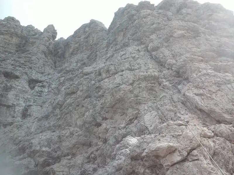
The Ferrata Tomaselli is a high-commitment vertical route that cuts across the compact west face of the Punta di Fanes Sud. Its modest length is offset by a concentration of technical and physical difficulties, with athletic, consistently exposed sections that demand experience and upper-body strength. The itinerary unfolds largely across slabs and dihedrals of Dolomitic rock, offering a continuous and demanding progression. The final reward is the panoramic summit at 2960 meters, with a 360-degree view over the Tofane and the Dolomites of Badia.
Approach
The quickest starting point is Passo Falzarego (2105 m), reachable from Cortina d'Ampezzo, Val Badia, or Alleghe. From the pass, take the cable car up to Rifugio Lagazuoi (2752 m). From here, head north along trail 401, descending toward Forcella Lagazuoi (2573 m, about 15 minutes). It's advisable to keep left at the junction, following trail 20 on a gentle traverse. Then, turn right onto trail 20B, which runs mid-height along the west face of the Grande Lagazuoi until you reach the site of the old Bivacco della Chiesa (2655 m, about 1 hour from the refuge). The approach follows a path carved into the rock, typical of wartime routes, offering an early taste of the exposed environment. From here, following the signs and a faint track northward beneath the wall, you quickly reach the actual start of the Ferrata Tomaselli (total time from the cable car arrival: about 1 hour and 15 minutes).
Via Ferrata
The route's technical character becomes apparent immediately after the start. After the first few meters, you face a demanding diagonal traverse on polished rock, which heavily taxes the arms due to a lack of natural holds. This is followed by a short but very exposed 2-3 meter downclimb, just before a horizontal traverse, again on smooth rock, leading to a 4-5 meter vertical ascent. This initial sequence, developed on compact slab, is selective and requires decisive movement. After the traverse, a small ledge offers a spot to rest.
The climb continues vertically on exposed rock, with holds that are not always easy to spot, though the difficulties are slightly less than the initial traverse. After about 20 meters of challenging climbing, the rock becomes more fractured, and you reach a panoramic, debris-covered ledge. The pace changes: you then proceed along an exposed, unsecured trail, with a few switchbacks, up to a wide balcony. The route continues toward the wall of Cima Fanes, traversing left along a narrow, exposed ledge that, after a series of ups and downs, leads to the start of the second equipped section.
This second part begins with a horizontal stretch along the ledge, followed by a series of stepped rock bands. You then traverse a new exposed, unsecured ledge to the right, passing some cairns and rounding a corner to reach the start of the third and final section. Be careful not to veer left following the route of the Ferrata alla Cengia Veronesi. Instead, keep the ledge to the right, heading toward a vertical step that begins on a slab with good holds.
The climb becomes vertical and demanding once more, with sections assisted by rungs where the rock is smoother. You then reach a distinctive feature of the route: a long, airy equipped dihedral, developed alongside a deep crack. The first meters are particularly difficult, with rock offering few holds; you proceed by pulling on the cable until the crack, becoming diagonal, draws closer and provides some holds. The cable crosses the dihedral, allowing you to move to the right side where a stirrup aids progression. The dihedral remains very vertical and exposed, but in the central part, more holds appear. The final section, still very airy, runs along the right side of the crack and ends on a small rocky pulpit in a notch.
From the notch, the summit is close. You tackle two very exposed slabs, first vertical and then diagonal, until you reach a narrow ridge. With a few easy steps, you finally arrive on the summit of Cima Fanes Sud (2960 m). The climbing time from the start is about 1 hour and 45 minutes (3 hours total from Rifugio Lagazuoi).
Descent
From the summit, head northeast to begin the descent, which follows another quite challenging via ferrata. The first meters feature a series of vertical steps that require careful study to find the holds. You then traverse with a short overhanging section, demanding agility and decisive movement. Another characteristic passage is the descent inside a chimney, aided by a welcome stirrup halfway through the slightly overhanging section. Reaching a ledge, you tackle the final vertical meters to enter a gully that leads to the site of the Bivacco della Chiesa (about 45 minutes from the summit).
From here, to return to Passo Falzarego by cable car, retrace the approach trail back to Rifugio Lagazuoi (about 45 minutes from the bivouac, for a total of about 4 hours and 30 minutes). Alternatively, you can descend left of the ridge toward Forcella Travenanzes. From this notch, a crossroads of trails with numerous remains from the Great War, follow the path that descends to Passo Falzarego, reaching the starting point (about 1 hour and 15 minutes from the end of the equipped descent, for a total of about 5 hours).
Useful Notes
The Ferrata Tomaselli is a very well-marked but extremely challenging and exposed route. The difficulties are concentrated especially in the initial traverse and wall and, in the final part, in the long dihedral and slabs below the summit. The descent via ferrata is also not to be underestimated. Being north-facing and at high altitude, snowy sections may be encountered until June; wearing gloves during the descent is highly recommended. Given the high difficulty of some passages, it can be useful to know how to safely belay along the cable. For navigation, detailed topographic maps of the Cortina area and the Dolomites of Ampezzo or Val Badia are recommended.
Track and weather
Plan the route
Preview the GPX track from the backend, download it for your GPS device, open parking directions, and check a short forecast before leaving.
Images
FAQ
What level of commitment does this via ferrata require?
ferrata.faqAnswers.commitment
How much elevation gain should I plan for?
The listed ferrata elevation gain is 326 m. Also consider approach, return and maximum altitude, because they can matter more than the equipped section alone.
Where is the route located?
Ferrata Tomaselli a Cima Fanes is located in Cima Fanes, Belluno, Italy. Before leaving, check parking, access and current local conditions.
When is the best time to climb it?
The best season depends on altitude, aspect and lingering snow. Avoid storms, wet rock and uncertain conditions; start early and keep a margin for the return.
Gear and safety planning
Use the technical data on this page to plan equipment, timing and offline navigation. For a general checklist, read the equipment guide before opening the route in the app.
Video
Watch the route
Useful YouTube videos for getting a real feel for the route before you go.
Logbook
Route condition reports
Recent community notes about closures, snow, equipment damage, trail issues and current conditions.
Community
Reviews, check-ins and photos
-
0 reviews
0
0 climbers
0
Shared by the community
Community photos
Recent images uploaded by Sferrati members.
No community photos yet
Open this route in the app to add the first photo.
Reviews
Recent impressions from climbers who know the route.
No reviews yet
Be the first to review this via ferrata from the app.
Continue in the app
Track the climb, save maps offline, and sync this route to your personal profile.
Use the app to climb
Offline maps, tracking, saves, and profile sync.
Scan the code before leaving, install the app, and keep your route data ready when reception fades.
