
Ferrata Lipella alla Tofana di Rozes
Tofana di Rozes · Belluno · Italy
Technical data
- Difficulty
- Difficile
- Status
- aperta
- Distance
- 10,2 km
- Total duration
- 8 h
- Approach
- 1 h 15 min
- Ferrata time
- 4 h
- Elevation gain
- 550 m
- Max altitude
- 3225 m
Route planning
How to plan Ferrata Lipella alla Tofana di Rozes
Ferrata Lipella alla Tofana di Rozes is in Tofana di Rozes, Belluno, Italy and is rated Difficile. Available route data lists about 8 h total time, 10,2 km of distance, 550 m of elevation gain.
For day planning, consider an approach of about 75 min, about 240 min on the cable, a maximum altitude near 3225 m. Reported route features include: Alta montagna, Scale, Itinerario lungo, Interesse Storico.
The page includes a parking or driving-directions reference. A GPX track is available to review and download.
As with every via ferrata, evaluate season, lingering snow, storms, crowds and equipment condition. Page last updated on 7/4/2026.
Features
Description
Overview
The Ferrata Giovanni Lipella is a committing alpine itinerary that unfolds across the imposing western wall of the Tofana di Rozes. Its difficulty lies not so much in the technical complexity of individual passages, but rather in its length, the accumulated elevation gain, and the severe high-mountain environment. The route offers continuous and spectacular progression, with constant views of the Lagazuoi Group and the ridges of Fanes. It is reserved for experienced hikers with excellent physical fitness and a solid familiarity with alpine terrain.
Approach
The most direct access point is the Rifugio Dibona (2083 m), reachable by car from Cortina d'Ampezzo via a paved road that branches off the state highway at Passo Falzarego. An alternative approach from the pass itself is longer and more strenuous. From the rifugio, head west following signs for sentiero 403. At the first junction, ignore the right-hand turn toward Rifugio Giussani (the descent route) and continue straight, joining the wide and well-marked sentiero 404. This trail runs at the foot of the majestic south face of the Tofana di Rozes, offering an early taste of its imposing Dolomitic morphology. Ignoring a branch trail for the Ferrata alla Grotta di Tofana, follow the 404 consistently, which is signed for the Ferrata delle Gallerie del Castelletto and the Lipella. The trail curves decisively to the right and leads to an open area at the start of the Ferrata alla Galleria del Castelletto (2475 m), an ideal spot to gear up. The approach from Rifugio Dibona takes about 1 hour and 15 minutes.
Via Ferrata
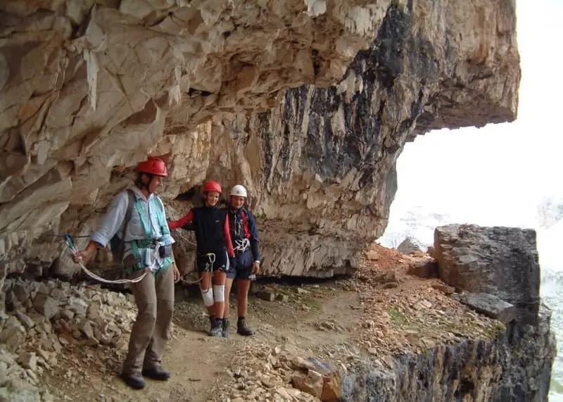
The route begins with the Ferrata alla Galleria del Castelletto, a fascinating and historic prelude, though optional. Those who skip it can ascend directly from Forcella Col dei Bos. After the first few meters of steel cable, an iron ladder provides access to a World War I tunnel, long and pitch black, making a headlamp mandatory. You advance along a rock staircase, ignoring a side branch, pass a lookout post, and proceed over a floor that is often damp and slippery. You exit the tunnel (about 20 minutes from the start) near Forcella di Rozes. From here, a traverse path cuts across the west face of the Tofana; watch out for possible residual snow patches. A slight descent brings you to the sign marking the start of the Ferrata Giovanni Lipella (2520 m), about 40 minutes after exiting the tunnel.
The Ferrata Lipella proper begins with sloping rock slabs, followed by a well-stepped vertical pitch. You ascend a dihedral and, after a short unroped section, tackle a long, exposed traverse that starts horizontally and requires caution due to rock protrusions. A subsequent traverse is more technical in its first steps, then becomes more vertical but with better holds. You emerge onto a long ledge, partly unprotected, which you follow in a slight descent, skirting exposed gullies. The rhythm is broken: horizontal progression along ledges alternates with vertical pitches on the wall. After the ledge, you climb diagonally to the right up a beautiful, jagged wall with solid, well-holded rock, then tackle a pleasant chimney to ascend, though exposed. A series of short traverses leads to a new, narrower ledge, which you follow around recesses. Progression resumes vertically on exposed, stepped walls until you reach the Tre Dita junction (2700 m), about 1 hour and 30 minutes from the start of the Lipella. Here, the left branch toward Rifugio Giussani serves as an escape route or the end of the climb.
For the summit, take the right branch following the "Cima" sign. A new long ledge introduces the second section of the route, characterized by vertical pitches of moderate difficulty and climbable passages. After a panoramic point, you face one of the most challenging sections: a vertical pitch with sparse holds, requiring you to pull hard on the cable. You then traverse a final, very narrow and exposed ledge, demanding balance and concentration. The last equipped section features a couple of difficult moves on smooth slabs with poor holds. Once past these, a final ledge to the right merges with the normal route coming up from Rifugio Giussani (3030 m). Following the logical but tiring summit ridge, non-technical, you finally gain the summit cross of the Tofana di Rozes (3225 m). The total time from the start of the Galleria del Castelletto is about 4 hours, for a total of about 5 hours and 15 minutes from Rifugio Dibona.
Descent
From the summit, retrace the final section of the normal route back to the junction with the ferrata. Keeping right, follow the blue blazes along the trail that descends to Rifugio Giussani (2580 m), in about 1 hour and 15 minutes. From the rifugio, take sentiero 403, initially steep, which then transforms into a pleasant tourist path between the Tofana di Mezzo and the Tofana di Rozes. At the junction encountered on the approach, keep right to return to Rifugio Dibona. The descent from Giussani takes about 1 hour, for a total hike of about 8 hours.
Useful Notes
The Galleria del Castelletto is a spiral tunnel about 500 meters long, completely dark in large sections. The cable serves as a handrail over a floor that is often damp and slippery, making a headlamp essential. While traversing the numerous ledges, extreme care must be taken not to dislodge debris, as these ledges often run parallel and stacked with hundreds of meters of exposure. The itinerary is very long and takes the entire day; careful planning, an early start, and stable weather conditions are essential. Full via ferrata equipment, helmet, appropriate high-mountain clothing, and sufficient water and food supplies are recommended.
Track and weather
Plan the route
Preview the GPX track from the backend, download it for your GPS device, open parking directions, and check a short forecast before leaving.
Images
FAQ
What level of commitment does this via ferrata require?
ferrata.faqAnswers.commitment
How much elevation gain should I plan for?
The listed ferrata elevation gain is 550 m. Also consider approach, return and maximum altitude, because they can matter more than the equipped section alone.
Where is the route located?
Ferrata Lipella alla Tofana di Rozes is located in Tofana di Rozes, Belluno, Italy. Before leaving, check parking, access and current local conditions.
When is the best time to climb it?
The best season depends on altitude, aspect and lingering snow. Avoid storms, wet rock and uncertain conditions; start early and keep a margin for the return.
Gear and safety planning
Use the technical data on this page to plan equipment, timing and offline navigation. For a general checklist, read the equipment guide before opening the route in the app.
Video
Watch the route
Useful YouTube videos for getting a real feel for the route before you go.
Logbook
Route condition reports
Recent community notes about closures, snow, equipment damage, trail issues and current conditions.
Community
Reviews, check-ins and photos
-
0 reviews
0
0 climbers
0
Shared by the community
Community photos
Recent images uploaded by Sferrati members.
No community photos yet
Open this route in the app to add the first photo.
Reviews
Recent impressions from climbers who know the route.
No reviews yet
Be the first to review this via ferrata from the app.
Continue in the app
Track the climb, save maps offline, and sync this route to your personal profile.
Use the app to climb
Offline maps, tracking, saves, and profile sync.
Scan the code before leaving, install the app, and keep your route data ready when reception fades.
