
Ferrata Strada degli Alpini
Dolomiti di Sesto · Bolzano · Italy
Technical data
- Difficulty
- Moderatamente Difficile
- Status
- aperta
- Distance
- 11 km
- Total duration
- 8 h
- Approach
- 3 h 30 min
- Ferrata time
- 2 h 30 min
- Elevation gain
- 337 m
- Max altitude
- 2717 m
Route planning
How to plan Ferrata Strada degli Alpini
Ferrata Strada degli Alpini is in Dolomiti di Sesto, Bolzano, Italy and is rated Moderatamente Difficile. Available route data lists about 8 h total time, 11 km of distance, 337 m of elevation gain.
For day planning, consider an approach of about 210 min, about 150 min on the cable, a maximum altitude near 2717 m. Reported route features include: Ponti sospesi, Scale, Itinerario lungo, Interesse Storico.
The page includes a parking or driving-directions reference. A GPX track is not available yet, so bring an alternative map source.
As with every via ferrata, evaluate season, lingering snow, storms, crowds and equipment condition. Page last updated on 7/4/2026.
Features
Description
Overview
The Ferrata Strada degli Alpini winds through a severe and spectacular environment in the heart of the Sesto Dolomites, climbing the entire eastern flank of the Upper Val Fiscalina. This loop itinerary, demanding in terms of physical effort, connects Rifugio Comici to Forcella Undici. Its length and elevation gain are both considerable. The route develops mainly along ledges, offering an experience that is more horizontal and exposed than technical for much of the way, but it still requires endurance, familiarity with exposure, and absolutely stable weather conditions.
Approach
The route begins at the Albergo Dolomitenhof in Val Fiscalina (1454 m). From the parking lot, take the gravel road of trail 102 heading south, reaching the Rifugio al Fondo Valle (1548 m) in about 30 minutes. Continuing on trail 102 southwest, at a junction keep left for trail 103, which heads toward Rifugio Comici. This section climbs with a steady gradient up the left side of the Lower Val Fiscalina, a physical approach that prepares you for the effort ahead. The view gradually opens up onto the opposite slope, where the line of the future via ferrata is already visible. After about 2 hours and 30 minutes total, you arrive at Rifugio Comici (2224 m).
From the refuge, trail 103 continues south, descends slightly, then climbs left (southeast) toward Forcella Giralba, with the imposing Cima Dodici (Croda dei Toni) on the right. Before the notch, a junction on the left indicates trail 101 for Monte Popera. Instead, continue straight toward a saddle, cross it, and descend a few meters to another junction: ignoring the deviation to the right for the normal route to Monte Popera, continue straight north, skirting the slope. This mid-slope stretch, on stable terrain, finally leads to the starting ledge of the via ferrata, reached about an hour from Rifugio Comici.
Via Ferrata
The start begins with short easy rock steps, immediately introducing the character of the route. You then enter the famous Cengia della Salvezza, a historic walkway carved into the dolomite during the Great War. The first section runs along a wide ledge, at times unsecured, offering a rhythmic and secure progression. The morphology becomes more spectacular as the ledge bends around a notch in the wall: to bypass it, you pass inside a narrow gorge, an iconic passage whose shape resembles a sword blade. Emerging on the opposite side, after more short rock steps, the ledge continues to snake with modest ups and downs along the west wall of the spurs of Cima Undici.
The setting is highly exposed, with the precipice of the Val Fiscalina opening to the left, but the width of the ledge ensures safety. The panorama is continuous and majestic, spanning Cima Dodici and, below, Rifugio Comici. Near a rocky overhang, a particular passage requires you to duck down to cross a wooden walkway. Continue to a recess where a snowfield or seasonal waterfall often persists. From here, the route, often without protection, begins a more physical climb over scree terrain. After passing another possible snowfield, you reach an old military wall that conventionally marks the end of the first section of the via ferrata, about 1 hour and 45 minutes from the start (5h 15m total).
A long unprotected ledge section follows, a false flat that is easy to walk along, allowing you to catch your breath and admire the landscape. This horizontal stretch finally leads to Forcella Undici, reached about 45 minutes from the wall. Here the Ferrata Strada degli Alpini ends, with a 360-degree panorama of the Croda Rossa di Sesto, Cima Undici, Cima Dodici, and, to the west, as far as Cima Uno and the distant Rifugio Locatelli. The total time from the start is about 6 hours.
Descent
From Forcella Undici, there are two options for the return.
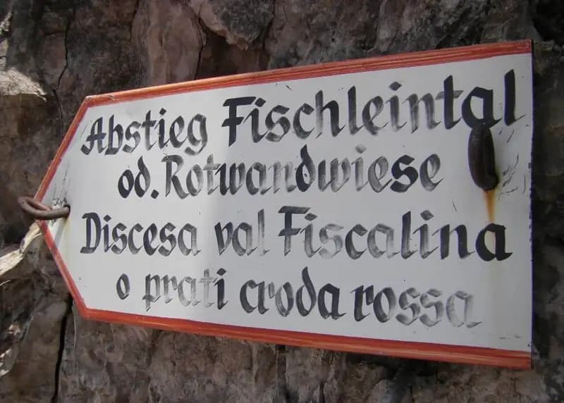
The first option, more direct, follows trail marker 124. This skirts the Elsferschartzespitze and descends steeply into Val Fiscalina. It includes a secured traverse in descent and a couple of scree-filled gullies, passages that require attention but not particular technique. After these, you enter a wide scree basin dominated on the right by the Croda Rossa di Sesto. Keeping to trail marker 124 in constant descent and ignoring side junctions, you exit the basin and return to the parking lot in about 1 hour and 30 minutes from the notch (6h 45m total).
The second option, more challenging and scenic, reaches the Passo della Sentinella and then descends into Val Fiscalina, along a route also known as the Ferrata del Passo Sentinella. From the notch, continue to the right. After initial easy ledges, the terrain becomes more unstable and the route more technical, with protection at the most exposed points. You tackle several ledges until a metal ladder, which you climb to cross a channel and emerge on the opposite side, always in strong exposure. An exposed section on a slight uphill leads to a long wooden walkway. After a final ledge and a traverse, you face a series of steeper vertical steps that, after a stretch of trail, bring you to Passo della Sentinella (2717 m), reached about an hour from Forcella Undici (6h 15m total). The pass, rich in war remains, offers views of the Vallon Popera (with Rifugio Berti) and the Vallon Sentinella to the left.
The descent goes left into the Vallon Sentinella. The first section is very steep and secured with fixed ropes, a vertical passage to be tackled with concentration. You descend a long succession of rock steps and vertical drops to a junction with the trail of the first option. Keeping left for Val Fiscalina, follow trail marker 124, which leads back to the parking lot, for a total time of about 8 hours.
Useful Notes
The Ferrata Strada degli Alpini is characterized, for the first two-thirds, by a continuous, horizontal rhythm along well-equipped but exposed ledges, without any particular technical passages. Its challenge lies in the length, the altitude, and the constant exposure. The two descent options, on the other hand, have different characters: the direct one is faster but with sections of unstable terrain; the one via Passo Sentinella is more technical, with medium-difficult passages in descent and some unprotected sections that demand a steady foot.
The hike is very long, and after Rifugio Comici, there are no other refreshment points. It takes place at altitudes close to 3000 meters, where conditions can change rapidly, making it essential to tackle it only in stable weather. Beware of persistent snowfields: in the presence of hard snow, the use of crampons may be necessary. Planning, proper equipment, and excellent physical condition are fundamental for a safe and successful outing.
Track and weather
Plan the route
Preview the GPX track from the backend, download it for your GPS device, open parking directions, and check a short forecast before leaving.
GPX track unavailable
This route does not include a downloadable track yet.
Images
FAQ
What level of commitment does this via ferrata require?
ferrata.faqAnswers.commitment
How much elevation gain should I plan for?
The listed ferrata elevation gain is 337 m. Also consider approach, return and maximum altitude, because they can matter more than the equipped section alone.
Where is the route located?
Ferrata Strada degli Alpini is located in Dolomiti di Sesto, Bolzano, Italy. Before leaving, check parking, access and current local conditions.
When is the best time to climb it?
The best season depends on altitude, aspect and lingering snow. Avoid storms, wet rock and uncertain conditions; start early and keep a margin for the return.
Gear and safety planning
Use the technical data on this page to plan equipment, timing and offline navigation. For a general checklist, read the equipment guide before opening the route in the app.
Video
Watch the route
Useful YouTube videos for getting a real feel for the route before you go.
Logbook
Route condition reports
Recent community notes about closures, snow, equipment damage, trail issues and current conditions.
Community
Reviews, check-ins and photos
-
0 reviews
0
0 climbers
0
Shared by the community
Community photos
Recent images uploaded by Sferrati members.
No community photos yet
Open this route in the app to add the first photo.
Reviews
Recent impressions from climbers who know the route.
No reviews yet
Be the first to review this via ferrata from the app.
Continue in the app
Track the climb, save maps offline, and sync this route to your personal profile.
Use the app to climb
Offline maps, tracking, saves, and profile sync.
Scan the code before leaving, install the app, and keep your route data ready when reception fades.
