
Ferrata Vandelli al Sorapiss
Gruppo del Sorapiss · Belluno · Italy
Technical data
- Difficulty
- Moderatamente Difficile
- Status
- aperta
- Distance
- 15,6 km
- Total duration
- 6 h 45 min
- Approach
- 2 h 15 min
- Ferrata time
- 2 h
- Elevation gain
- 1195 m
Route planning
How to plan Ferrata Vandelli al Sorapiss
Ferrata Vandelli al Sorapiss is in Gruppo del Sorapiss, Belluno, Italy and is rated Moderatamente Difficile. Available route data lists about 6 h 45 min total time, 15,6 km of distance, 1195 m of elevation gain.
For day planning, consider an approach of about 135 min, about 120 min on the cable. Reported route features include: Scale.
The page includes a parking or driving-directions reference. A GPX track is available to review and download.
As with every via ferrata, evaluate season, lingering snow, storms, crowds and equipment condition. Page last updated on 6/4/2026.
Features
Description
Panoramica
La Ferrata Vandelli si sviluppa sul versante orientale del Gruppo del Sorapiss, lungo la parete del Col del Fuoco. È un itinerario di media difficoltà, continuo e ben logico, che non raggiunge una vetta ma collega il Rifugio Vandelli al Bivacco Comici. In questa descrizione l’escursione è proposta con partenza e rientro a Federavecia, senza utilizzo di mezzi aggiuntivi.
Avvicinamento
Si parte da Federavecia, lungo la strada tra Misurina e Auronzo di Cadore, parcheggiando nei pressi dell’hotel Cristallo. Dal parcheggio si segue il sentiero CAI 217 / AV4, che sale inizialmente nel bosco e poi con pendenza crescente tra tornanti e tratti più ripidi. Dopo circa 600 m di dislivello si raggiunge il Rifugio Vandelli (1928 m) in circa 1h45’.
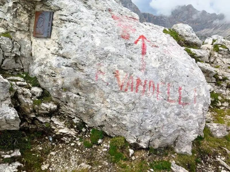
Dal rifugio si segue il segnavia 243, lasciando sulla destra il Dito di Dio, e si sale con decisione verso sud fino alla base della parete, dove una targhetta metallica indica l’inizio della ferrata (45’ dal rifugio).
Via Ferrata
La ferrata percorre in diagonale la parete orientale del Col del Fuoco, sfruttandone i punti più favorevoli. L’attacco è caratterizzato da una breve scaletta seguita da una rampa obliqua che conduce a un camino, superato sul lato sinistro grazie a piccole scalette. Si prosegue poi su roccette e una prima cengia esposta, seguita da una fessura appoggiata facilmente arrampicabile.
La parte centrale della via è un susseguirsi di cenge strette e traversi molto panoramici, sempre ben protetti ma con esposizione marcata. I passaggi restano tecnicamente moderati, con buoni appoggi per i piedi, purché si mantenga una progressione fluida senza eccessive soste.
La ferrata continua tagliando trasversalmente la parete fino all’ingresso di un canalone, dove si risalgono alcuni brevi balzi verticali senza difficoltà rilevanti. Raggiunto il punto più alto, si passa sul versante opposto e si inizia la discesa verso il Bivacco Comici, alternando sentiero, cenge e brevi tratti attrezzati percorsi in discesa. Questo tratto richiede attenzione per la roccia non sempre stabile e per il cavo poco teso. Si raggiunge infine il Bivacco Comici (2000 m), dove termina la ferrata (circa 4h15’ totali).
Discesa
Dal bivacco si segue il Sentiero Attrezzato Osiride Brodevani, mantenendo l’imbraco indossato per la presenza di tratti verticali. Si scende nel vallone detritico della Busa del Banco, ignorando il sentiero che devia a sud. La discesa alterna sentiero, salti verticali, traversi e tratti con fondo instabile, dove l’attrezzatura funge principalmente da corrimano.
Terminati i tratti attrezzati, si raggiunge una bacheca che segna la fine del sentiero Brodevani e ci si innesta sul sentiero 226, che in falso piano conduce verso est. Per rientrare al parcheggio è necessario superare un ultimo risalire di circa 200 m di dislivello lungo il corso del Fiume Ansiei, prima di tornare a Federavecia (2h30’ dal bivacco).
Nota: dal 2019 il Sentiero Brodevani è interessato da frane in alcuni punti ed è sconsigliato a chi non è esperto. In alternativa è preferibile rientrare per l’itinerario di salita o inserire la ferrata in un anello più ampio attorno al Sorapiss.
Note utili
La Ferrata Vandelli è tracciata in modo intelligente e consente una progressione quasi sempre in arrampicata, senza necessità di trazionare sul cavo. L’esposizione è costante ma mai estrema. Alcune scalette e il cavo metallico non risultano sempre in condizioni ottimali e poco tesi, aspetto da tenere in considerazione soprattutto nei tratti di discesa.
Track and weather
Plan the route
Preview the GPX track from the backend, download it for your GPS device, open parking directions, and check a short forecast before leaving.
Images
FAQ
What level of commitment does this via ferrata require?
ferrata.faqAnswers.commitment
How much elevation gain should I plan for?
The listed ferrata elevation gain is 1195 m. Also consider approach, return and maximum altitude, because they can matter more than the equipped section alone.
Where is the route located?
Ferrata Vandelli al Sorapiss is located in Gruppo del Sorapiss, Belluno, Italy. Before leaving, check parking, access and current local conditions.
When is the best time to climb it?
The best season depends on altitude, aspect and lingering snow. Avoid storms, wet rock and uncertain conditions; start early and keep a margin for the return.
Gear and safety planning
Use the technical data on this page to plan equipment, timing and offline navigation. For a general checklist, read the equipment guide before opening the route in the app.
Video
Watch the route
Useful YouTube videos for getting a real feel for the route before you go.
Logbook
Route condition reports
Recent community notes about closures, snow, equipment damage, trail issues and current conditions.
Community
Reviews, check-ins and photos
-
0 reviews
0
0 climbers
0
Shared by the community
Community photos
Recent images uploaded by Sferrati members.
No community photos yet
Open this route in the app to add the first photo.
Reviews
Recent impressions from climbers who know the route.
No reviews yet
Be the first to review this via ferrata from the app.
Continue in the app
Track the climb, save maps offline, and sync this route to your personal profile.
Use the app to climb
Offline maps, tracking, saves, and profile sync.
Scan the code before leaving, install the app, and keep your route data ready when reception fades.
